[:ja]大西卓哉宇宙飛行士がISSから撮影したアジアと欧州を結ぶトルコ、イスタンブールのボスポラス海峡です。
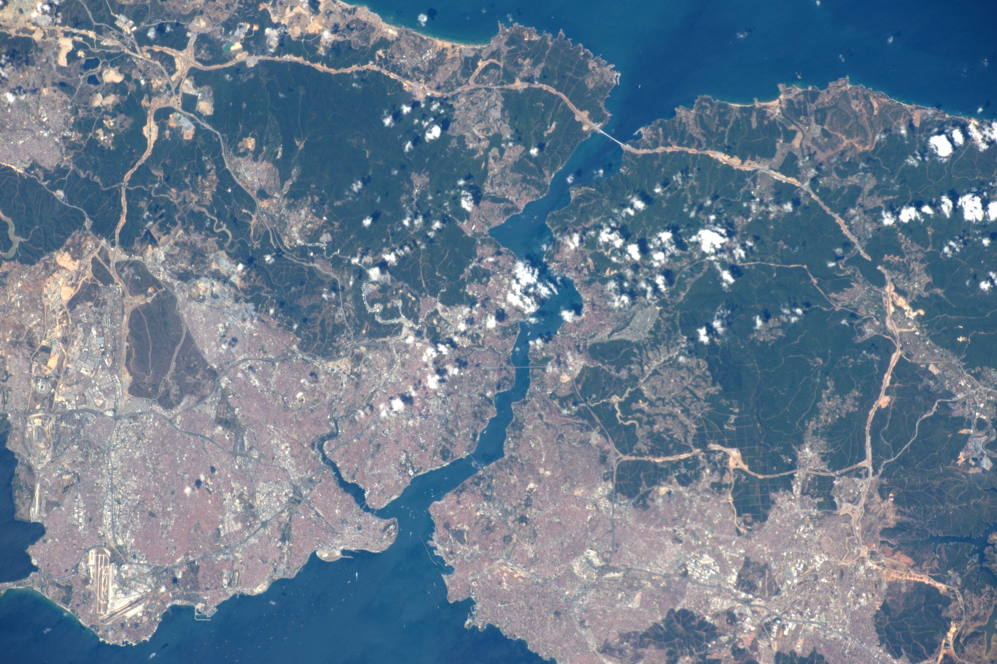
南北に細長く、北は黒海、南はマルマラ海で、黒海と地中海を結ぶ海上交通の要衝をなしています。長さは南北約30km、幅は最も広い地点で3700m、最も狭い地点でわずか800m程、水深は36m~124m。金角湾の南側がイスタンブール旧市街です。海峡には、第一ボスポラス大橋、ファーティフ・スルタン・メフメト橋、ヤウズ・スルタン・セリム橋の3つの自動車用橋と3つの海底トンネルがあります。
地上の様子はこちらです。

参考文献: Takuya Onishi’s Tweet
ウェブ地球儀で地球俯瞰画像を見る: LiVEARTH
[Earthview Wonders] No.414: Bosphorus Strait🇹🇷
Astronaut Takuya Onishi captured from ISS Asia-Europe bridging Bosphorus Strait, Istanbul, Turkey.
The Bosphorus is a narrow, natural strait and an internationally significant waterway located in northwestern Turkey. The strait is wide 800-3700m, 30km length north-south, with 36-124m depth. To the south of the Golden Horn Bay lies Old Istanbul. The strait has 3 bridges and 3 undersea tunnels.
The local scenery on the ground is as follows.
Reference: Takuya Onishi’s Tweet
See earthview photo gallery with web-globe: LiVEARTH[:en][Earthview Wonders] No.414: Bosphorus Strait🇹🇷
Astronaut Takuya Onishi captured from ISS Asia-Europe bridging Bosphorus Strait, Istanbul, Turkey.
The Bosphorus is a narrow, natural strait and an internationally significant waterway located in northwestern Turkey. The strait is wide 800-3700m, 30km length north-south, with 36-124m depth. To the south of the Golden Horn Bay lies Old Istanbul. The strait has 3 bridges and 3 undersea tunnels.
The local scenery on the ground is as follows.
Reference: Takuya Onishi’s Tweet
See earthview photo gallery with web-globe: LiVEARTH[:]