[:ja]アントン・シュカプレロフ宇宙飛行士がISSから撮影したトルコのイスタンブールと、アジアと欧州をつなぐボスポラス海峡です。画像は北側の黒海からマルマラ海方面を見ています。
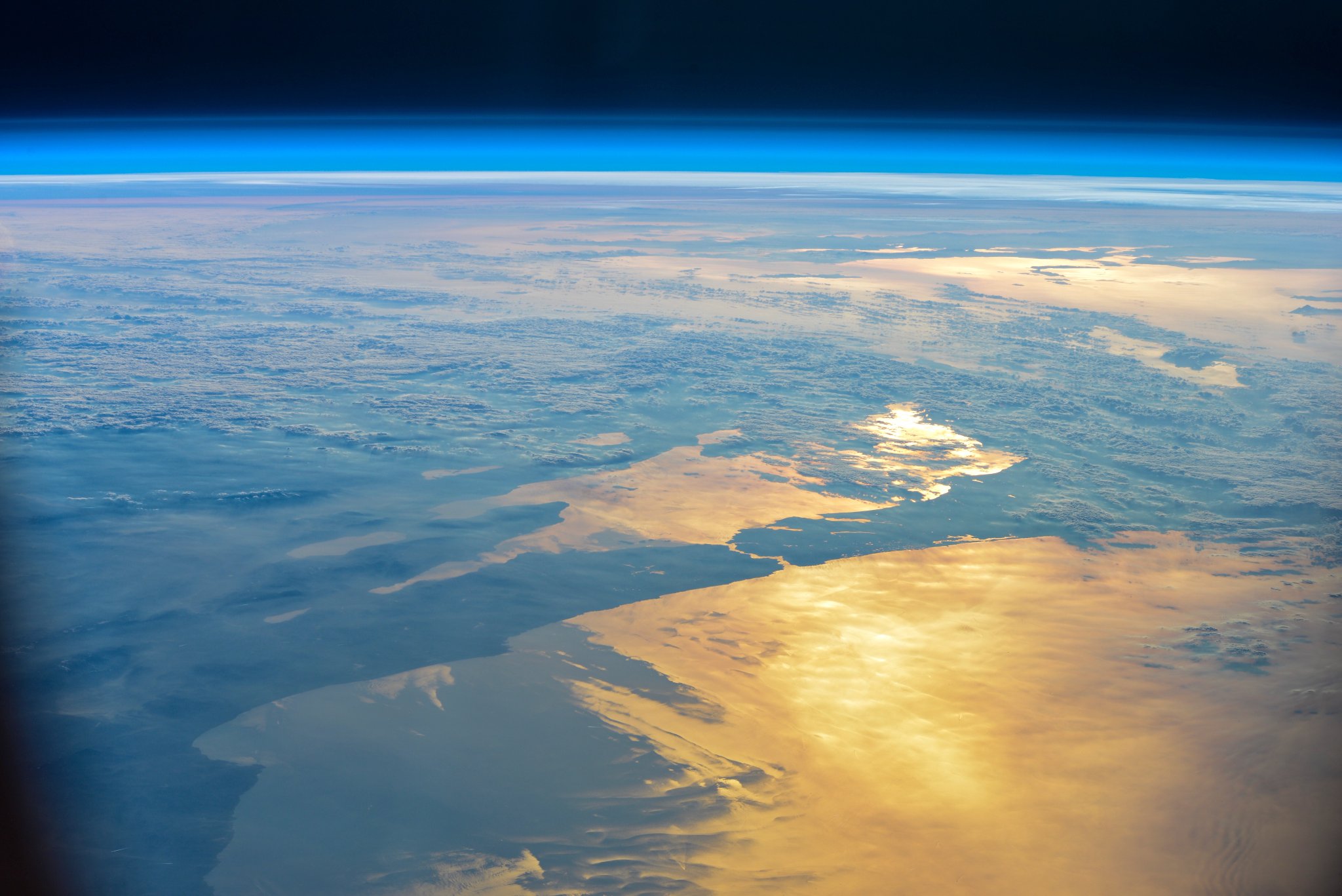
ボスポラス海峡は南北に細長く、北は黒海、南はマルマラ海で、黒海と地中海を結ぶ海上交通の要衝をなしています。長さは南北約30km、幅は最も広い地点で3700m、最も狭い地点でわずか800m程、水深は36~124m。海峡には、第一ボスポラス大橋、ファーティフ・スルタン・メフメト橋、ヤウズ・スルタン・セリム橋の3つの自動車用橋と3つの海底トンネルがあります。No.414でも紹介しています。
地上の様子はこちらです。

参考文献: Anton Shkaplerov’s Tweet
ウェブ地球儀で地球俯瞰画像を見る: LiVEARTH
[Earthview Wonders] No.446: Istanbul and Bosphorus Strait🇹🇷
Astronaut Anton Shkaplerov captured from ISS Istanbul of Turkey and Bosphorus Strait which links Asia and Europe. The image was taken from the Black Sea toward the Sea of Marmara.
The Bosphorus is a narrow, natural strait and an internationally significant waterway located in northwestern Turkey. The strait is wide 800-3700m, 30km length north-south, with 36-124m depth. To the south of the Golden Horn Bay lies Old Istanbul. The strait has 3 bridges and 3 undersea tunnels. Bosphorus Strait was introduced with No.414 as well.
The local scenery on the ground is as follows.
Reference: Anton Shkaplerov’s Tweet
See earthview photo gallery with web-globe: LiVEARTH[:en][Earthview Wonders] No.446: Istanbul and Bosphorus Strait🇹🇷
Astronaut Anton Shkaplerov captured from ISS Istanbul of Turkey and Bosphorus Strait which links Asia and Europe. The image was taken from the Black Sea toward the Sea of Marmara.
The Bosphorus is a narrow, natural strait and an internationally significant waterway located in northwestern Turkey. The strait is wide 800-3700m, 30km length north-south, with 36-124m depth. To the south of the Golden Horn Bay lies Old Istanbul. The strait has 3 bridges and 3 undersea tunnels. Bosphorus Strait was introduced with No.414 as well.
The local scenery on the ground is as follows.
Reference: Anton Shkaplerov’s Tweet
See earthview photo gallery with web-globe: LiVEARTH[:]