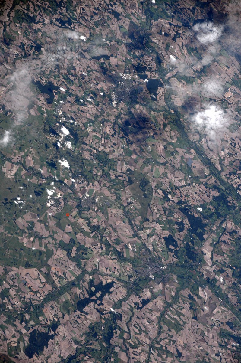
[:ja]ランディ・ブレズニク宇宙飛行士がISSから撮影したユネスコの世界遺産、イギリスのストーンヘンジです。ロンドンから西に約200kmのイギリス南部ソールズベリーから北西に13km程に位置する環状列石で、画像では赤丸で示しています。
この直立巨石が紀元前2500~2000年の間に立てられたと考えられていますが、目的は、太陽崇拝の祭祀場、古代の天文台、ケルト民族のドルイド教徒の礼拝堂など、様々な説が唱えられており、未だ結論は出ていません。夏至の日に、高さ6mの玄武岩のヒールストーンと祭壇石を結ぶ直線上に太陽が昇ることから、設計者には天文学の高い知識があり、また、倒れないよう安定させるため石と石の間には凹凸を設けるなど、高度な技術が使われていました。
地上の様子はこちらです。

参考文献: Randy Bresnik’s Tweet
ウェブ地球儀で地球俯瞰画像を見る: LiVEARTH
[Earthview Wonders] No.449: Stonehenge, U.K.🇬🇧
Astronaut Randy Bresnik captured from ISS the stonehenge, U.K., a prehistoric monument and UNESCO’s World Heritage, 3km west of Amesbury. The location of the site is shown by the red circle.
It was believed to be constructed from 2500-2000BC by a culture that left no written records, and many aspects such as how and why it was built remain subject to debate. The timber circle was oriented towards the rising sun on the midwinter solstice, opposing the solar alignments at Stonehenge, implying the high level of astronomy possessed by the producer.
The local scenery on the ground is as follows.
Reference: Randy Bresnik’s Tweet
See earthview photo gallery with web-globe: LiVEARTH[:en][Earthview Wonders] No.449: Stonehenge, U.K.🇬🇧
Astronaut Randy Bresnik captured from ISS the stonehenge, U.K., a prehistoric monument and UNESCO’s World Heritage, 3km west of Amesbury. The location of the site is shown by the red circle.
It was believed to be constructed from 2500-2000BC by a culture that left no written records, and many aspects such as how and why it was built remain subject to debate. The timber circle was oriented towards the rising sun on the midwinter solstice, opposing the solar alignments at Stonehenge, implying the high level of astronomy possessed by the producer.
The local scenery on the ground is as follows.
Reference: Randy Bresnik’s Tweet
See earthview photo gallery with web-globe: LiVEARTH[:]