[:ja]NASAの地球観測衛星Landsatが撮影したチリのイースター島です。
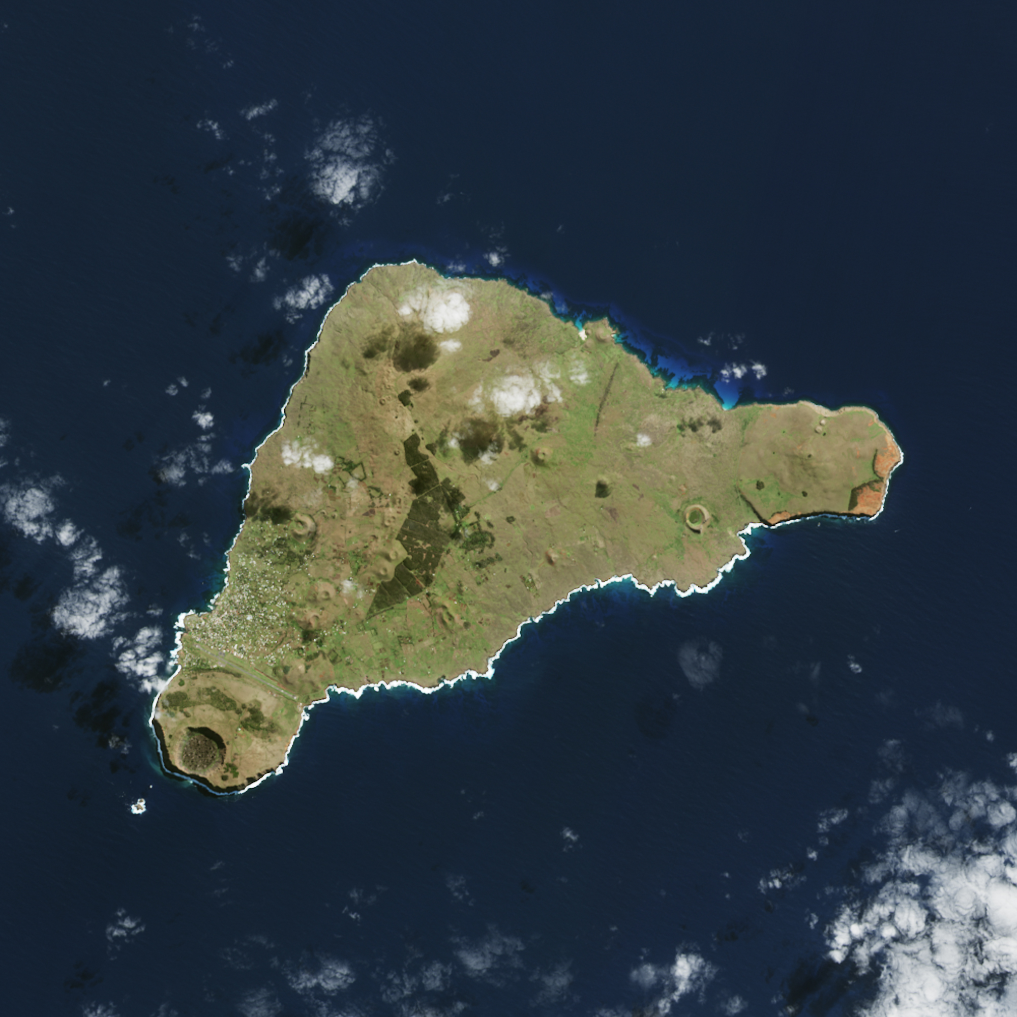
イースター島は、チリ領の太平洋上に位置する火山島です。1722年4月5日の復活祭(イースター)の夜、オランダ海軍提督のヤーコプ・ロッヘフェーンが発見した日にちなみ島名が付けられました。ジャレド・ダイアモンドらによれば、7~8世紀頃に、アフ(プラットホーム状に作られた石の祭壇)作りが始まり、遅くとも10世紀頃にはモアイも作られるようになったとされています。また、モアイを作り、運び、建てる為には大量の木材が必要で、伐採によって森が失われ、こうした人為的な自然破壊が究極的にイースター島文明の崩壊を呼んだとする説を述べています。
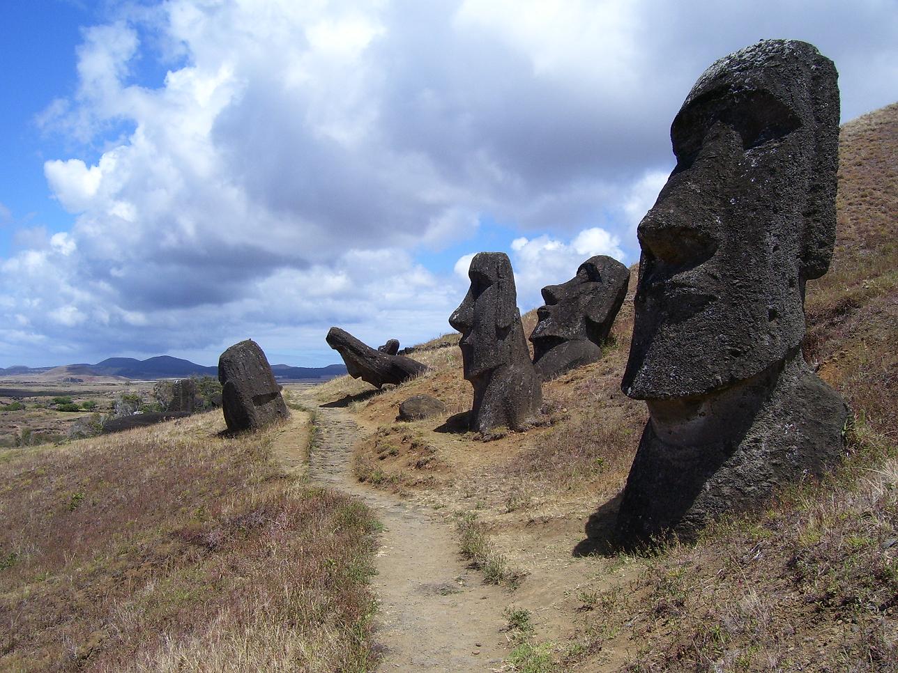
地上の様子はこちらです。
参考文献: NASA Landsat
ウェブ地球儀で地球俯瞰画像を見る: LiVEARTH
[Earthview Wonders] No.477: Easter Island, Chile🇨🇱
NASA’s Landsat satellite captured Easter Island, Chile.
Easter Island is a Chilean island in the southeastern Pacific Ocean, at the southeasternmost point of the Polynesian Triangle in Oceania. The name “Easter Island” was given by the island’s first recorded visitor Dutch explorer Jacob Roggeveen, who encountered it on Easter Sunday (5 April) in 1722. Polynesian people most likely settled on Easter Island sometime between 700 and 1100 AD and started creating enormous stone moai and other artifacts. However, human activity and overpopulation led to gradual deforestation and extinction of natural resources which severely weakened the civilization.
The local scenery on the ground is as follows.
Reference: NASA Landsat
See earthview photo gallery with web-globe: LiVEARTH[:en][Earthview Wonders] No.477: Easter Island, Chile🇨🇱
NASA’s Landsat satellite captured Easter Island, Chile.
Easter Island is a Chilean island in the southeastern Pacific Ocean, at the southeasternmost point of the Polynesian Triangle in Oceania. The name “Easter Island” was given by the island’s first recorded visitor Dutch explorer Jacob Roggeveen, who encountered it on Easter Sunday (5 April) in 1722. Polynesian people most likely settled on Easter Island sometime between 700 and 1100 AD and started creating enormous stone moai and other artifacts. However, human activity and overpopulation led to gradual deforestation and extinction of natural resources which severely weakened the civilization.
The local scenery on the ground is as follows.
Reference: NASA Landsat
See earthview photo gallery with web-globe: LiVEARTH[:]