[:ja]ISSから撮影されたカザフスタン東部にある中央アジア最大のバルハシ湖です(カスピ海は中央アジアの湖ではありません)。
バルハシ湖は長さ605km、最大幅74km、平均水深5.8m、最大水深25.6m、湖の西半分は淡水、東半分は塩湖で、かつてはアラル海のほうが広かったのですが、アラル海の縮小・分裂により、バルハシ湖が中央アジア最大となりました。天山山脈からイリ川を流れ、水が流入しますが、11月~4月中旬の間は氷結します。バルハシ湖も近年では流入量の減少、水質汚染が危惧されています。
地上の様子はこちらです。

参考文献: NASA Earth Observatory
ウェブ地球儀で地球俯瞰画像を見る: LiVEARTH
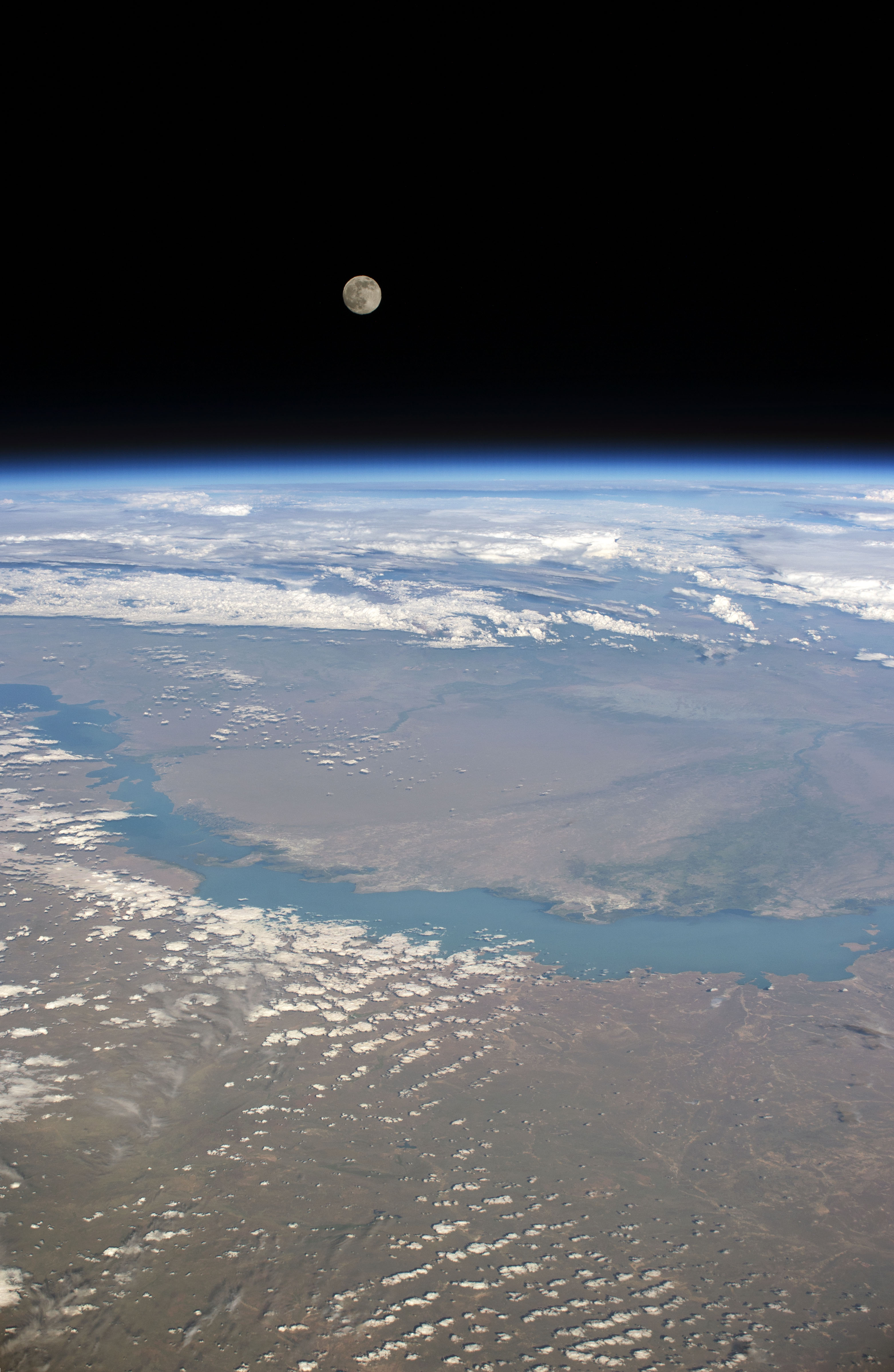
[Earthview Wonders] No.478: Moon and Lake Balkhash, Kazakhstan🇰🇿
ISS captured Lake Balkhash, Kazakhstan.
Lake Balkhash the largest lake in the Central Asia and has 605km length, 74km width, 5.8m average depth and 25.6m maximum depth. The western part is fresh water, while the eastern half is saline. Lake Balkhash became the largest lake in the Central Asia as the Aral Sea shrank as a result of the diversion of water from rivers. The Tian Shan Mountains flow into the lake via Ili River but the lake becomes frozen from November to April. Today there is concern about the lake’s shallowing due to desertification and industrial activity.
The local scenery on the ground is as follows.
Reference: NASA Earth Observatory
See earthview photo gallery with web-globe: LiVEARTH[:en][Earthview Wonders] No.478: Moon and Lake Balkhash, Kazakhstan🇰🇿
ISS captured Lake Balkhash, Kazakhstan.
Lake Balkhash the largest lake in the Central Asia and has 605km length, 74km width, 5.8m average depth and 25.6m maximum depth. The western part is fresh water, while the eastern half is saline. Lake Balkhash became the largest lake in the Central Asia as the Aral Sea shrank as a result of the diversion of water from rivers. The Tian Shan Mountains flow into the lake via Ili River but the lake becomes frozen from November to April. Today there is concern about the lake’s shallowing due to desertification and industrial activity.
The local scenery on the ground is as follows.
Reference: NASA Earth Observatory
See earthview photo gallery with web-globe: LiVEARTH[:]