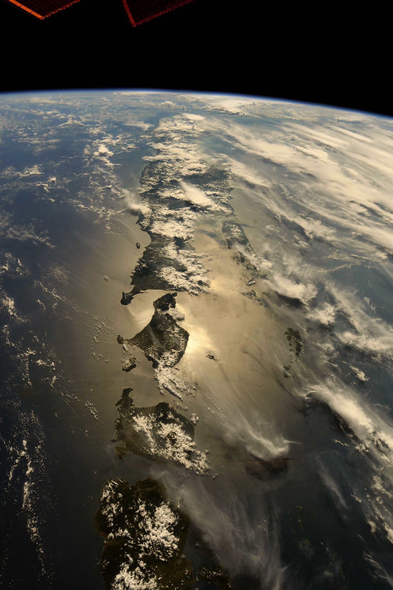
[:ja]Selamat pagi! リッキーアーノルド宇宙飛行士がISSから撮影したインドネシアのジャワ島、バリ島、ロンボク島です。バリ島とロンボク島の間にはウォレス線が通っています。
様々な生物の分布を見ていると、ある境界線を挟んで多くの生物が入れ替わり、かなり異なった生物相になることがあります。イギリスのアルフレッド・ウォレスが1868年、インドネシアにおける生物研究の中から、主として動物相の差をもとにその存在を主張しました。これはウォレス線と呼ばれ、スンダ列島のバリ島とロンボク島の間を通り、ボルネオ島、セレベス島の間を経て、ミンダナオ島の南へ抜けるものです。氷期には海面が下降し、東南アジア半島部からボルネオ島、バリ島までの一帯がスンダランドと呼ばれる陸続きとなっていたことが原因です。
こちらがウォレス線です。

ロンボク海峡の地上の様子はこちらです。

参考文献: Ricky Arnold’s Tweet
ウェブ地球儀で地球俯瞰画像を見る: LiVEARTH
[Earthview Wonders] No.482: Indonesia🇮🇩
Selamat pagi! Astronaut Ricky Arnold captured from ISS Java, Bali and Lombok Island, Indonesia. Between Bali and Lombok lies Wallace Line.
There are lines with which eco-species become different. One of these lines is called Wallace Line, a faunal boundary line drawn in 1859 by the British naturalist Alfred Russel Wallace, that separates the ecozones of Asia and Wallacea, a transitional zone between Asia and Australia. The line runs through Indonesia, between Borneo and Sulawesi (Celebes), and through the Lombok Strait between Bali and Lombok. During ice age glacial advances, when the ocean levels were up to 120m lower, both Asia and Australia were united with what are now islands, and this affected the distribution of animals.
Wallace Line is as follows.
The local scenery of Lombok Strait is as follows.
Reference: Ricky Arnold’s Tweet
See earthview photo gallery with web-globe: LiVEARTH[:en][Earthview Wonders] No.482: Indonesia🇮🇩
Selamat pagi! Astronaut Ricky Arnold captured from ISS Java, Bali and Lombok Island, Indonesia. Between Bali and Lombok lies Wallace Line.
There are lines with which eco-species become different. One of these lines is called Wallace Line, a faunal boundary line drawn in 1859 by the British naturalist Alfred Russel Wallace, that separates the ecozones of Asia and Wallacea, a transitional zone between Asia and Australia. The line runs through Indonesia, between Borneo and Sulawesi (Celebes), and through the Lombok Strait between Bali and Lombok. During ice age glacial advances, when the ocean levels were up to 120m lower, both Asia and Australia were united with what are now islands, and this affected the distribution of animals.
Wallace Line is as follows.
The local scenery of Lombok Strait is as follows.
Reference: Ricky Arnold’s Tweet
See earthview photo gallery with web-globe: LiVEARTH[:]