[:ja]ランディ・ブレズニク宇宙飛行士がISSから撮影したオランダのハーグ、アムステルダム、ロッテルダム付近です。
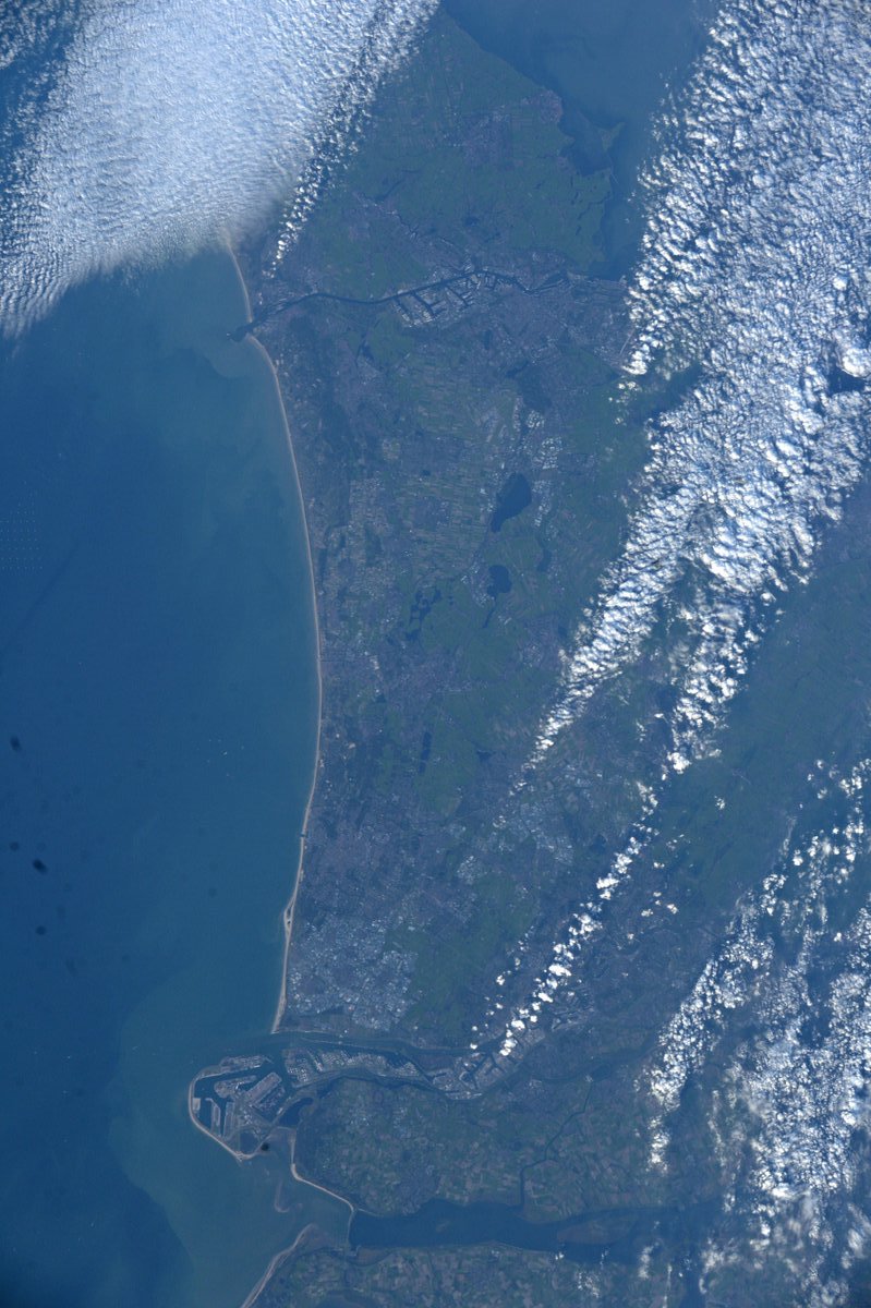
オランダ語のNederland(ネーデルラント)は「低地の国」「低地地方」を意味し、実際、国土の1/4は海面下に位置しており、最低地点はロッテルダム北東のマイナス6.7メートルです。干拓を行うと地面が低下し、過去数世紀にわたり、1世紀当たり15~20センチメートルも低下してきましたが、国土は海側から海岸沿いの砂丘部、ポルダー、東部の高地があり、砂丘部は北海の高潮から国土を守る大切な働きをしています。ユーロネクストの取引所であるアムステルダム証券取引所(AEX)に代表されるように、オランダ最大の産業は金融・流通を中心としたサービス産業で、全GDPの2/3を占めています。また、ライン川の河口に、欧州最大のロッテルダム港(ユーロポート)も所有しています。
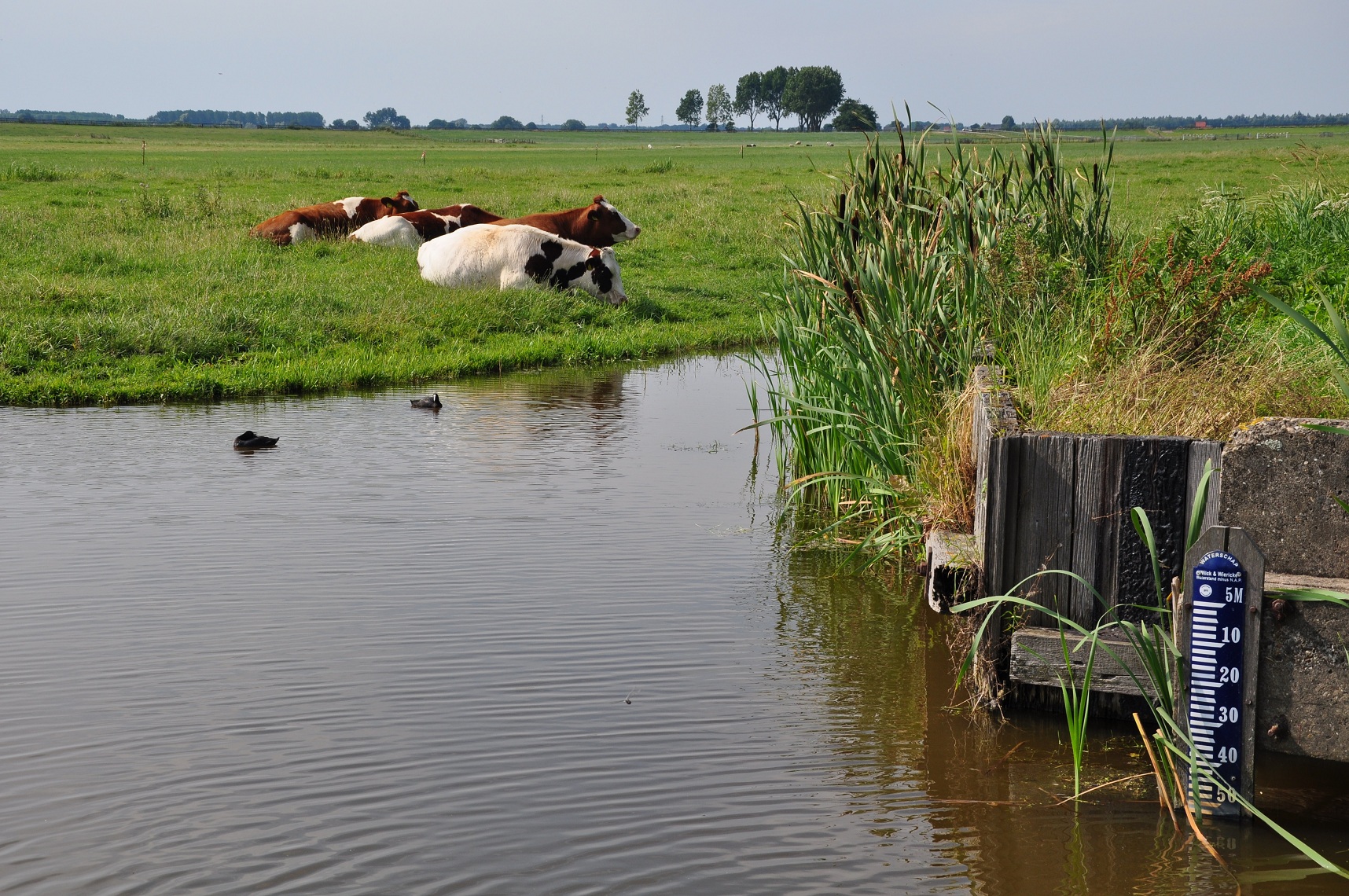
海抜-5.5mの湿地を干拓して作り出した低地ポルダーの様子はこちらです。
参考文献: Randy Bresnik’s Tweet
ウェブ地球儀で地球俯瞰画像を見る: LiVEARTH
[Earthview Wonders] No.487: Netherlands🇳🇱
Astronaut Randy Bresnik captured from ISS Den Haag, Amsterdam and Rotterdam of Netherlands.
“Netherlands” literally means “lower countries”, influenced by its low land and flat geography, with only about 50% of its land exceeding 1m above sea level. Most of the areas below sea level are man-made, caused by peat extraction or achieved through land reclamation. As represented by Amsterdam Stock Exchange (AEX), financial and service industry accounts for 2/3 of GDP. The country also has the Port of Rotterdam, the largest in Europe.
A polder at 5.53 metres below sea level is as follows.
Reference: Randy Bresnik’s Tweet
See earthview photo gallery with web-globe: LiVEARTH[:en][Earthview Wonders] No.487: Netherlands🇳🇱
Astronaut Randy Bresnik captured from ISS Den Haag, Amsterdam and Rotterdam of Netherlands.
“Netherlands” literally means “lower countries”, influenced by its low land and flat geography, with only about 50% of its land exceeding 1m above sea level. Most of the areas below sea level are man-made, caused by peat extraction or achieved through land reclamation. As represented by Amsterdam Stock Exchange (AEX), financial and service industry accounts for 2/3 of GDP. The country also has the Port of Rotterdam, the largest in Europe.
A polder at 5.53 metres below sea level is as follows.
Reference: Randy Bresnik’s Tweet
See earthview photo gallery with web-globe: LiVEARTH[:]