[:ja]今週最初の投稿は北極から。米海洋大気庁NOAAの地球観測衛星NOAA-20が撮影した北極です。NOAAはこの極地画像をアースデー(4/22)に合わせて初めて公開しました。
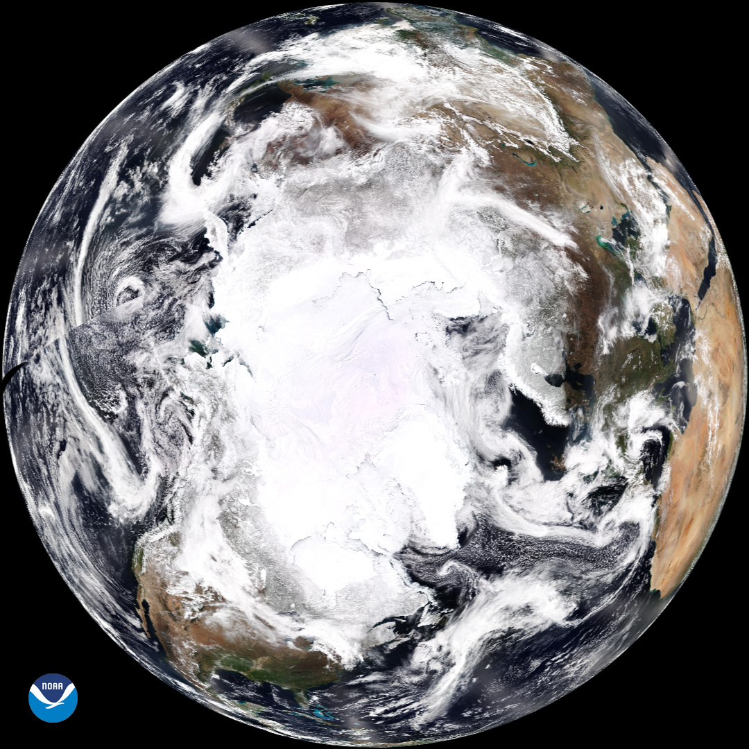
NOAA-20は1日に14回赤道を横切り、北極や南極を観測し続けていますが、北半球全体が写っている画像はなかなかないので貴重です。南極と違って北極には大陸がりませんので、北極点は海氷上です。地上の様子はこちらです。

参考文献: NOAA Shares First New View of the North Pole for Earth Day!
ウェブ地球儀で地球俯瞰画像を見る: LiVEARTH
[Earthview Wonders] No.489: North Pole
This week starts with the North Pole. NOAA’s NOAA-20 satellite captured the North Pole and northern hemisphere which was shared on the Earth Day (4/22) for the first time.
NOAA-20 circles the Earth from pole to pole and crosses the equator about 14 times daily, providing full global coverage twice a day. Unlike Antarctica, the North Pole is located over the sea ice as there is no continent. The local scenery on the ground is as follows.
Reference: NOAA Shares First New View of the North Pole for Earth Day!
See earthview photo gallery with web-globe: LiVEARTH[:en][Earthview Wonders] No.489: North Pole
This week starts with the North Pole. NOAA’s NOAA-20 satellite captured the North Pole and northern hemisphere which was shared on the Earth Day (4/22) for the first time.
NOAA-20 circles the Earth from pole to pole and crosses the equator about 14 times daily, providing full global coverage twice a day. Unlike Antarctica, the North Pole is located over the sea ice as there is no continent. The local scenery on the ground is as follows.
Reference: NOAA Shares First New View of the North Pole for Earth Day!
See earthview photo gallery with web-globe: LiVEARTH[:]