[:ja]ランディ・ブレズニク宇宙飛行士がISSから撮影した米国ロサンゼルスです。
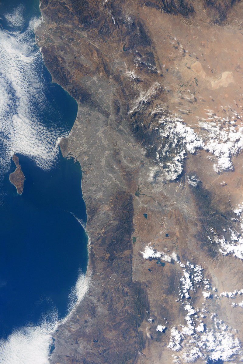
画像からも明らかですが、灰色の都市圏が砂漠の中に忽然と存在しています。市の北東にモハーベ砂漠、北西にコースト山脈、東にシエラネバダ山脈がそれぞれ広がります。広域都市圏は、ロサンゼルス郡、オレンジ郡、リバーサイド郡、サンバーナーディーノ郡、ベンチュラ郡を含み、5郡の人口は約約1900万人です。もともとは沿岸部で、インディアン部族が豊富な漁猟資源を糧に漁猟採集生活を営んでいました。1781年に、入植者が現ロサンゼルス市ダウンタウンのオルベラ街あたりに小さな村落を建設し、町の名をEl Pueblo de Nuestra Señora la Reina de los Ángeles de Porciúncula(我らが貴婦人、ポルツィウンコラの天使たちの女王の町)と名づけ、それが縮まったものです。
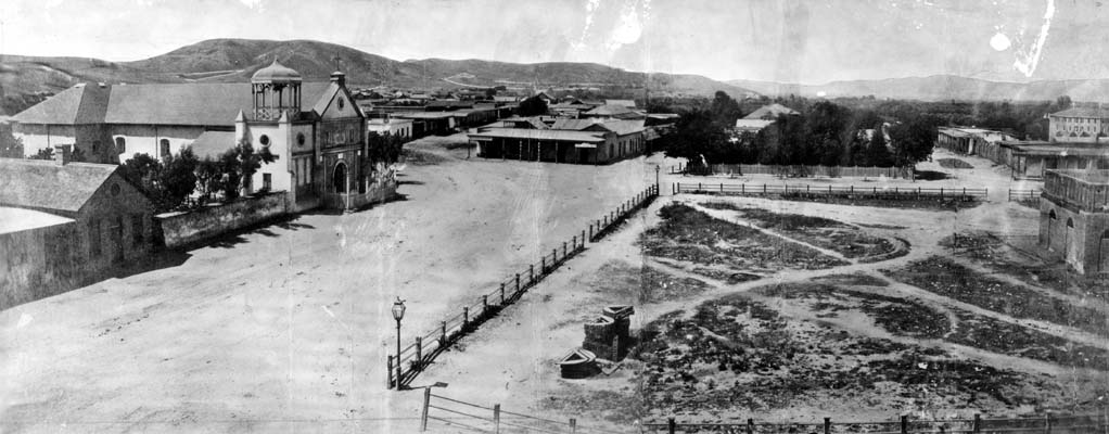
1869年の地上の様子はこちらです。
参考文献: Randy Bresnik’s Tweet
ウェブ地球儀で地球俯瞰画像を見る: LiVEARTH
[Earthview Wonders] No.506: Los Angeles, U.S.🇺🇸
Astronaut Randy Bresnik captured from ISS Los Angeles, U.S..
As can be seen from the image, grayish metropolitan area with about 19 million population spread in the desert. Historically home to the Chumash and Tongva, the city was officially founded in 1781, by Spanish governor Felipe de Neve. A group of 44 settlers known as “Los Pobladores” founded the pueblo they called “El Pueblo de Nuestra Señora la Reina de los Ángeles de Porciúncula” which was shortened to be the current name.
The local scenery on the ground is as follows.
Reference: Randy Bresnik’s Tweet
See earthview photo gallery with web-globe: LiVEARTH[:en][Earthview Wonders] No.506: Los Angeles, U.S.🇺🇸
Astronaut Randy Bresnik captured from ISS Los Angeles, U.S..
As can be seen from the image, grayish metropolitan area with about 19 million population spread in the desert. Historically home to the Chumash and Tongva, the city was officially founded in 1781, by Spanish governor Felipe de Neve. A group of 44 settlers known as “Los Pobladores” founded the pueblo they called “El Pueblo de Nuestra Señora la Reina de los Ángeles de Porciúncula” which was shortened to be the current name.
The local scenery on the ground is as follows.
Reference: Randy Bresnik’s Tweet
See earthview photo gallery with web-globe: LiVEARTH[:]