[:ja]ランディ・ブレズニク宇宙飛行士がISSから撮影したニュージーランド南島の南アルプスです。
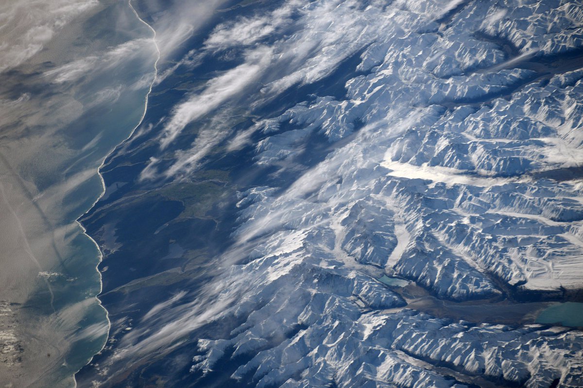
南アルプス山脈は、ニュージーランド南島を形作る「背骨」にあたる山脈で、ヨーロッパのアルプス山脈にその姿が似ていることから、名付けられました。画像にはニュージーランド最高峰のクック山(標高3,724m)のアオラキ/マウント・クック国立公園の北側のファタロア付近が見えています。ダイナミックな氷河の景観が楽しめます。
ファタロア付近の地上の様子はこちらです。

参考文献: Randy Bresnik’s Tweet
ウェブ地球儀で地球俯瞰画像を見る: LiVEARTH
[Earthview Wonders] No.514: Southern Alps of New Zealand🇳🇿
Astronaut Randy Bresnik captured from ISS the Southern Alps, New Zealand.
The Southern Alps is a mountain range extending along much of the length of New Zealand’s South Island, reaching its greatest elevations near the range’s western side. The image shows the northern part of tallest peak Aoraki / Mount Cook (3,724m) near Whataroa. Dynamic view of the glacier is recognized.
The local scenery on the ground near Whataroa is as follows.
Reference: Randy Bresnik’s Tweet
See earthview photo gallery with web-globe: LiVEARTH[:en][Earthview Wonders] No.514: Southern Alps of New Zealand🇳🇿
Astronaut Randy Bresnik captured from ISS the Southern Alps, New Zealand.
The Southern Alps is a mountain range extending along much of the length of New Zealand’s South Island, reaching its greatest elevations near the range’s western side. The image shows the northern part of tallest peak Aoraki / Mount Cook (3,724m) near Whataroa. Dynamic view of the glacier is recognized.
The local scenery on the ground near Whataroa is as follows.
Reference: Randy Bresnik’s Tweet
See earthview photo gallery with web-globe: LiVEARTH[:]