[:ja]リッキー・アーノルド宇宙飛行士がISSから撮影したブラジル北東部、ベレム市近郊のアマゾン川河口です。
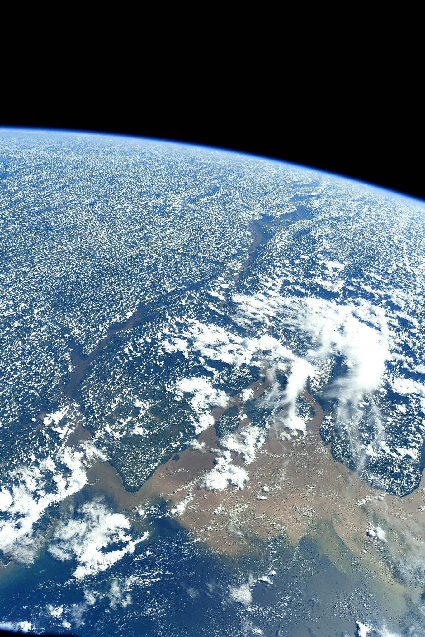
アマゾン川は南米のブラジルとその周辺国の熱帯雨林を流れ、大西洋に注ぐ世界最大級の河川です。特に流域面積では2位以下のコンゴ川、ナイル川、ミシシッピ川のそれぞれ2倍程度となっています。画像からは、アマゾン川によって運ばれてくる土砂が河口付近に堆積しているのがわかります。また、熱帯雨林の地表から蒸発する水蒸気が雲になっている様子がわかります。
地上の様子はこちらです。

参考文献: Ricky Arnold’s Tweet
ウェブ地球儀で地球俯瞰画像を見る: LiVEARTH
[Earthview Wonders] No.521: Amazon River🇧🇷
Astronaut Ricky Arnold captured from ISS panoramic view of Amazon River near Belem, northeastern Brazil.
The local scenery on the ground is as follows.
The Amazon River in South America is the largest river by discharge volume of water in the world, and either the longest or second longest. The image clearly shows sediments discharged by the river are laid up at the mouth of Amazon River. Moreover, clouds formed over rainforest land is created from water vapor evaporated due to heat can be seen.
The local scenery on the ground is as follows.
Reference: Ricky Arnold’s Tweet
See earthview photo gallery with web-globe: LiVEARTH[:en][Earthview Wonders] No.521: Amazon River🇧🇷
Astronaut Ricky Arnold captured from ISS panoramic view of Amazon River near Belem, northeastern Brazil.
The local scenery on the ground is as follows.
The Amazon River in South America is the largest river by discharge volume of water in the world, and either the longest or second longest. The image clearly shows sediments discharged by the river are laid up at the mouth of Amazon River. Moreover, clouds formed over rainforest land is created from water vapor evaporated due to heat can be seen.
The local scenery on the ground is as follows.
Reference: Ricky Arnold’s Tweet
See earthview photo gallery with web-globe: LiVEARTH[:]