[:ja]アレックス・ゲルスト宇宙飛行士がISSから撮影したアルジェリア付近のサハラ砂漠です。火星か?と思ってしまうほど、赤い大地が広がっています。
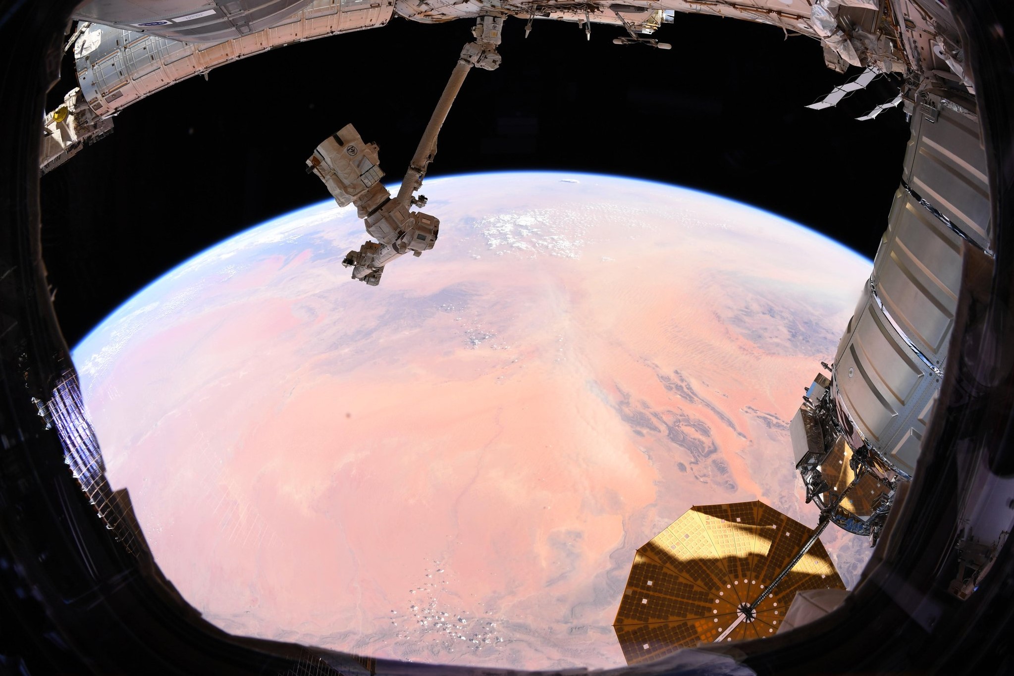
アルジェリアは国土の大部分を砂漠が占め、乾燥した平原地帯となっていますが、北部には2000m級のアトラス山脈が走り、地中海沿岸は雨量も多く草原なども広がり、国民の約95%がこの地域に居住しています。アルジェリア南東部は山がちで、ホガール山地は火山性で、アルジェリア最高峰のタハト山 (2,918m) を有します。
地上の様子はこちらです。

参考文献: Alex Gerst’s Tweet
ウェブ地球儀で地球俯瞰画像を見る: LiVEARTH
[Earthview Wonders] No.543: Algeria and Sahara Desert🇩🇿
Astronaut Alex Gerst captured from ISS Algeria and Sahara Desert. For its reddish color, the image can be mistaken for Mars.
Algeria’s southern part includes a significant portion of the Sahara. To the north, the Tell Atlas form with the Saharan Atlas, further south, two parallel sets of reliefs in approaching eastbound, and between which are inserted vast plains and highlands. The vast mountain ranges of Aures and Nememcha occupy the entire northeastern Algeria and are delineated by the Tunisian border, with the highest point of Mt. Tahat (2,918m).
The local scenery on the ground is as follows.
Reference: Alex Gerst’s Tweet
See earthview photo gallery with web-globe: LiVEARTH[:en][Earthview Wonders] No.543: Algeria and Sahara Desert🇩🇿
Astronaut Alex Gerst captured from ISS Algeria and Sahara Desert. For its reddish color, the image can be mistaken for Mars.
Algeria’s southern part includes a significant portion of the Sahara. To the north, the Tell Atlas form with the Saharan Atlas, further south, two parallel sets of reliefs in approaching eastbound, and between which are inserted vast plains and highlands. The vast mountain ranges of Aures and Nememcha occupy the entire northeastern Algeria and are delineated by the Tunisian border, with the highest point of Mt. Tahat (2,918m).
The local scenery on the ground is as follows.
Reference: Alex Gerst’s Tweet
See earthview photo gallery with web-globe: LiVEARTH[:]