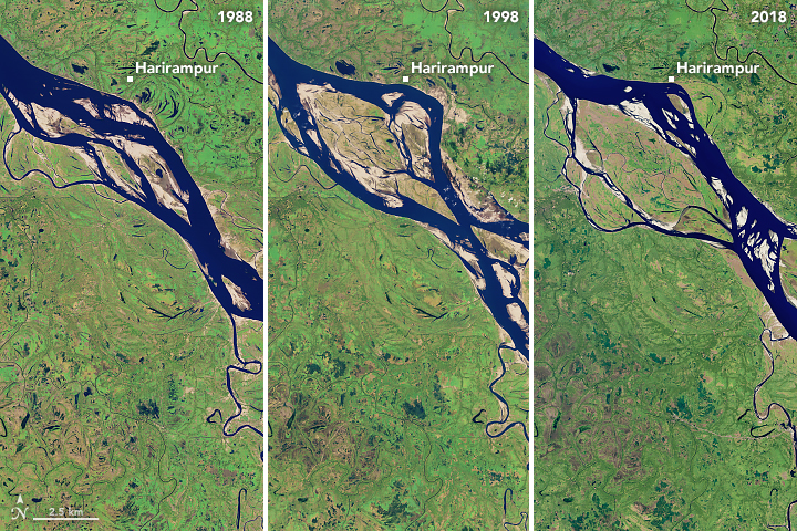
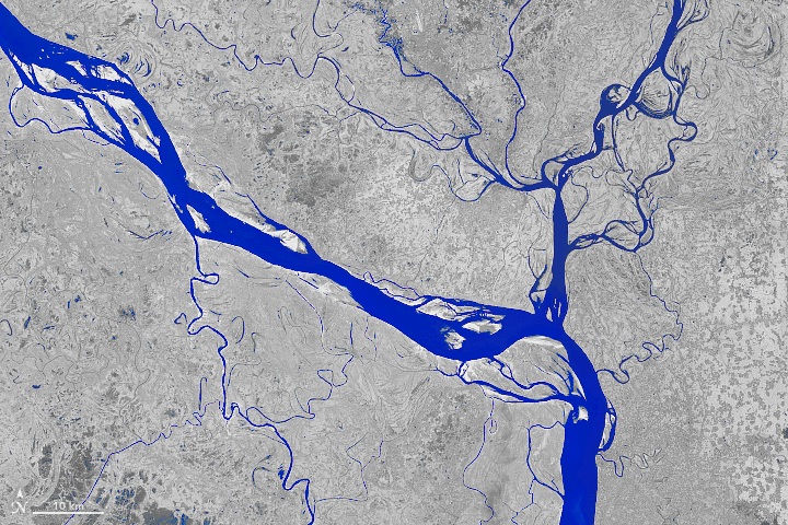
[:ja]NASAの地球観測衛星Landsat5, 8が撮影したバングラデシュのハリランプール付近のパドマ川が変化する様子です。1988年から2018年までの30年の間に川の流れ方が大きく変わったていることがよくわかります。
パドマ川はガンジス川下流の一部で、バングラデシュ中部を流れます。ガンジス川・ブラマプトラ川に次ぐバングラデシュ第3の大河であり、バングラデシュ東部を流れてガンジス川と合流し、ベンガル湾に注ぎ、同国の大部分を占める広大な三角州(デルタ)地帯を形成しています。過去30年間で、天候による降雨や川の氾濫、近隣のダムの建設などにより川の流域は変わり、その結果、毎年数百ヘクタールもの農地や宅地が消失してきました。
パドマ川の地上の様子はこちらです。

参考文献: The Most Erosive Area on the Padma (NASA Earth Observatory)
ウェブ地球儀で地球俯瞰画像を見る: LiVEARTH
[Earthview Wonders] No.572: Changing Padma River, Bangladesh🇧🇩
NASA’s Landsat 5 and 8 captured Padma River near Harirampur, Bangladesh. The image clear shows the changes of shape and drainage basin of the Padma over 30 years (1988-2018).
Padma River is a major river in Bangladesh and is the main distributary of the Ganges, flowing generally southeast for 120km to its confluence with the Meghna River near the Bay of Bengal. For decades, the Padma has meandered in different shapes through central Bangladesh. Zigzag patterns on the land shows a geologic story of the region, such as a large flooding event or the opening of a nearby dam. Every year, hundreds of hectares of land erode and fall into the Padma River.
The local scenery of the Padma on the ground is as follows.
Reference: The Most Erosive Area on the Padma (NASA Earth Observatory)
See earthview photo gallery with web-globe: LiVEARTH[:en][Earthview Wonders] No.572: Changing Padma River, Bangladesh🇧🇩
NASA’s Landsat 5 and 8 captured Padma River near Harirampur, Bangladesh. The image clear shows the changes of shape and drainage basin of the Padma over 30 years (1988-2018).
Padma River is a major river in Bangladesh and is the main distributary of the Ganges, flowing generally southeast for 120km to its confluence with the Meghna River near the Bay of Bengal. For decades, the Padma has meandered in different shapes through central Bangladesh. Zigzag patterns on the land shows a geologic story of the region, such as a large flooding event or the opening of a nearby dam. Every year, hundreds of hectares of land erode and fall into the Padma River.
The local scenery of the Padma on the ground is as follows.
Reference: The Most Erosive Area on the Padma (NASA Earth Observatory)
See earthview photo gallery with web-globe: LiVEARTH[:]