[:ja]リッキー・アーノルド宇宙飛行士がISSから撮影した黒海です。
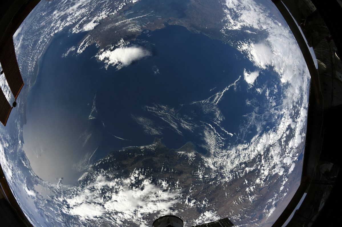
黒海は、ヨーロッパとアジアの間にある内海で、大西洋の縁海の一つである。マルマラ海を経てエーゲ海、地中海に繋がります。黒海に面する国は、南岸がトルコで、そこから時計回りにブルガリア、ルーマニア、ウクライナ、ロシア、ジョージアです。
最大水深は2,206m。名称は黒味を帯びた海水に由来し、この黒味の原因は硫化鉄であるとする説と、地中海よりも豊富な微小藻類であるとする説があります。
黒海の海水は水深200mを境として冷たく塩分の薄い表層水(河川から流入し、地中海へ流出)と、暖かく塩分の濃い深層水(地中海から流入)が層を成して混合しません。表層水は充分な酸素を含むため豊かな生態系を擁しており、漁業も行われている。漁獲高は年25万トンから30万tに上り、その3分の2がアンチョビで、残りはアジやイワシ、ニシンやチョウザメなどです。
地上の様子はこちらです。

参考文献: Ricky Arnold’s Tweet
地球俯瞰画像を見る: LiVEARTH
[Earthview Wonders] No.592: Black Sea🇹🇷🇧🇬🇷🇴🇺🇦🇷🇺🇬🇪
Astronaut Ricky Arnold captured from ISS Black Sea.
The Black Sea is a body of water and marginal sea of the Atlantic Ocean between Eastern Europe, the Caucasus, and Western Asia. It is supplied by a number of major rivers, such as the Danube, Dnieper, Southern Bug, Dniester, Don, and the Rioni, and about a third of Europe drains into the Black Sea. Black Sea is surrounded by Bulgaria, Romania, Ukraine, Russia and Georgia. The Black Sea outflow is cooler and less saline, and floats over the warm, more saline Mediterranean inflow – as a result of differences in density caused by differences in salinity – leading to a significant anoxic layer well below the surface waters.
The local scenery on the ground is as follows.
Reference: Ricky Arnold’s Tweet
See earthview photo gallery: LiVEARTHBlack Sea.
The Black Sea is a body of water and marginal sea of the Atlantic Ocean between Eastern Europe, the Caucasus, and Western Asia. It is supplied by a number of major rivers, such as the Danube, Dnieper, Southern Bug, Dniester, Don, and the Rioni, and about a third of Europe drains into the Black Sea. Black Sea is surrounded by Bulgaria, Romania, Ukraine, Russia and Georgia. The Black Sea outflow is cooler and less saline, and floats over the warm, more saline Mediterranean inflow – as a result of differences in density caused by differences in salinity – leading to a significant anoxic layer well below the surface waters.
The local scenery on the ground is as follows.
Reference: Ricky Arnold’s Tweet
See earthview photo gallery: LiVEARTH