[:ja]アレックス・ゲルスト宇宙飛行士がISSから撮影したオランダ付近で北海に注ぐライン川です。太陽光が水面に鏡面反射するサングリント(sunglint)と呼ばれる現象により、水の流れがわかりやすくなっています。
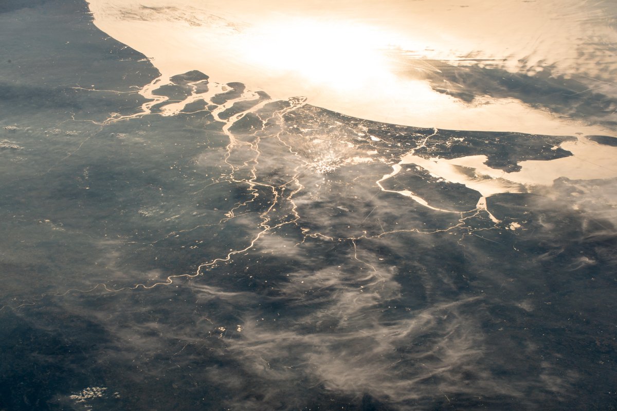
ライン川は、スイスアルプスのトーマ湖に端を発し、ボーデン湖に入りドイツ・フランスの国境を北に向かいます。ドイツ国内を流れ、ボン、ケルン、デュッセルドルフ、デュースブルクなどを通過しオランダ国内へと入ったあと2分岐し、ワール川とレク川となりロッテルダム付近で北海に注いでいます。画像からわかりますが、北海に注ぐ部分はオランダ付近でかなり複雑になっています。
ロッテルダムの地上の様子はこちらです。

参考文献: Alex Gerst’s Tweet
地球俯瞰画像を見る: LiVEARTH
[Earthview Wonders] No.597: The Rhine and North Sea🇳🇱
Astronaut Alex Gerst captured from ISS the Rhine River flowing into the North Sea. The Sunglint clarifies the flow path of the Rhine near Netherlands.
The Rhine is a European river that begins in the southeastern Swiss Alps, flows through the German Rhineland and the Netherlands and eventually empties into the North Sea. It is the second-longest river in Central and Western Europe (after the Danube), at about 1,230km. As can be recognized from the photo, the drainage of the Rhine near Rotterdam, Netherlands is quite intricate.
The local scenery on the ground is as follows.
Reference: Alex Gerst’s Tweet
See earthview photo gallery: LiVEARTH[:en][Earthview Wonders] No.597: The Rhine and North Sea🇳🇱
Astronaut Alex Gerst captured from ISS the Rhine River flowing into the North Sea. The Sunglint clarifies the flow path of the Rhine near Netherlands.
The Rhine is a European river that begins in the southeastern Swiss Alps, flows through the German Rhineland and the Netherlands and eventually empties into the North Sea. It is the second-longest river in Central and Western Europe (after the Danube), at about 1,230km. As can be recognized from the photo, the drainage of the Rhine near Rotterdam, Netherlands is quite intricate.
The local scenery on the ground is as follows.
Reference: Alex Gerst’s Tweet
See earthview photo gallery: LiVEARTH[:]