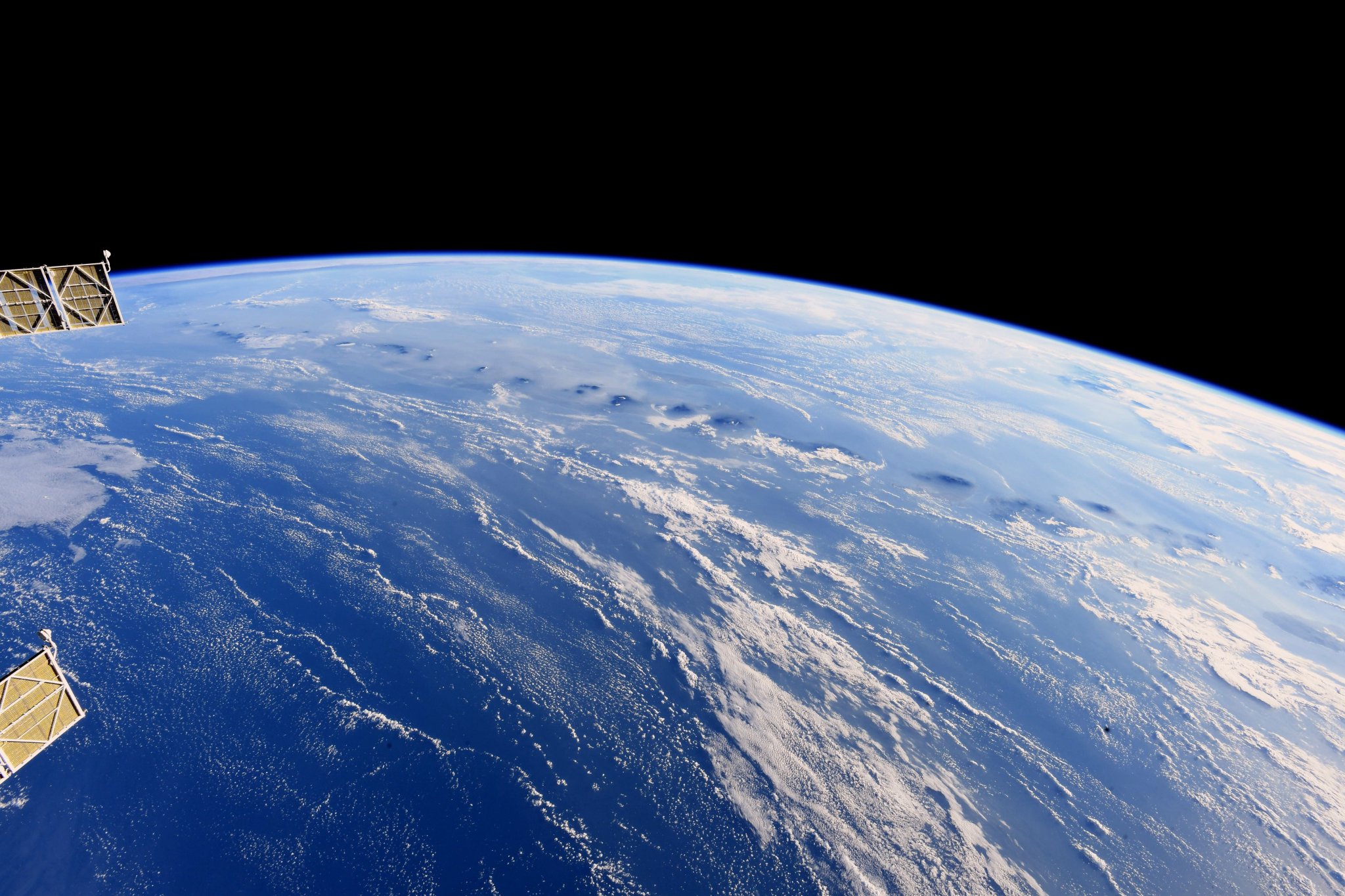
[:ja]ドリュー・フューステル宇宙飛行士がISSから撮影したインドネシアのスンダ列島です。ジャワ島のムラピ山からスンバワ島のタンボラ山が写っています。

スンダ列島はインド・オーストラリアプレートがユーラシアプレートの下に沈み込んで形成されている海溝の北東に連なる弓なりの列島で、北はミャンマーから、南はオーストラリアの西側まで5,500kmに渡り広げっています。画像は、インドネシアの東ヌサ・トゥンガラ州付近の火山帯です。
リンチャ島の地上の様子はこちらです。

参考文献: Drew Feustel’s Tweet
地球俯瞰画像を見る: LiVEARTH
[Earthview Wonders] No.600: Sunda Megathrust🇮🇩
Astronaut Drew Feustel captured from ISS the Sunda Megathrust, Indonesia. The photo shows the Mt. Merapi of Java to Mt. Tambora of Sumbawa.

The Sunda Megathrust is a fault that extends approximately 5,500km from Myanmar in the north, running along the southwestern side of Sumatra, to the south of Java and Bali before terminating near Australia. It is a megathrust, located at a convergent plate boundary where it forms the interface between the overriding Eurasian plate and the subducting Indo-Australian plate. It is one of the most seismogenic structures on Earth, being responsible for many great and giant earthquakes, including the 2004 Indian Ocean earthquake and tsunami that killed over 230,000 people.
The local scenery of Rinca Island on the ground is as follows.

Reference: Drew Feustel’s Tweet
See earthview photo gallery: LiVEARTH[:en][Earthview Wonders] No.600: Sunda Megathrust🇮🇩
Astronaut Drew Feustel captured from ISS the Sunda Megathrust, Indonesia. The photo shows the Mt. Merapi of Java to Mt. Tambora of Sumbawa.

The Sunda Megathrust is a fault that extends approximately 5,500km from Myanmar in the north, running along the southwestern side of Sumatra, to the south of Java and Bali before terminating near Australia. It is a megathrust, located at a convergent plate boundary where it forms the interface between the overriding Eurasian plate and the subducting Indo-Australian plate. It is one of the most seismogenic structures on Earth, being responsible for many great and giant earthquakes, including the 2004 Indian Ocean earthquake and tsunami that killed over 230,000 people.
The local scenery of Rinca Island on the ground is as follows.

Reference: Drew Feustel’s Tweet
See earthview photo gallery: LiVEARTH[:]