[:ja]ESAの地球観測衛星Sentinel 2が撮影した南スーダンを流れるソバト川です。
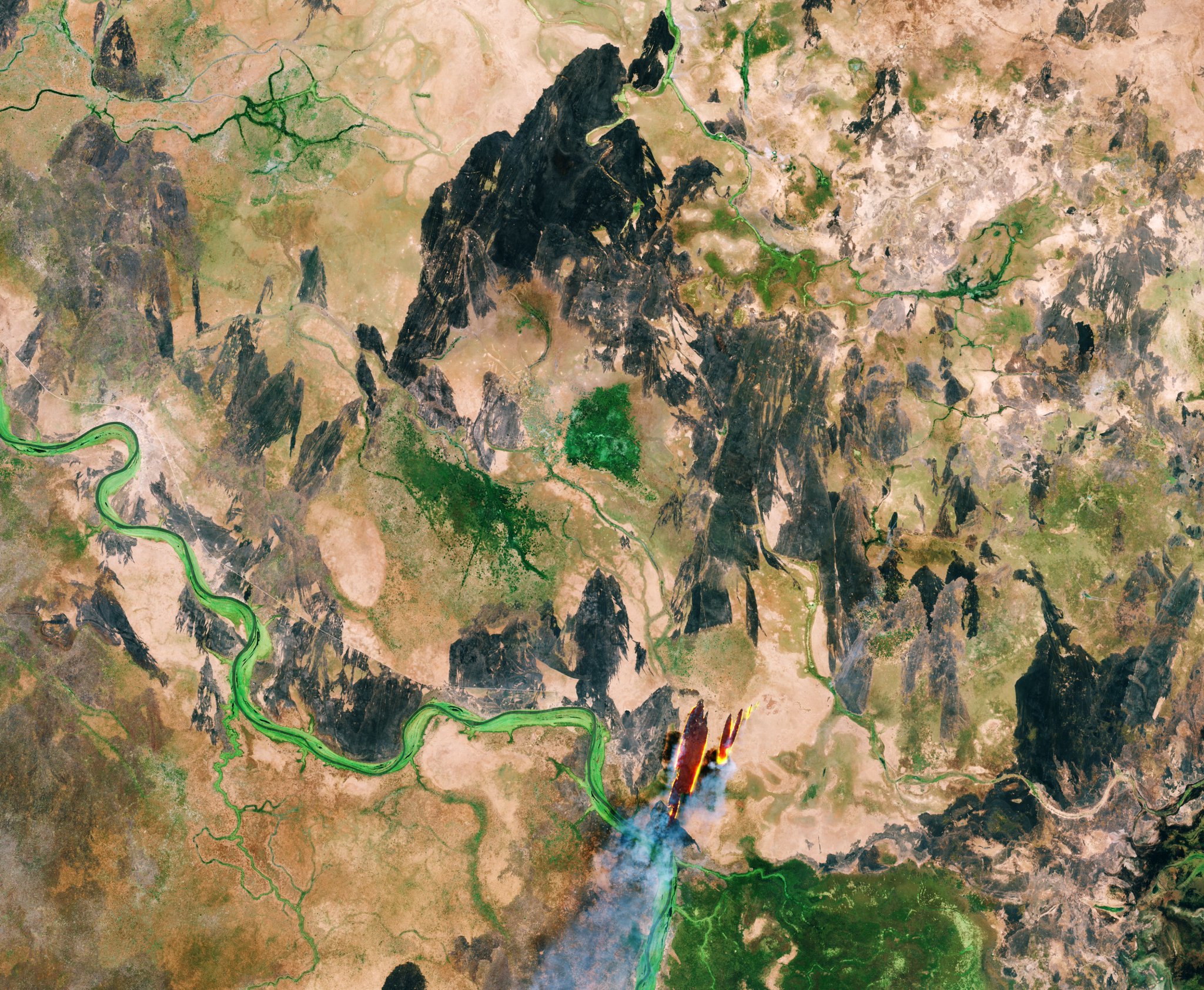
南スーダンは、東アフリカの国家で、2011年にスーダン共和国の南部10州が、アフリカ大陸54番目の国家として分離独立しました。2005年に結ばれた第二次スーダン内戦の包括的な暫定和平合意により、スーダン政府から自治を認められ、2011年までは、スーダン領でありながら南部スーダン自治政府の統治下にありました。内戦の影響もあり、2014年、非政府組織の平和基金会が発表した「世界で最も脆弱な国家ランキング」で、南スーダンは首位となっています。また、ソバト川は南スーダンとエチオピアとの国境で西流するバロ川と北流するピボル川との合流により形成され、白ナイル川に注ぎます。
ソバト川の地上の様子はこちらです。

参考文献: ESA Earth Observation’s Tweet
地球俯瞰画像を見る: LiVEARTH
[Earthview Wonders] No.614: South Sudan🇸🇸
ESA’s Sentinel 2 captured South Sudan and Sobat River.
South Sudan is a landlocked country in East-Central Africa. The country gained its independence from the Republic of the Sudan in 2011, making it the newest country with widespread recognition. South Sudan has suffered ethnic violence and has been in a civil war since 2013. As of 2017, it has the highest score on the American Fund for Peace’s Fragile States Index, surpassing Somalia.
The local scenery on the ground is as follows.
Reference: ESA Earth Observation’s Tweet
See earthview photo gallery: LiVEARTH[:en][Earthview Wonders] No.614: South Sudan🇸🇸
ESA’s Sentinel 2 captured South Sudan and Sobat River.
South Sudan is a landlocked country in East-Central Africa. The country gained its independence from the Republic of the Sudan in 2011, making it the newest country with widespread recognition. South Sudan has suffered ethnic violence and has been in a civil war since 2013. As of 2017, it has the highest score on the American Fund for Peace’s Fragile States Index, surpassing Somalia.
The local scenery on the ground is as follows.
Reference: ESA Earth Observation’s Tweet
See earthview photo gallery: LiVEARTH[:]