[:ja]NASAの地球観測衛星Landsatが撮影したアフリカ南東部のマラウイの首都リロングウェです。
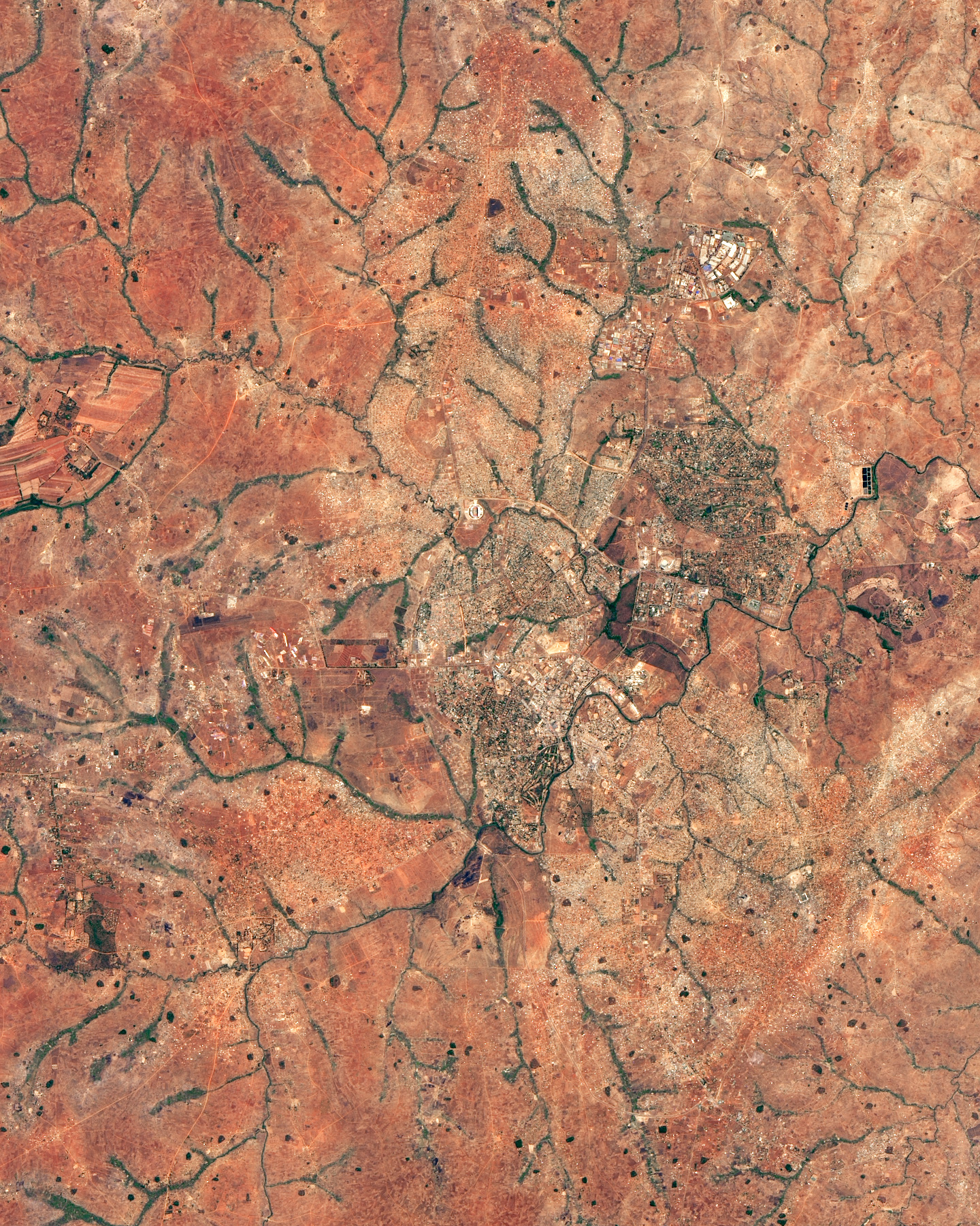
マラウイは、アフリカ大地溝帯に位置する内陸国で、東西の幅は90-161km、南北の長さは900kmと南北に細長い形をした国です。国土はほとんど高原上にあり、マラウイ湖が大きな面積を占めます。独立以降、アフリカでは珍しく対外戦争や内戦を経験しておらず“The Warm Heart of Africa”(アフリカの温かい心)という別称を持ちます。
リロングウェの地上の様子はこちらです。

参考文献: Lilongwe and Landsat Grew Up Together (NASA Earth Observatory)
地球俯瞰画像を見る: LiVEARTH
[Earthview Wonders] No.663: Lilongwe, Malawi🇲🇼
NASA’s Landsat captured Lilongwe, the capital of Malawi.
Malawi is a landlocked country in southeast Africa, with 18 million population. Lake Malawi takes up about a third of Malawi’s area. The country is also nicknamed “The Warm Heart of Africa”, for having no experience of civil war. The country’s economy is heavily based in agriculture, with a largely rural population.
The local scenery on the ground is as follows.
Reference: Lilongwe and Landsat Grew Up Together (NASA Earth Observatory)
See earthview photo gallery: LiVEARTH[:en][Earthview Wonders] No.663: Lilongwe, Malawi🇲🇼
NASA’s Landsat captured Lilongwe, the capital of Malawi.
Malawi is a landlocked country in southeast Africa, with 18 million population. Lake Malawi takes up about a third of Malawi’s area. The country is also nicknamed “The Warm Heart of Africa”, for having no experience of civil war. The country’s economy is heavily based in agriculture, with a largely rural population.
The local scenery on the ground is as follows.
Reference: Lilongwe and Landsat Grew Up Together (NASA Earth Observatory)
See earthview photo gallery: LiVEARTH[:]