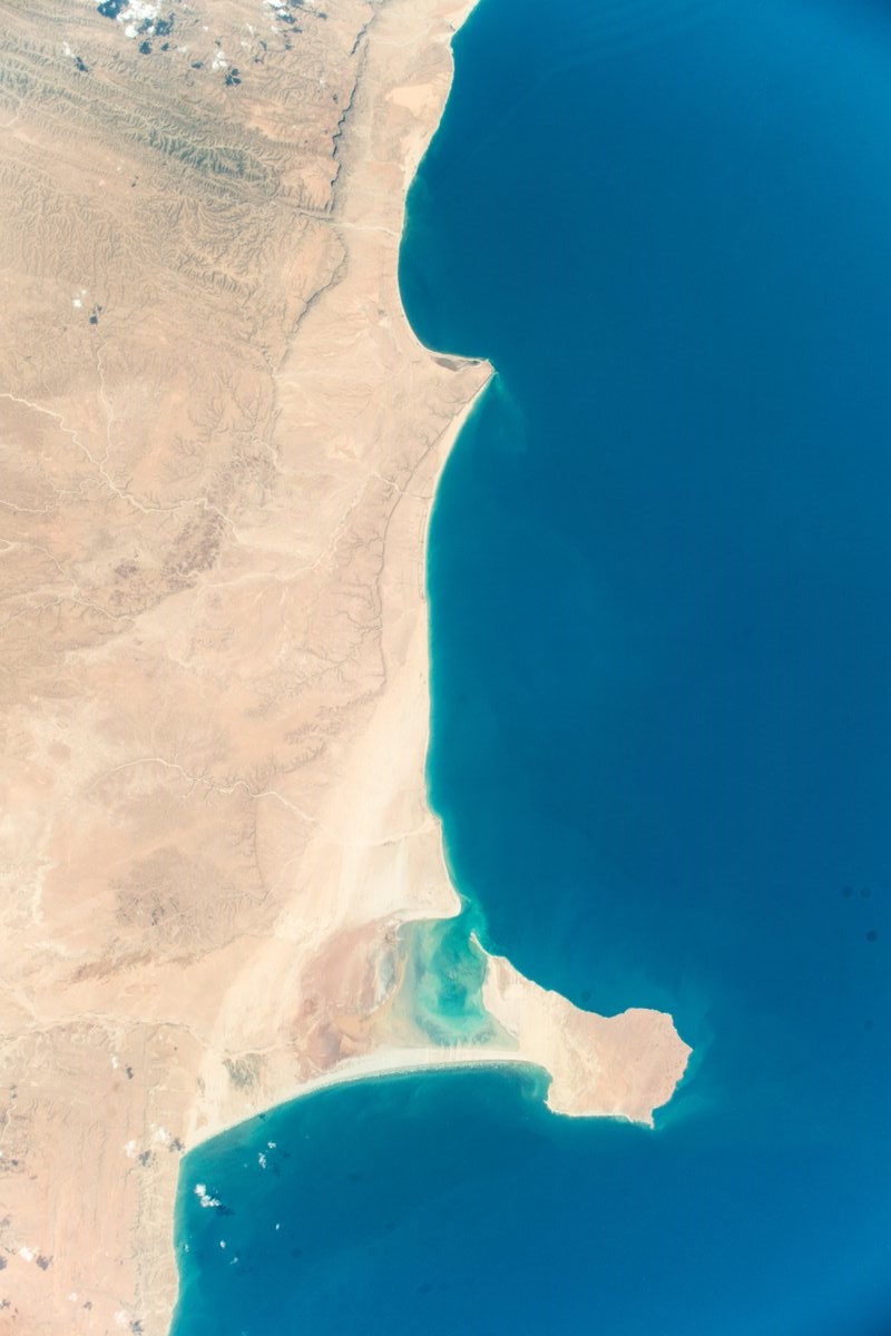
[:ja]アレックス・ゲルスト宇宙飛行士がISSから撮影したアフリカ最東端のソマリアのハフーン岬です。
ソマリアは、東アフリカのアフリカの角と呼ばれる地域を領域とする国家で、インド洋とアデン湾に面しています。1991年勃発の内戦により国土は分断され、事実上の無政府状態が続きました。のちにエチオピアの軍事支援を受けた暫定政権が発足し、現在では正式な政府が成立したが、依然として一部地域を他の国家であると主張する政府が統治しています。 現在の国土はソマリア連邦共和国政府が統治する南部と、1998年7月に自治宣言したプントランドの北東部、91年に独立宣言した旧英領のソマリランド共和国の北部、2014年に樹立された南西ソマリアに大きく4分割されています。
地上の様子はこちらです。

参考文献: Alex Gerst’s Tweet
地球俯瞰画像を見る: LiVEARTH
[Earthview Wonders] No.705: Hafun, Somalia🇸🇴
Astronaut Alex Gerst captured from ISS Hafun, Somalia which is the easternmost town in continental Africa.
Somalia is a sovereign state with its territory located in the Horn of Africa. It is bordered by the Gulf of Aden to the north and Indian Ocean to the east. Somalia has the longest coastline on Africa’s mainland, and its terrain consists mainly of plateaus, plains and highlands. In 2011–2012, a political process providing benchmarks for the establishment of permanent democratic institutions was launched. Somalia has maintained an informal economy, mainly based on livestock, remittances from Somalis working abroad, and telecommunications.
The local scenery on the ground is as follows.
Reference: Alex Gerst’s Tweet
See earthview photo gallery: LiVEARTH[:en][Earthview Wonders] No.705: Hafun, Somalia🇸🇴
Astronaut Alex Gerst captured from ISS Hafun, Somalia which is the easternmost town in continental Africa.
Somalia is a sovereign state with its territory located in the Horn of Africa. It is bordered by the Gulf of Aden to the north and Indian Ocean to the east. Somalia has the longest coastline on Africa’s mainland, and its terrain consists mainly of plateaus, plains and highlands. In 2011–2012, a political process providing benchmarks for the establishment of permanent democratic institutions was launched. Somalia has maintained an informal economy, mainly based on livestock, remittances from Somalis working abroad, and telecommunications.
The local scenery on the ground is as follows.
Reference: Alex Gerst’s Tweet
See earthview photo gallery: LiVEARTH[:]