[:ja]宇宙飛行士が国際宇宙ステーションISSから撮影した米国のグレートプレーンズです。
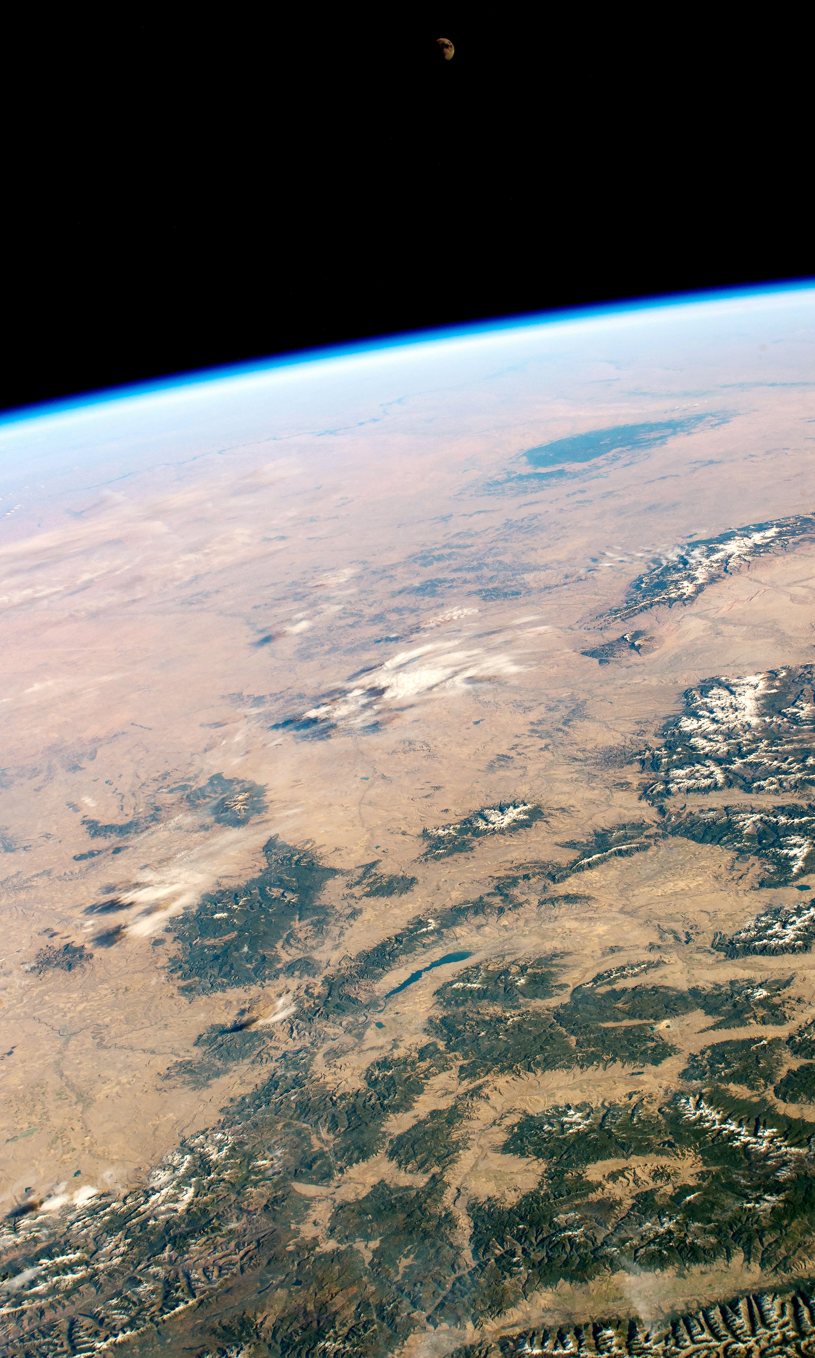
グレートプレーンズは、北アメリカ大陸の中西部、ロッキー山脈の東側と中央平原の間を南北に広がる台地状の大平原です。約1万年前の氷河侵食によって削られた五大湖沿岸の土壌が高気圧によって運ばれ、中央平原にかけて堆積し、プレーリー土(肥沃な土)となりました。よって、グレートプレーンズの東部は穀倉地帯となっており、灌漑によって小麦やトウモロコシが栽培されています。
地上の様子はこちらです。

参考文献: ‘s Tweet
地球俯瞰画像を見る: LiVEARTH
[Earthview Wonders] No.706: Great Planes🇺🇸
Astronaut on board ISS captured the Great Planes, U.S. This is the photo of Helena-Lewis & Clark National Forest, Montana, where the Rocky Mountains meet the Great Plains of central-northwest United States.
The Great Plains is the broad expanse of flat land, much of it covered in prairie, steppe, and grassland, that lies west of the Mississippi River tallgrass prairie in the United States and east of the Rocky Mountains in the U.S. and Canada. Many areas of the Great Plains have become productive crop-growing areas because of extensive irrigation on large landholdings.
The local scenery on the ground is as follows.
Reference: ‘s Tweet
See earthview photo gallery: LiVEARTH[:en][Earthview Wonders] No.706: Great Planes🇺🇸
Astronaut on board ISS captured the Great Planes, U.S. This is the photo of Helena-Lewis & Clark National Forest, Montana, where the Rocky Mountains meet the Great Plains of central-northwest United States.
The Great Plains is the broad expanse of flat land, much of it covered in prairie, steppe, and grassland, that lies west of the Mississippi River tallgrass prairie in the United States and east of the Rocky Mountains in the U.S. and Canada. Many areas of the Great Plains have become productive crop-growing areas because of extensive irrigation on large landholdings.
The local scenery on the ground is as follows.
Reference: ‘s Tweet
See earthview photo gallery: LiVEARTH[:]