[:ja]アレックス・ゲルスト宇宙飛行士がISSから撮影したボリビアのウユニ塩湖です。
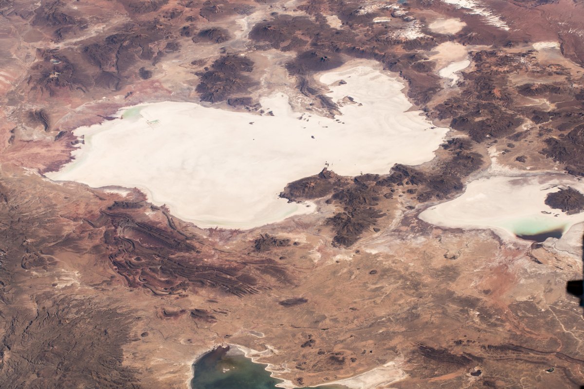
ウユニ塩原はボリビア中央西部のアルティプラーノにある塩の大地で、標高約3,700mにある南北約100km、東西約250km、面積約10,582km2の広大な塩の固まりです。この塩原は高低差が100km四方で50cmしかないことが調査により判明しており、「世界で最も平らな場所」でもあります。そのため雨季に雨により冠水すると、その水が波も立たないほど薄く広がるため、水が蒸発するまでのわずかな期間に「天空の鏡」と形容される巨大な鏡が出現します。ウユニ塩湖が画像からも左下の太平洋からせりあがったアンデス山脈中にあることがわかります。
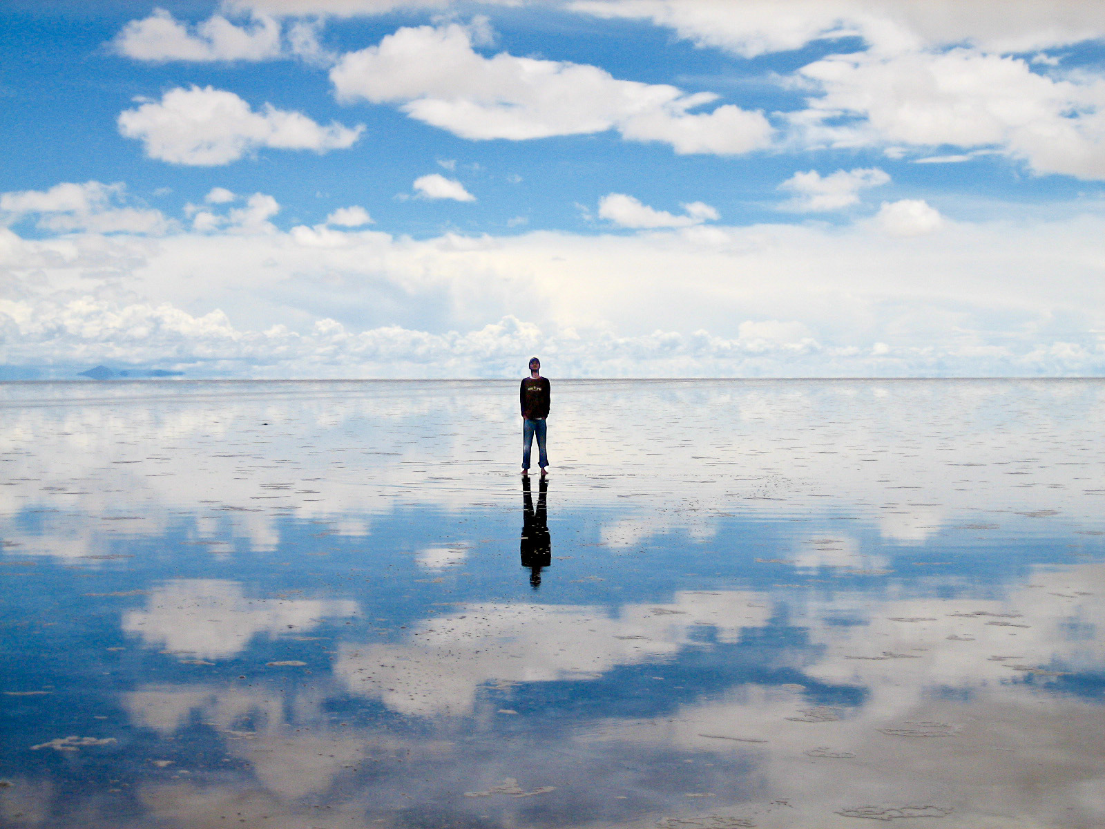
地上の様子はこちらです。
参考文献: Alex Gerst’s Tweet
地球俯瞰画像を見る: LiVEARTH
[Earthview Wonders] No.718: Uyuni Salt Lake, Bolivia🇧🇴
Astronaut Alex Gerst captured from ISS Uyuni Salt Lake (Salar de Uyuni), Bolivia.
Occupying over 10,000km2, the vast Salar de Uyuni lies at the southern end of the Altiplano, a high plain of inland drainage in the central Andes. On the whole, the Salar de Uyuni is very flat, with a surface elevation variation of less than 1m. The Salar serves as the major transport route across the Bolivian Altiplano and is a major breeding ground for several species of flamingos. From the image it is clear that the lake is located at 3700m in the Andes Mountains.
The local scenery on the ground is as follows.
Reference: Alex Gerst’s Tweet
See earthview photo gallery: LiVEARTH[:en][Earthview Wonders] No.718: Uyuni Salt Lake, Bolivia🇧🇴
Astronaut Alex Gerst captured from ISS Uyuni Salt Lake (Salar de Uyuni), Bolivia.
Occupying over 10,000km2, the vast Salar de Uyuni lies at the southern end of the Altiplano, a high plain of inland drainage in the central Andes. On the whole, the Salar de Uyuni is very flat, with a surface elevation variation of less than 1m. The Salar serves as the major transport route across the Bolivian Altiplano and is a major breeding ground for several species of flamingos. From the image it is clear that the lake is located at 3700m in the Andes Mountains.
The local scenery on the ground is as follows.
Reference: Alex Gerst’s Tweet
See earthview photo gallery: LiVEARTH[:]