[:ja]欧州宇宙機関ESAの地球観測衛星Sentinel-2Aが撮影したチャド湖です。
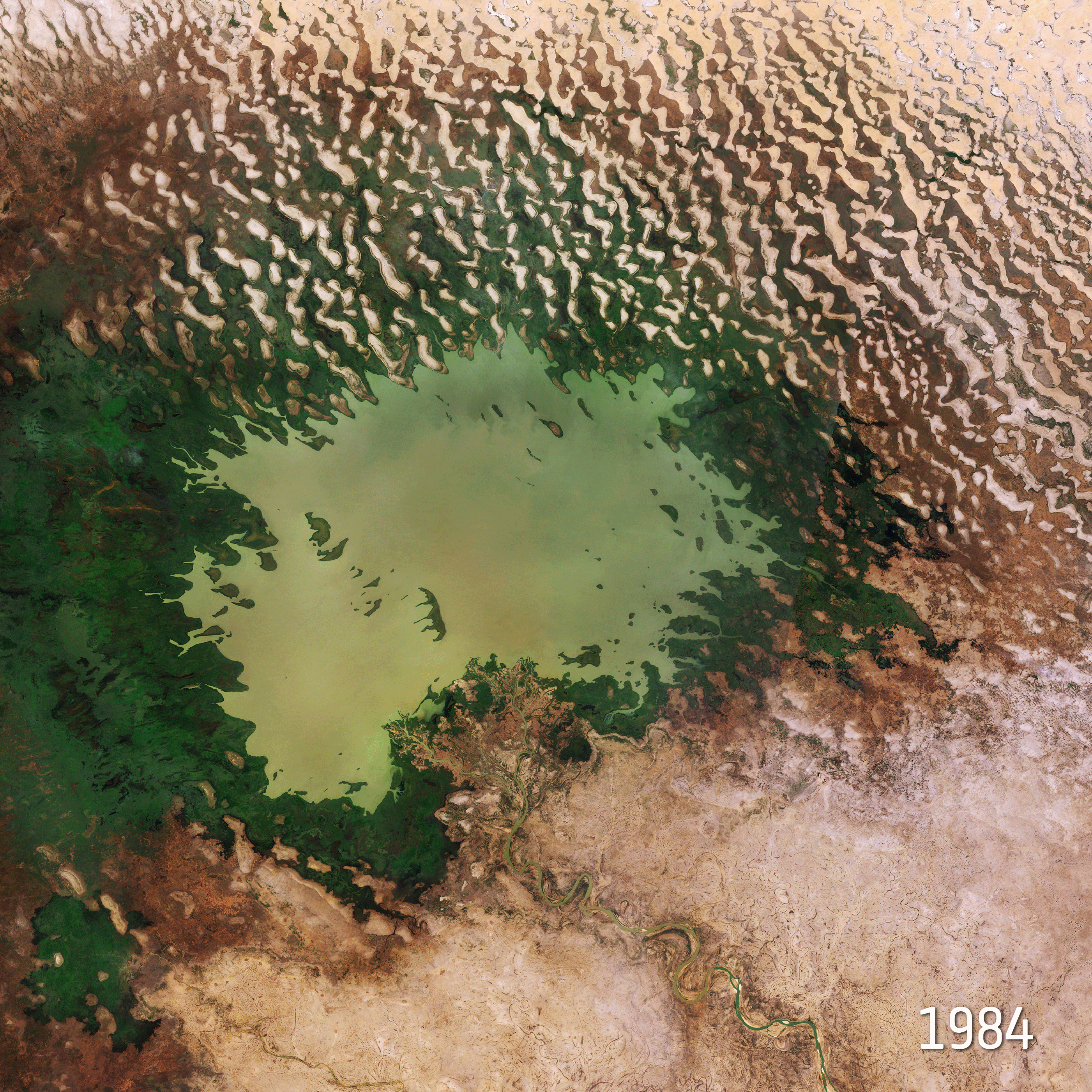
チャド湖は、チャド、ニジェール、ナイジェリア、カメルーンの4ヶ国にまたがるアフリカ大陸中央部の湖で、チャドは現地語で「大きな水域」という意味があります。面積は大きいですが、水深は浅く、最深地点でも7mしかありません。周辺の国々に居住する3,000万人以上の人々に水を供給していますが、水深が浅いため、漁業は発達していません。現在、灌漑・気候変動により面積が10%以下まで激減しており、大きな問題になっています。チャド湖、及びシャリ川・ロゴーヌ川を利用した周辺諸国での大規模な灌漑が湖が干上がっている理由です。
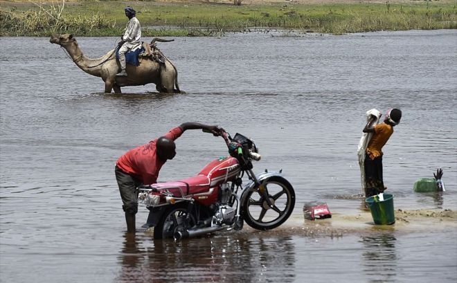
地上の様子はこちらです。
[Earthview Wonders] No.736: Lake Chad🇹🇩🇳🇪🇳🇬🇨🇲
ESA’s Sentinel-2A satellite captured Lake Chad.
Once one of Africa’s largest lakes, Lake Chad has shrunk by around 90% since the 1960s. This receding water is down to a reduction of precipitation, induced by climate change, as well as development of modern irrigation systems for agriculture and the increasing human demand for freshwater. Lake Chad is economically important, providing water to more than 30 million people living in the four countries surrounding it (Chad, Cameroon, Niger, and Nigeria) on the edge of the Sahara.
The local scenery on the ground is as follows.
Reference: Lake Chad’s Shrinking Waters (ESA)
See earthview photo gallery: LiVEARTH[:en][Earthview Wonders] No.736: Lake Chad🇹🇩🇳🇪🇳🇬🇨🇲
ESA’s Sentinel-2A satellite captured Lake Chad.
Once one of Africa’s largest lakes, Lake Chad has shrunk by around 90% since the 1960s. This receding water is down to a reduction of precipitation, induced by climate change, as well as development of modern irrigation systems for agriculture and the increasing human demand for freshwater. Lake Chad is economically important, providing water to more than 30 million people living in the four countries surrounding it (Chad, Cameroon, Niger, and Nigeria) on the edge of the Sahara.
The local scenery on the ground is as follows.
Reference: Lake Chad’s Shrinking Waters (ESA)
See earthview photo gallery: LiVEARTH[:]