[:ja]ESAの地球観測衛星Sentinel-2Aが撮影したイースター島です。
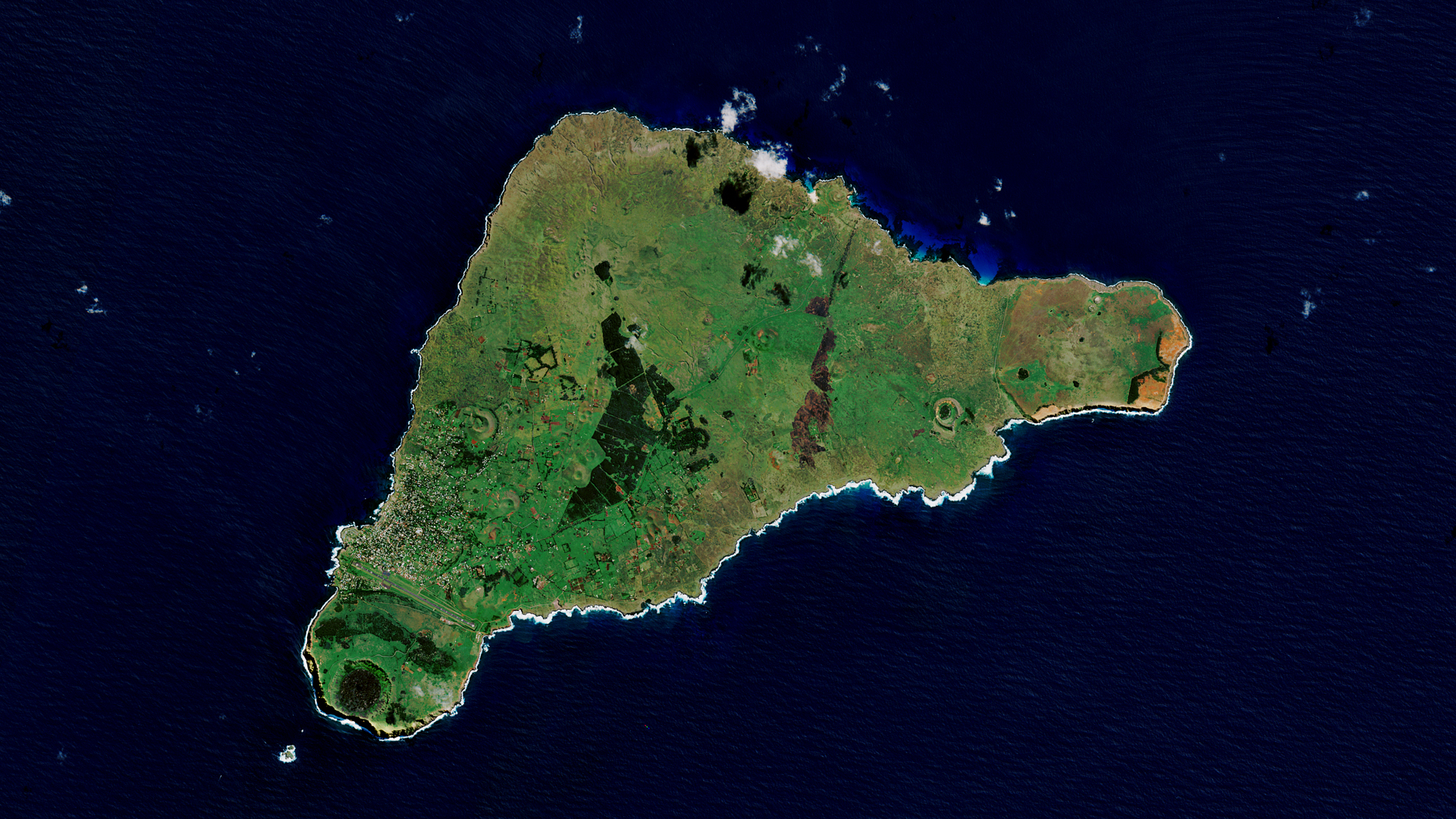
イースター島は、チリ領の太平洋上に位置する火山島で、ポリネシア・トライアングルの東端に当たり、モアイの建つ島として有名です。名前の由来は、1700年代にヨーロッパ人が島に到達した日がイースターの日曜日だったことによります。最も近い有人島まで直線距離2,000km余と、絶海の孤島となっています。ジャレド・ダイアモンドらによれば、7世紀〜8世紀頃に、アフ(プラットホーム状に作られた石の祭壇)作りが始まり、遅くとも10世紀頃にはモアイも作られるようになったとされています。他のポリネシアの地域と違っていたのは、島が完全に孤立していたため外敵の脅威が全くなく、加工しやすい軟らかな凝灰岩が大量に存在していたこととされています。
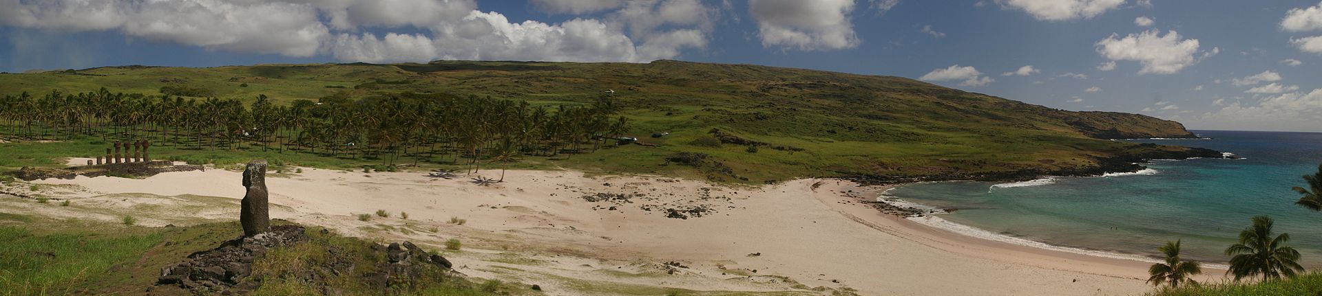
地上の様子はこちらです。
参考文献: Easter Island (ESA)
地球俯瞰画像を見る: LiVEARTH
[Earthview Wonders] No.749: Easter Island
ESA’s Sentinel-2A satellite captured Easter Island.
Easter Island is a Chilean island in the southeastern Pacific Ocean, at the southeasternmost point of the Polynesian Triangle in Oceania. Easter Island is most famous for its nearly 1,000 extant monumental statues, called Moai, created by the early Rapa Nui people. The island was given its current name the day Europeans arrived in the 1700s – on Easter Sunday. Jared Diamond suggested that cannibalism took place on Easter Island after the construction of the moai contributed to environmental degradation when extreme deforestation destabilized an already precarious ecosystem.
The local scenery on the ground is as follows.
Reference: Easter Island (ESA)
See earthview photo gallery: LiVEARTH[:en][Earthview Wonders] No.749: Easter Island
ESA’s Sentinel-2A satellite captured Easter Island.
Easter Island is a Chilean island in the southeastern Pacific Ocean, at the southeasternmost point of the Polynesian Triangle in Oceania. Easter Island is most famous for its nearly 1,000 extant monumental statues, called Moai, created by the early Rapa Nui people. The island was given its current name the day Europeans arrived in the 1700s – on Easter Sunday. Jared Diamond suggested that cannibalism took place on Easter Island after the construction of the moai contributed to environmental degradation when extreme deforestation destabilized an already precarious ecosystem.
The local scenery on the ground is as follows.
Reference: Easter Island (ESA)
See earthview photo gallery: LiVEARTH[:]