[:ja]デービッド・サンジャック宇宙飛行士がISSから撮影した南アメリカ上空の積乱雲です。場所はパラグアイ付近です。
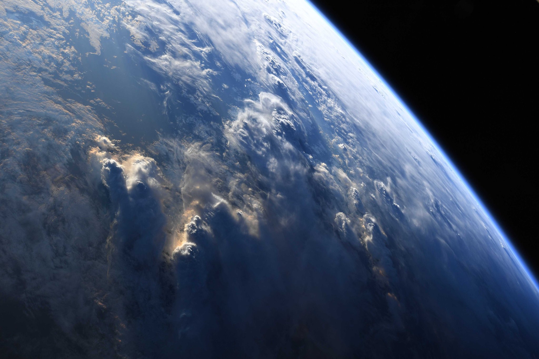
積乱雲は、強い上昇気流によって積雲から成長して塔あるいは山のように立ち上り、雲頂が時には成層圏下部にも達することがあるような、巨大な雲のことです。積乱雲の鉛直方向の大きさは雲の種類の中でも最大であり、雲底から雲頂までの高さは1万メートルを超えることもあります。
参考文献: David Saint-Jacques’s Tweet
地球俯瞰画像を見る: LiVEARTH
[Earthview Wonders] No.757: Cumulonimbus Clouds Over South America
Astronaut David Saint-Jacques captured from ISS the cumulonimbus clouds over Paraguay, South America.
Cumulonimbus is a dense, towering vertical cloud, forming from water vapor carried by powerful upward air currents. If observed during a storm, these clouds may be referred to as thunderheads. Cumulonimbus can form alone, in clusters, or along cold front squall lines. These clouds are capable of producing lightning and other dangerous severe weather, such as tornadoes. The clouds can reach as high as 16,000m.
Reference: David Saint-Jacques’s Tweet
See earthview photo gallery: LiVEARTH[:en][Earthview Wonders] No.757: Cumulonimbus Clouds Over South America
Astronaut David Saint-Jacques captured from ISS the cumulonimbus clouds over Paraguay, South America.
Cumulonimbus is a dense, towering vertical cloud, forming from water vapor carried by powerful upward air currents. If observed during a storm, these clouds may be referred to as thunderheads. Cumulonimbus can form alone, in clusters, or along cold front squall lines. These clouds are capable of producing lightning and other dangerous severe weather, such as tornadoes. The clouds can reach as high as 16,000m.
Reference: David Saint-Jacques’s Tweet
See earthview photo gallery: LiVEARTH[:]