[:ja]デービッド・サンジャック宇宙飛行士がISSから撮影した北米西海岸沿いのカスケード山脈です。画像は米国北部の町、ベリンガム付近です。
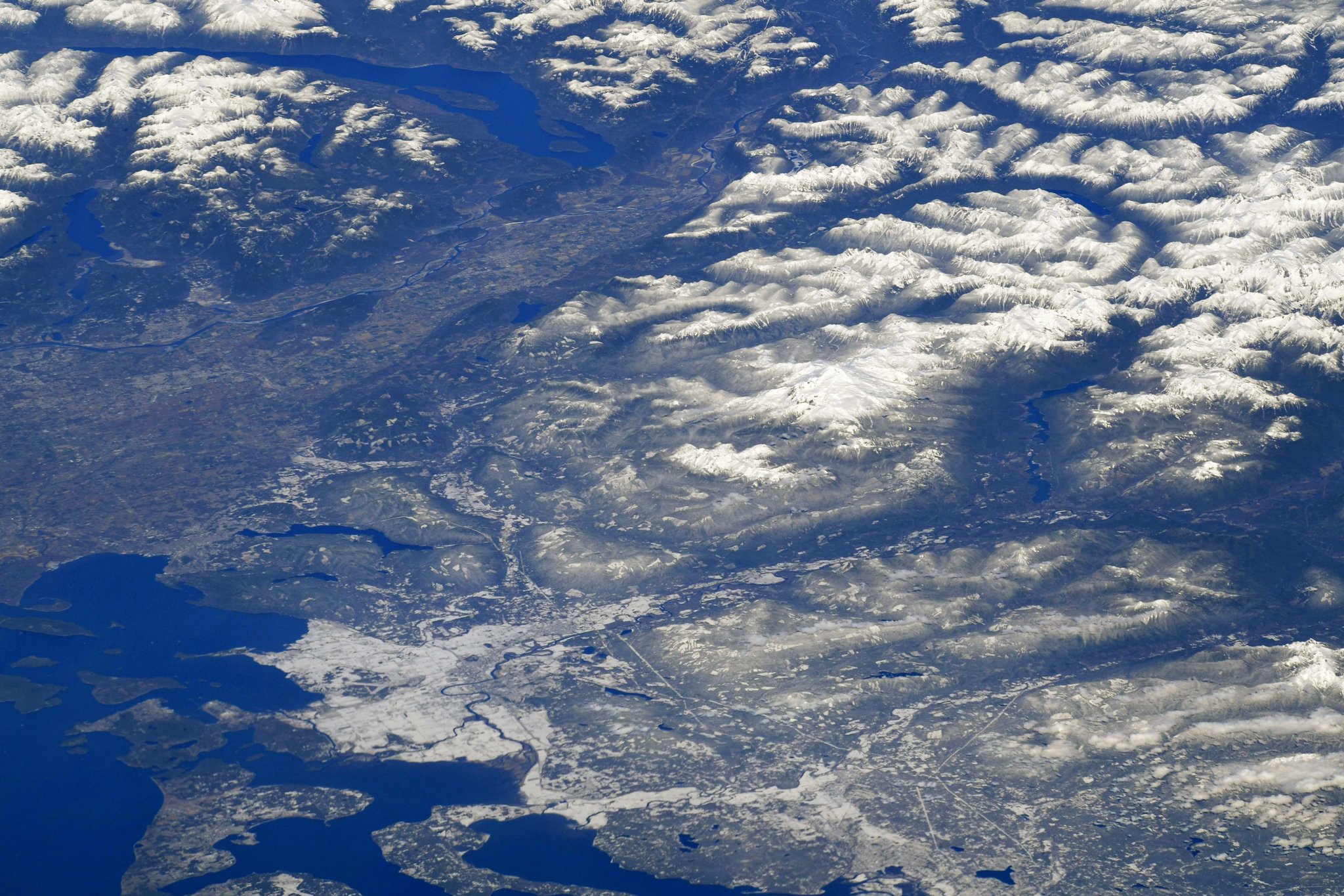
カスケード山脈は北米大陸の西海岸沿いを南北に走る山脈で、カナダのブリティッシュ・コロンビア州からアメリカ・カリフォルニア州北部のシャスタ・カスケード地方まで連なっています。また、カスケード山脈は環太平洋火山帯の一部であり、アメリカ本土で発生した歴史的な火山噴火はすべてカスケード山脈の火山で発生しています。20世紀に起こった有名な噴火は2回あり、1回目は1914年から1921年にかけてカリフォルニア州北部のラッセン山で、2回目は1980年にワシントン州南部のセント・ヘレンズ山で発生しました。
コロンビア川がカスケード山脈を南北に分け、オレゴン州とワシントン州の境となっている地上の様子はこちらです。

参考文献: David Saint-Jacques’ Tweet
地球俯瞰画像を見る: LiVEARTH
[Earthview Wonders] No.758: Cascade Range🇨🇦🇺🇸
Astronaut David Saint-Jacques captured from ISS the Cascade Range of western North America. The image shows Bellingham near the border of Canada and the U.S.
The Cascade Range or Cascades is a major mountain range of western North America, extending from southern British Columbia through Washington and Oregon to Northern California. The Cascades are part of the Pacific Ocean’s Ring of Fire (volcanoes). All of the eruptions in the contiguous United States over the last 200 years have been from Cascade volcanoes (Lassen Peak, 1914-1921 and Mount St. Helens, 2004-2008).
The local scenery on the ground where the Columbia Gorge marks where the Columbia River splits the Cascade Range between the states of Washington and Oregon is as follows.
Reference: David Saint-Jacques’ Tweet
See earthview photo gallery: LiVEARTH[:en][Earthview Wonders] No.758: Cascade Range🇨🇦🇺🇸
Astronaut David Saint-Jacques captured from ISS the Cascade Range of western North America. The image shows Bellingham near the border of Canada and the U.S.
The Cascade Range or Cascades is a major mountain range of western North America, extending from southern British Columbia through Washington and Oregon to Northern California. The Cascades are part of the Pacific Ocean’s Ring of Fire (volcanoes). All of the eruptions in the contiguous United States over the last 200 years have been from Cascade volcanoes (Lassen Peak, 1914-1921 and Mount St. Helens, 2004-2008).
The local scenery on the ground where the Columbia Gorge marks where the Columbia River splits the Cascade Range between the states of Washington and Oregon is as follows.
Reference: David Saint-Jacques’ Tweet
See earthview photo gallery: LiVEARTH[:]