[:ja]宇宙飛行士がISSから撮影したモロッコです。
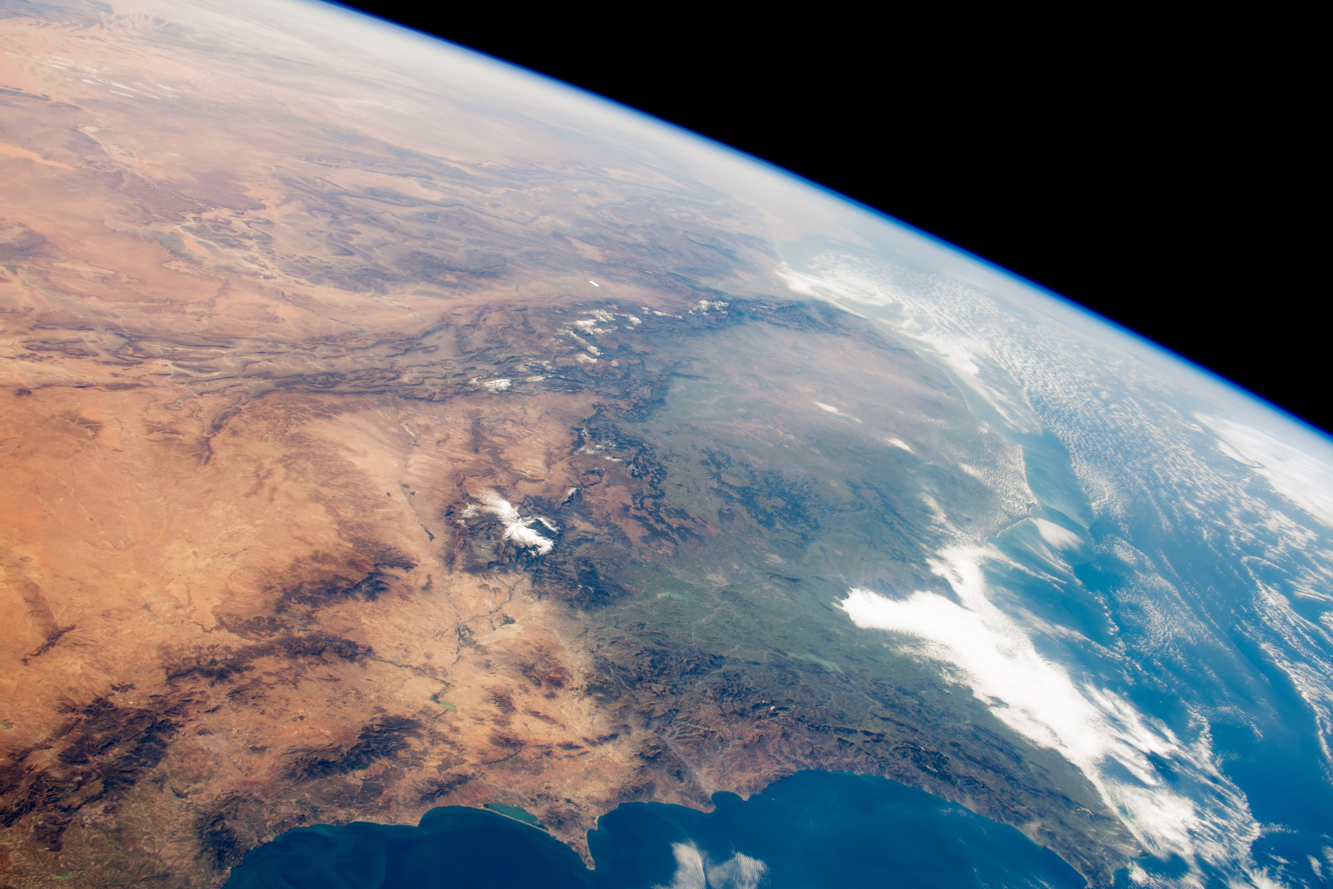
モロッコの海岸のうち約3/4は北大西洋に面し、残りは地中海に沿っています。アトラス山脈は複数の山脈が平行に走る褶曲山脈で、チュニジア北部からアルジェリア北部を通過し、ほぼモロッコの南西端まで2000km以上にわたって延びます。また、アトラス山脈の平均標高は3000mを超えます。大西洋沿岸、地中海岸と内陸部のオアシスを除き、植生はほとんど見られません。
地上の様子はこちらです。

参考文献: Wet and Dry Morocco (NASA Earth Observatory)
地球俯瞰画像を見る: LiVEARTH
[Earthview Wonders] No.806: Morocco🇲🇦
Astronaut on board ISS captured Morocco.
Morocco has a coast by the Atlantic Ocean that reaches past the Strait of Gibraltar into the Mediterranean Sea. The geography of Morocco spans from the Atlantic Ocean, to mountainous areas, to the Sahara desert. Most of the southeast portion of the country is in the Sahara Desert and as such is generally sparsely populated and unproductive economically.
The local scenery on the ground is as follows.
Reference: Wet and Dry Morocco (NASA Earth Observatory)
See earthview photo gallery: LiVEARTH[:en][Earthview Wonders] No.806: Morocco🇲🇦
Astronaut on board ISS captured Morocco.
Morocco has a coast by the Atlantic Ocean that reaches past the Strait of Gibraltar into the Mediterranean Sea. The geography of Morocco spans from the Atlantic Ocean, to mountainous areas, to the Sahara desert. Most of the southeast portion of the country is in the Sahara Desert and as such is generally sparsely populated and unproductive economically.
The local scenery on the ground is as follows.
Reference: Wet and Dry Morocco (NASA Earth Observatory)
See earthview photo gallery: LiVEARTH[:]