[:ja]宇宙飛行士がISSから撮影したマダガスカルのベツィボカデルタです。
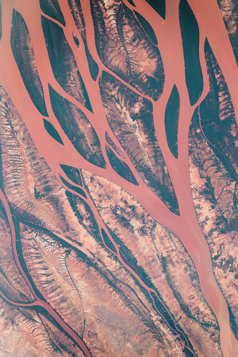
アフリカ東岸のインド洋に浮かぶマダガスカル島の中央には3000m級の山々が連なりますが、そこから525kmに渡って流れるベツィボカ川には、複雑な河口があります。マダガスカルの東側には熱帯雨林、西側にはマングローブやサバンナが広がっています。源流からマングローブなどを通過した川は、熱帯雨林の土壌に特徴的な鉄・アルミニウムの酸化物が多く赤褐色の強いシルトを含み、河口で堆積しています。
地上の様子はこちらです。

参考文献: A Close-Up View of the Betsiboka (NASA Earth Observatory)
地球俯瞰画像を見る: LiVEARTH
[Earthview Wonders] No.845: Betsiboka Delta, Madagascar🇲🇬
Astronaut on board ISS captured Betsiboka Delta, Madagascar.
Madagascar is a large island in the Indian Ocean, east of Africa. In the middle of the island lie 3000km mountains from which Betsiboka River runs 525km to form an intricate river delta. On the eastern side of Madagascar stretches rainforest and Mangrove and Savannah on the western side. The Betsiboka River passing through the Mangrove contains reddish iron and aluminum oxides, characteristic silt sediment of the rainforest which pile up at the river delta.
The local scenery on the ground is as follows.
Reference: A Close-Up View of the Betsiboka (NASA Earth Observatory)
See earthview photo gallery: LiVEARTH[:en][Earthview Wonders] No.845: Betsiboka Delta, Madagascar🇲🇬
Astronaut on board ISS captured Betsiboka Delta, Madagascar.
Madagascar is a large island in the Indian Ocean, east of Africa. In the middle of the island lie 3000km mountains from which Betsiboka River runs 525km to form an intricate river delta. On the eastern side of Madagascar stretches rainforest and Mangrove and Savannah on the western side. The Betsiboka River passing through the Mangrove contains reddish iron and aluminum oxides, characteristic silt sediment of the rainforest which pile up at the river delta.
The local scenery on the ground is as follows.
Reference: A Close-Up View of the Betsiboka (NASA Earth Observatory)
See earthview photo gallery: LiVEARTH[:]