[:ja]宇宙飛行士がISSから撮影したオーストラリアのシンプソン砂漠です。
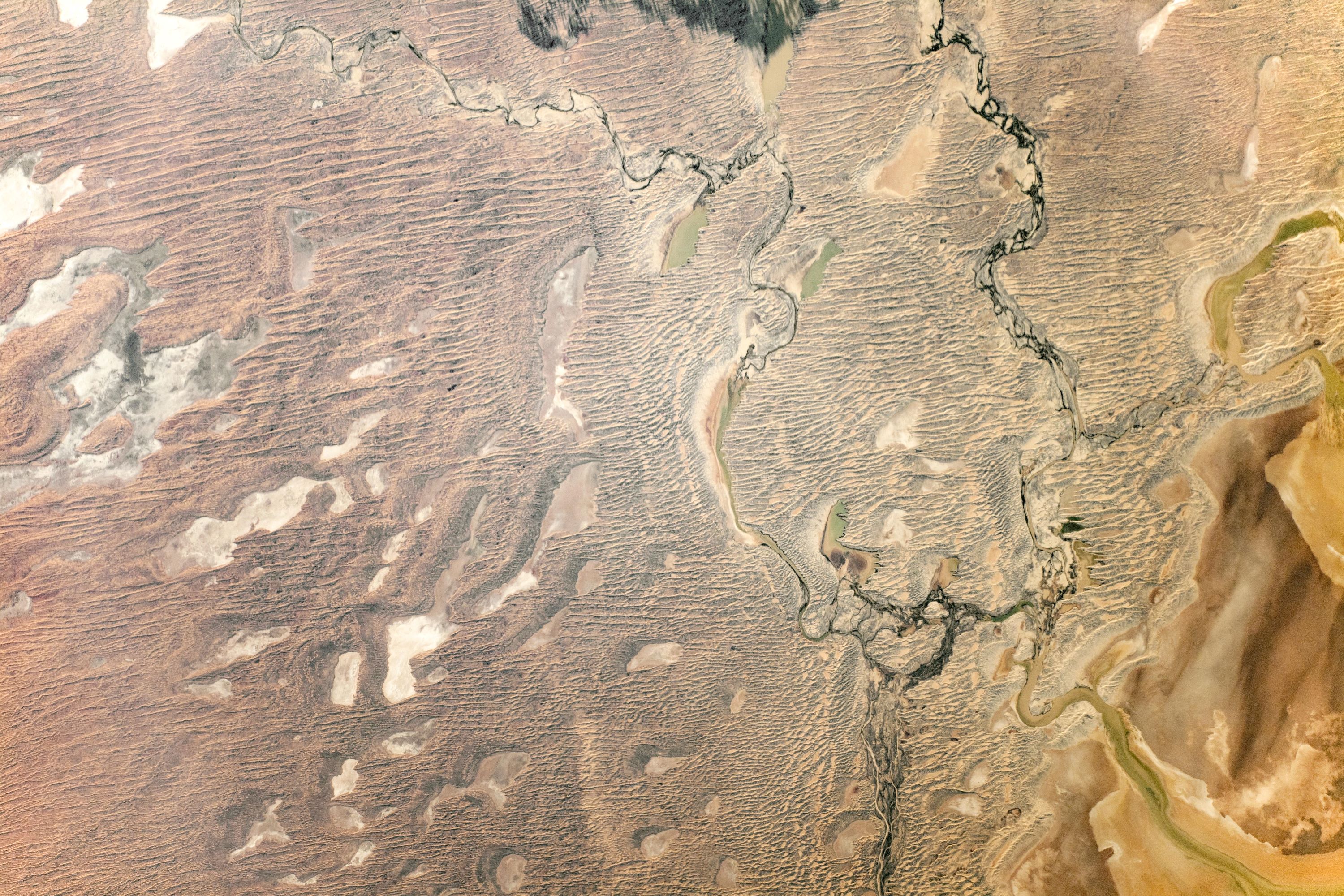
シンプソン砂漠はオーストラリア中央部に位置する砂漠でノーザンテリトリー、サウスオーストラリア州、クイーンズランド州にまたがります。この砂漠には世界最長のパラレルデューンと呼ばれる、北北西から南南東に向けて平行する多数の砂丘列が見られます。この砂丘列は数千年かけて風による浸食で形成されました。また、画像右下には同国最大の塩湖であるエア湖(カティサンダ)も見られます。
地上の様子はこちらです。


参考文献: Simpson Desert, Australia (NASA Earth Observatory)
地球俯瞰画像を見る: LiVEARTH
[Earthview Wonders] No.863: Simpson Desert, Australia🇦🇺
Astronaut on board ISS captured Simpson Desert, Australia.
The Simpson Desert is a large area of dry, red sandy plain and dunes in Northern Territory, South Australia and Queensland in central Australia. The Simpson Desert is an erg that contains the world’s longest parallel sand dunes which formed as a result of wind erosion and sand deposition taking place over thousands of years. Some of the dunes stretch more than 100km in length. Also Lake Eyre (Kati Thanda), Australia’s largest salt lake, can also be seen at the lower right corner of the photo.
The local scenery on the ground is as follows.
Reference: Simpson Desert, Australia (NASA Earth Observatory)
See earthview photo gallery: LiVEARTH[:en][Earthview Wonders] No.863: Simpson Desert, Australia🇦🇺
Astronaut on board ISS captured Simpson Desert, Australia.
The Simpson Desert is a large area of dry, red sandy plain and dunes in Northern Territory, South Australia and Queensland in central Australia. The Simpson Desert is an erg that contains the world’s longest parallel sand dunes which formed as a result of wind erosion and sand deposition taking place over thousands of years. Some of the dunes stretch more than 100km in length. Also Lake Eyre (Kati Thanda), Australia’s largest salt lake, can also be seen at the lower right corner of the photo.
The local scenery on the ground is as follows.
Reference: Simpson Desert, Australia (NASA Earth Observatory)
See earthview photo gallery: LiVEARTH[:]