[:ja]NASAの地球観測衛星Terraが撮影した、ベーリング海峡の海氷の様子です。
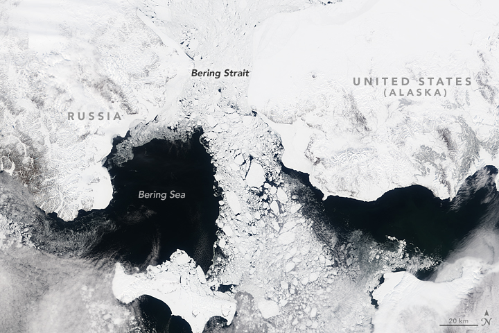
普段地図を見ていると季節感がなく、年中通れるように誤解してしまいますが、ほとんどの時期、氷が張っています。北極海氷の季節変動が激しく、毎年3月に最大化、9月に最小化します。
ウェブ地球儀で地球俯瞰画像を見る: LiVEARTH
[Earthview Wonders] No.87: Sea Ice of Bering Strait
The Bering Strait captured by NASA’s Terra satellite.
Looking at regular maps will never show the real status of the strait, but is actually filled with sea ice in many months of the year. This sea ice seasonal fluctuation hits maximum in March and minimum in September.
See earthview photo gallery with web-globe: LiVEARTH[:en][Earthview Wonders] No.87: Sea Ice of Bering Strait
The Bering Strait captured by NASA’s Terra satellite.
Looking at regular maps will never show the real status of the strait, but is actually filled with sea ice in many months of the year. This sea ice seasonal fluctuation hits maximum in March and minimum in September.
See earthview photo gallery with web-globe: LiVEARTH[:]