[:ja]ルカ・パルミタノ宇宙飛行士がISSから撮影したミシシッピー川の蛇行の様子です。場所はケンタッキー州、ミズーリ州、テネシー州の州境付近で、チカソー国立野生動物保護区が写っています。
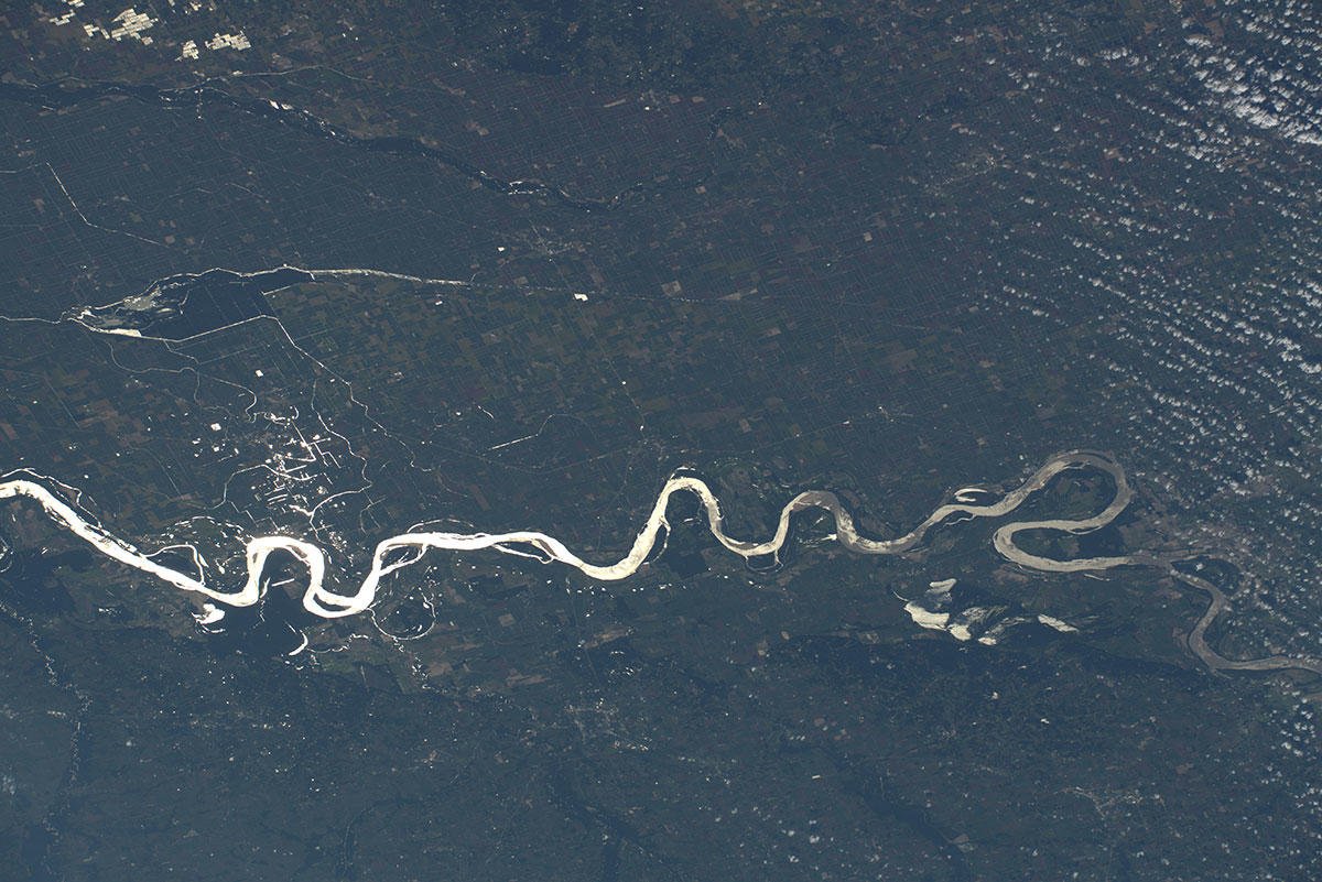
米国最長のミシシッピ川はミネソタ州を源流とし、3,779kmを流れ、メキシコ湾へと注いでいます。本流の全流路が構造平野であるアメリカの中央平原を流れており、そのため流路の勾配が緩いです。鉄道が敷かれるまでは、水運を担う重要な水路となっていた時期があり、蒸気船が航行する姿はアメリカ発展史における象徴的存在でした。水源のイタスカ湖に降った雨が河口に達するまで約90日を要します。周辺の気候は、ミズーリ州中央部以北は冷帯湿潤気候、それ以南は温暖湿潤気候となっています。
地上の様子はこちらです。

参考文献: Luca Parmitano’s Tweet
地球俯瞰画像を見る: LiVEARTH
[Earthview Wonders] No.881: Mississippi River🇺🇸
Astronaut Luca Parmitano captured from ISS winding Mississippi River near the boundary of Kentucky, Missouri and Tennessee. The photo shows the Chikasaw National Wildlife Refuge.
America’s longest Mississippi River’s source is Lake Itasca in northern Minnesota and it flows generally south for 3,779m to the delta in the Gulf of Mexico. Formed from thick layers of the river’s silt deposits, the Mississippi embayment is one of the most fertile regions of the country. The Mississippi River has experienced major pollution and environmental problems – most notably elevated nutrient and chemical levels from agricultural runoff, the primary contributor to the Gulf of Mexico dead zone.
The local scenery on the ground is as follows.
Reference: Luca Parmitano’s Tweet
See earthview photo gallery: LiVEARTH[:en][Earthview Wonders] No.881: Mississippi River🇺🇸
Astronaut Luca Parmitano captured from ISS winding Mississippi River near the boundary of Kentucky, Missouri and Tennessee. The photo shows the Chikasaw National Wildlife Refuge.
America’s longest Mississippi River’s source is Lake Itasca in northern Minnesota and it flows generally south for 3,779m to the delta in the Gulf of Mexico. Formed from thick layers of the river’s silt deposits, the Mississippi embayment is one of the most fertile regions of the country. The Mississippi River has experienced major pollution and environmental problems – most notably elevated nutrient and chemical levels from agricultural runoff, the primary contributor to the Gulf of Mexico dead zone.
The local scenery on the ground is as follows.
Reference: Luca Parmitano’s Tweet
See earthview photo gallery: LiVEARTH[:]