[:ja]NASAの地球観測衛星Landsat 8が撮影したロシア、シベリア北部のサンニコフ海峡です。画像中の黒い部分は氷ではなく水です。
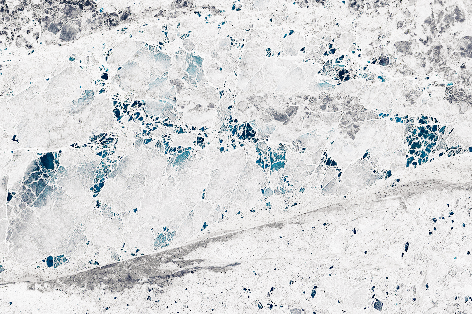
サンニコフ海峡は、レナ河口の東北、アンズ諸島とリャコフスキ諸島間の水道で、北極圏で大西洋と太平洋をつなぎます。この航路の大部分は北極海で、20世紀まで航路として開通したことはなかったのですが、近年の地球温暖化による影響で、年間で夏期の2ヶ月のみ航路として開通するようになりました。残りの期間は海氷や流氷などに覆われ、航行不能となります。ただし、サニコフ海峡の水深は13mしかなく、12.5m以下の商船しか通航できません。このためコンテナ船は4,000TEU(20フィートコンテナ換算で4,000個積みの商船)が上限とされ、輸送コストで不利となるようです。
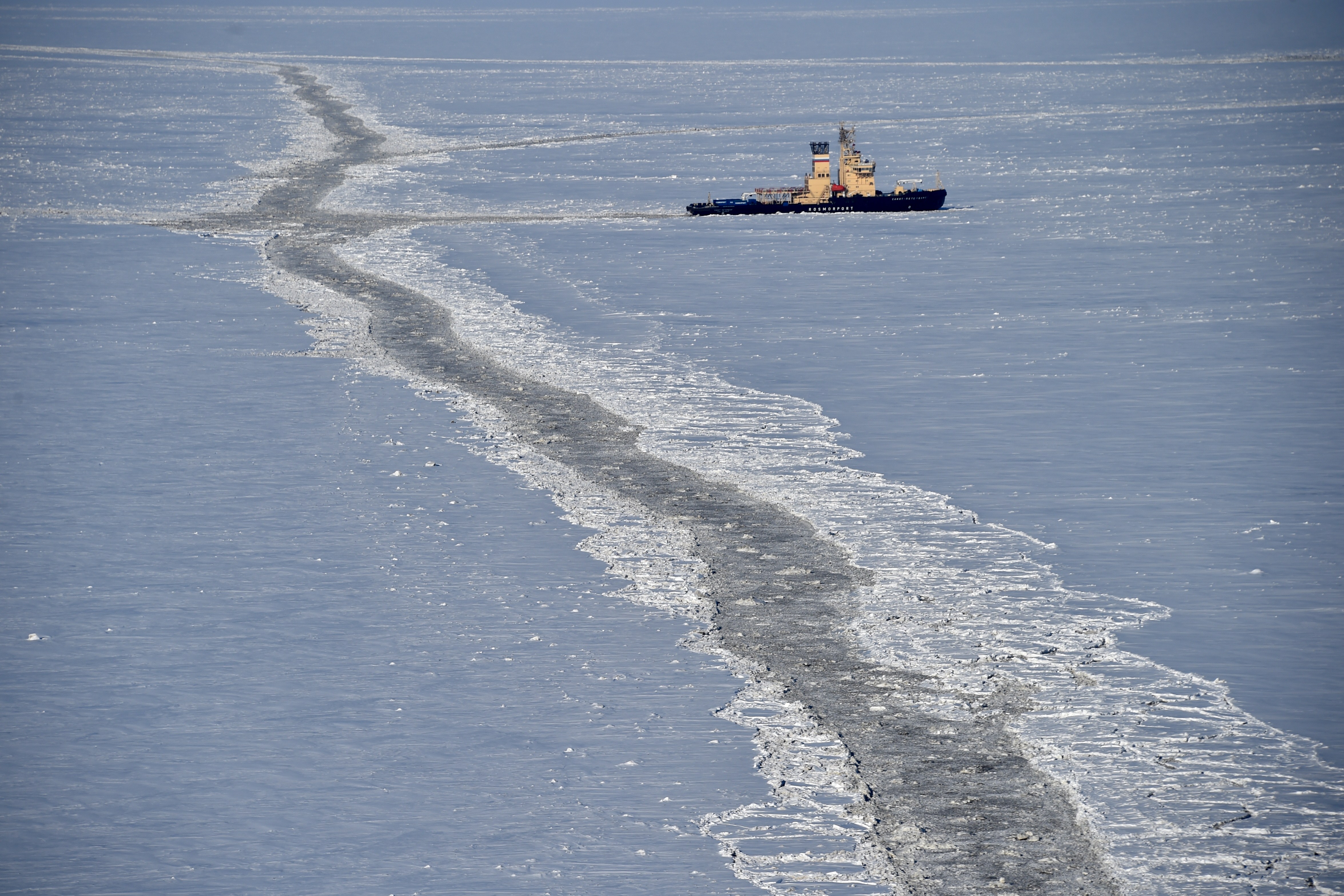
地上の様子はこちらです。

参考文献: Icy Art in the Sannikov Strait (NASA Earth Observatory)
地球俯瞰画像を見る: LiVEARTH
[Earthview Wonders] No.898: Sea Ice of Sannikov Strait🇷🇺
NASA’s Landsat 8 captured Sannikov Strait, Russia. Black areas are open water.
The Sannikov Strait is part of the Northeast Passage that connects the Atlantic and Pacific Ocean. As the world warms and the extent of Arctic sea ice continues to shrink, the route is expected to become increasingly viable for transit shipping for longer periods. The passage is currently passable for just a few months of the year. However, the strait is only 13m deep and ships with a shallow-draft cannot go thruogh it.
The local scenery on the ground is as follows.
Reference: Icy Art in the Sannikov Strait (NASA Earth Observatory)
See earthview photo gallery: LiVEARTH[:en][Earthview Wonders] No.898: Sea Ice of Sannikov Strait🇷🇺
NASA’s Landsat 8 captured Sannikov Strait, Russia. Black areas are open water.
The Sannikov Strait is part of the Northeast Passage that connects the Atlantic and Pacific Ocean. As the world warms and the extent of Arctic sea ice continues to shrink, the route is expected to become increasingly viable for transit shipping for longer periods. The passage is currently passable for just a few months of the year. However, the strait is only 13m deep and ships with a shallow-draft cannot go thruogh it.
The local scenery on the ground is as follows.
Reference: Icy Art in the Sannikov Strait (NASA Earth Observatory)
See earthview photo gallery: LiVEARTH[:]