[:ja]NASAの地球観測衛星Landsat 8が撮影した南極のパイン島氷河です。
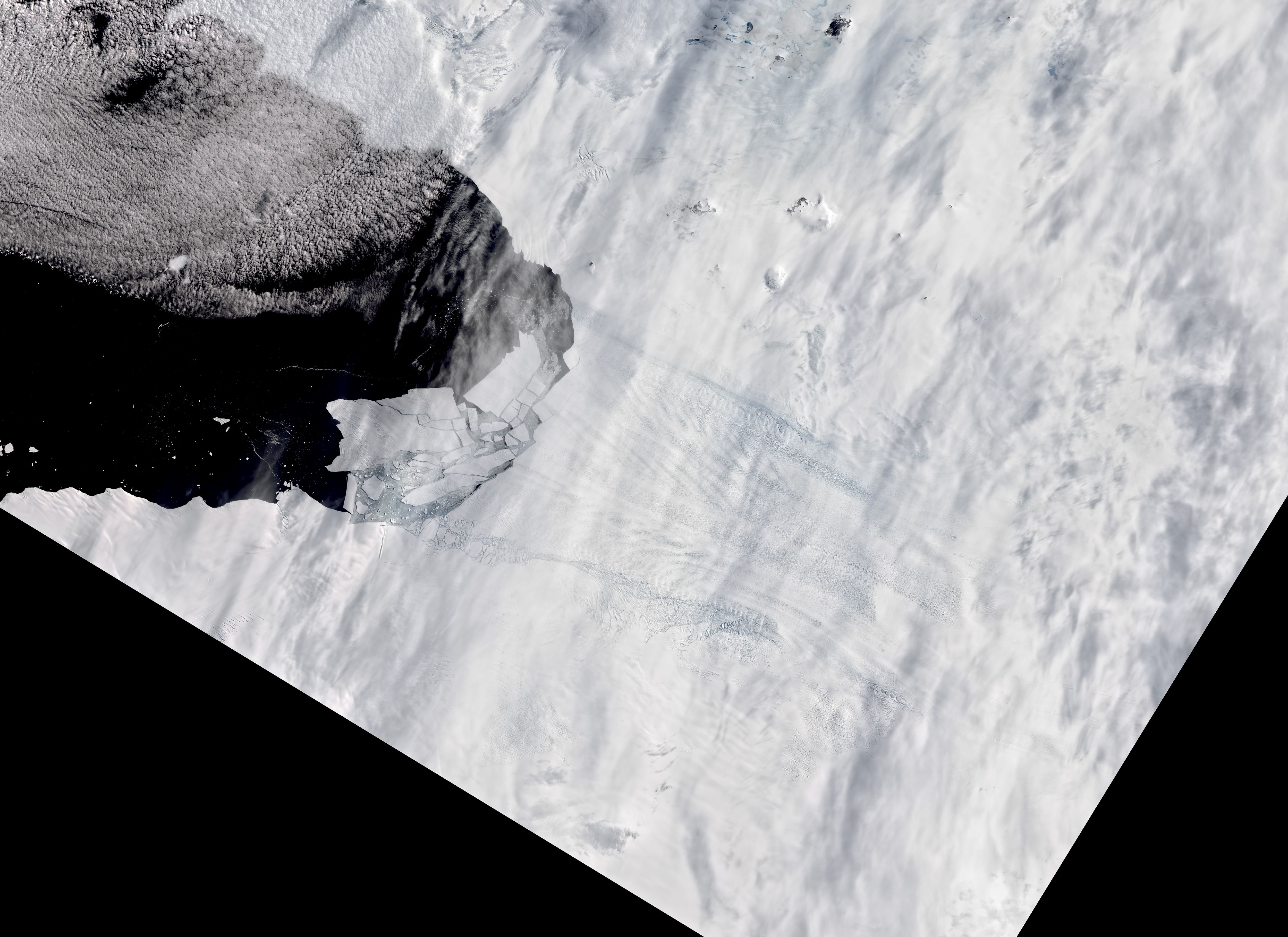
2020年2月9日に地球観測衛星Sentinel-1のレーダーイメージがパイン島氷河の氷塊の分離を確認しました。パイン島氷河は南極で最も速く融解している氷河で、南極全体の氷の融解量の25%を占めます。2008年の報告では、海岸沿いでの氷の速度と厚さを測って氷床から出ていく氷の量を調べ、大陸全体に積もった雪の量と比べたところ、東南極氷床はバランスが取れているが西南極氷床はバランスが取れておらず、氷が減っていることがわかり、原因はパイン島氷河などの氷流が加速したことによるものでした。
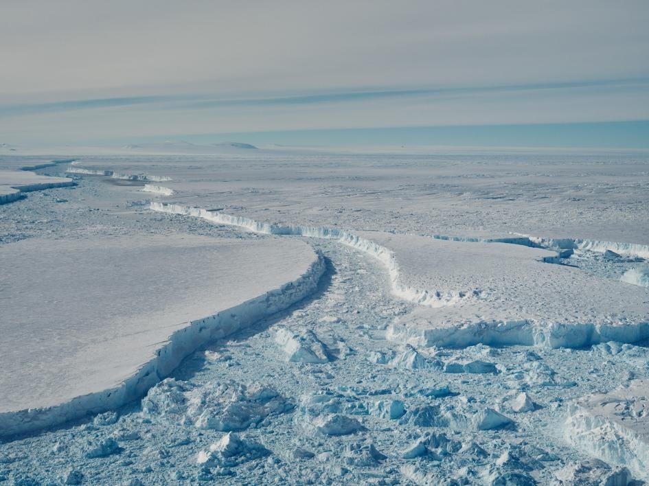
地上の様子はこちらです。
参考文献: Pine Island Glacier’s Newest Iceberg (NASA Earth Observatory)
地球俯瞰画像を見る: LiVEARTH
[Earthview Wonders] No.962: Pine Island Glacier, Antarctica🇦🇶
NASA’s Landsat 8 captured Pine Island Glacier, Antarctica.
On Feb. 9, 2020, radar images from the Sentinel-1 satellites showed numerous icebergs detaching from the glacier and floating in Pine Island Bay. Pine Island Glacier (PIG) is a large ice stream, and the fastest melting glacier in Antarctica, responsible for about 25% of Antarctica’s ice loss. The glacier ice streams flow west-northwest along the south side of the Hudson Mountains into Pine Island Bay, Amundsen Sea, Antarctica. The area drained by Pine Island Glacier comprises about 10% of the West Antarctic Ice Sheet. Satellite measurements have shown that the Pine Island Glacier Basin has a greater net contribution of ice to the sea than any other ice drainage basin in the world and this has increased due to recent acceleration of the ice stream.
The local scenery on the ground is as follows.
Reference: Pine Island Glacier’s Newest Iceberg (NASA Earth Observatory)
See earthview photo gallery: LiVEARTH[:en][Earthview Wonders] No.962: Pine Island Glacier, Antarctica🇦🇶
NASA’s Landsat 8 captured Pine Island Glacier, Antarctica.
On Feb. 9, 2020, radar images from the Sentinel-1 satellites showed numerous icebergs detaching from the glacier and floating in Pine Island Bay. Pine Island Glacier (PIG) is a large ice stream, and the fastest melting glacier in Antarctica, responsible for about 25% of Antarctica’s ice loss. The glacier ice streams flow west-northwest along the south side of the Hudson Mountains into Pine Island Bay, Amundsen Sea, Antarctica. The area drained by Pine Island Glacier comprises about 10% of the West Antarctic Ice Sheet. Satellite measurements have shown that the Pine Island Glacier Basin has a greater net contribution of ice to the sea than any other ice drainage basin in the world and this has increased due to recent acceleration of the ice stream.
The local scenery on the ground is as follows.
Reference: Pine Island Glacier’s Newest Iceberg (NASA Earth Observatory)
See earthview photo gallery: LiVEARTH[:]