[:ja]欧州宇宙機関ESAの地球観測衛星Copernicus SEntinel-3Aが撮影したニュージーランド全体です。ニュージーランドは、マオリ語で「白く長い雲のたなびく地」という意味で「アオテアロア」と呼ばれています。
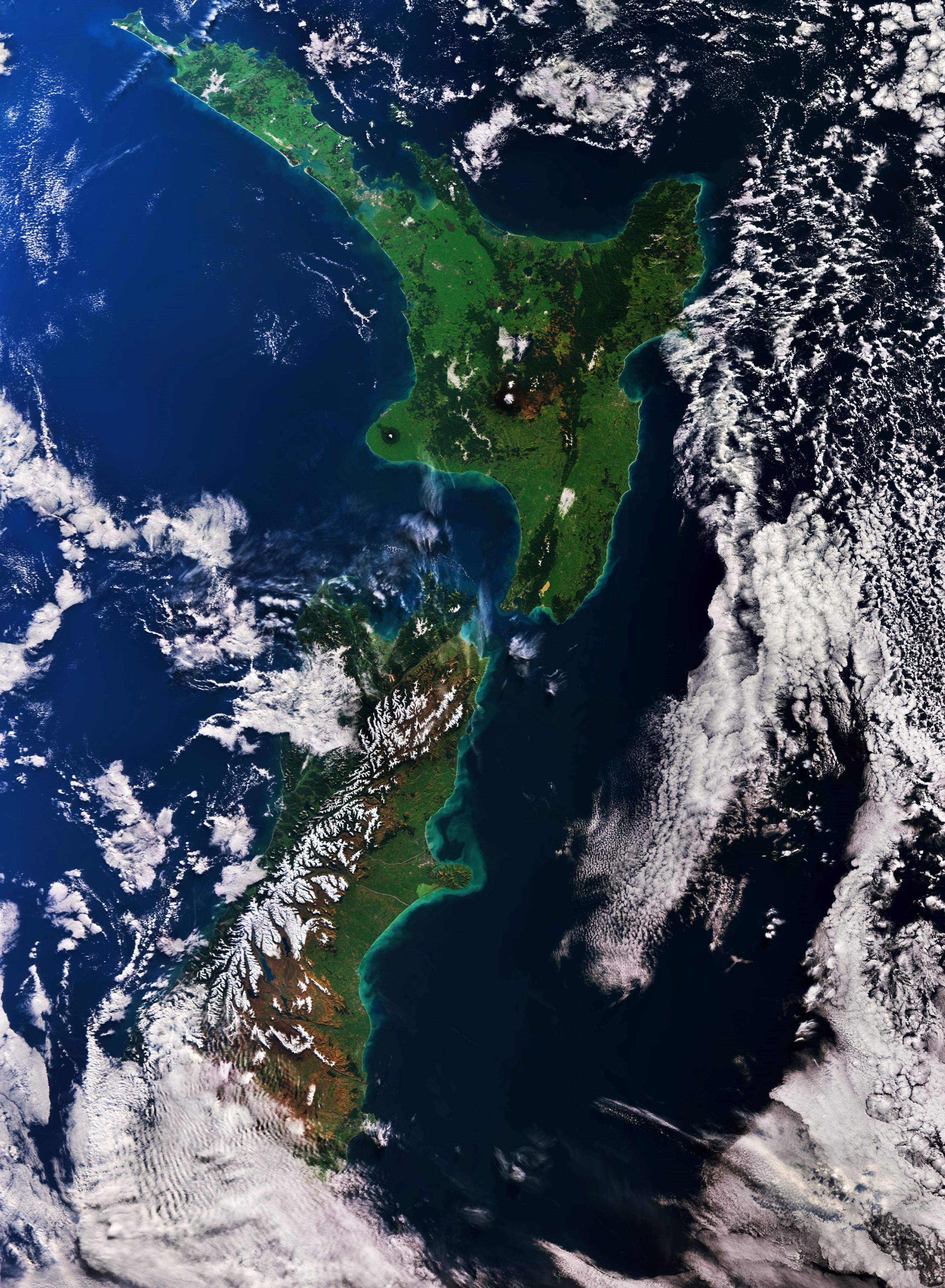
ニュージーランドはクック海峡を挟んで北島と南島からなります。この画像は2018年の8月に撮影されたもので、南島で南北500kmにわたって広がる南アルプス山脈が雪に覆われています。北島には、首都ウェリントンがあり、政府機関が集中しています。北島は、南島ほど険しい山脈はありませんが、火山活動が活発です。南島は、最も陸地面積の大きな島で、中心都市はクライストチャーチです。南アルプス山脈の最高峰は、3,724m のクック山(マオリ語ではアオラキ、「雲を貫く」という意味)です。他にもタスマン氷河、サザンアルプス、クック山、ミルフォード・サウンドのような豊かな自然も有名である。クイーンズタウンは世界的に有名な観光・保養地です。
最高峰のクック山の地上の様子はこちらです。

参考文献: New Zealand (United space in Europe)
地球俯瞰画像を見る: LiVEARTH
[Earthview Wonders] No.963: New Zealand🇳🇿
ESA’s Copernicus Sentinel-3A satellite captured New Zealand. Aotearoa is the Māori name for New Zealand.
Captured on Aug. 22, 2018, this image shows the snow-covered Southern Alps stretching 500 km across the west coast of the South Island. New Zealand has two main landmasses—the North Island, and the South Island—and around 600 smaller islands. Because of its remoteness, it was one of the last lands to be settled by humans. During its long period of isolation, New Zealand developed a distinct biodiversity of animal, fungal, and plant life. The country’s varied topography and its sharp mountain peaks, such as the Southern Alps, owe much to the tectonic uplift of land and volcanic eruptions.
The local scenery of Aoraki/Mount Cook, the the highest point of New Zealand at 3,724m, is as follows.
Reference: New Zealand (United space in Europe)
See earthview photo gallery: LiVEARTH[:en][Earthview Wonders] No.963: New Zealand🇳🇿
ESA’s Copernicus Sentinel-3A satellite captured New Zealand. Aotearoa is the Māori name for New Zealand.
Captured on Aug. 22, 2018, this image shows the snow-covered Southern Alps stretching 500 km across the west coast of the South Island. New Zealand has two main landmasses—the North Island, and the South Island—and around 600 smaller islands. Because of its remoteness, it was one of the last lands to be settled by humans. During its long period of isolation, New Zealand developed a distinct biodiversity of animal, fungal, and plant life. The country’s varied topography and its sharp mountain peaks, such as the Southern Alps, owe much to the tectonic uplift of land and volcanic eruptions.
The local scenery of Aoraki/Mount Cook, the the highest point of New Zealand at 3,724m, is as follows.
Reference: New Zealand (United space in Europe)
See earthview photo gallery: LiVEARTH[:]