[:ja]セルゲイ・リャザンスキー宇宙飛行士がISSから撮影したカリブ海、コロンビア領のプロビデンシア島です。
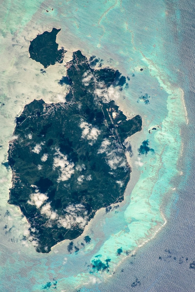
プロビデンシア島はカリブ海に浮かぶコロンビア領の火山性の山がちな島で、ニカラグアから240kmに位置し、サン・アンドレス島のすぐ北にある島です。1629年にイギリスの清教徒(ピューリタン)によりサン・アンドレス島と共に発見され、1631年から1635年までに540人余りの清教徒の白人が島で暮らしていました。1641年にスペインにより占領され、海賊も島に来るようになり、有名なヘンリー・モーガンも島に居ました。ニカラグアがサン・アンドレス島と共に島の統治権を主張していましたが、1991年にコロンビアに統治権を認めました。島の人口は約4,500人で、ココナッツやオレンジなどの柑橘類、漁業などが島の産業です。
地上の様子はこちらです。

参考文献: Sergey Ryazansky’s Tweet
地球俯瞰画像を見る: LiVEARTH
[Earthview Wonders] No.974: Providencia Island, Colombia🇨🇴
Astronaut Sergey Ryazansky captured from ISS Providencia Island, Colombia.
Isla de Providencia is a mountainous Caribbean island that is part of the Colombian department of Archipelago of San Andrés, lying midway between Costa Rica and Jamaica. Providencia’s maximum elevation is 360m above sea level. The island was the site of an English Puritan colony established in 1629 by the Providence Island Company, and was briefly taken by Spain in 1641. The pirate Henry Morgan used Providencia as a base for raiding the Spanish empire, and rumours suggest that much of his treasure remains hidden on the island.
The local scenery on the ground is as follows.
Reference: Sergey Ryazansky’s Tweet
See earthview photo gallery: LiVEARTH[:en][Earthview Wonders] No.974: Providencia Island, Colombia🇨🇴
Astronaut Sergey Ryazansky captured from ISS Providencia Island, Colombia.
Isla de Providencia is a mountainous Caribbean island that is part of the Colombian department of Archipelago of San Andrés, lying midway between Costa Rica and Jamaica. Providencia’s maximum elevation is 360m above sea level. The island was the site of an English Puritan colony established in 1629 by the Providence Island Company, and was briefly taken by Spain in 1641. The pirate Henry Morgan used Providencia as a base for raiding the Spanish empire, and rumours suggest that much of his treasure remains hidden on the island.
The local scenery on the ground is as follows.
Reference: Sergey Ryazansky’s Tweet
See earthview photo gallery: LiVEARTH[:]