NASA’s Terra satellite captured James Bay, Canada. Typically, fast ice grows in December and breaks up in May, but the ice still remains in June, as shown in the image.
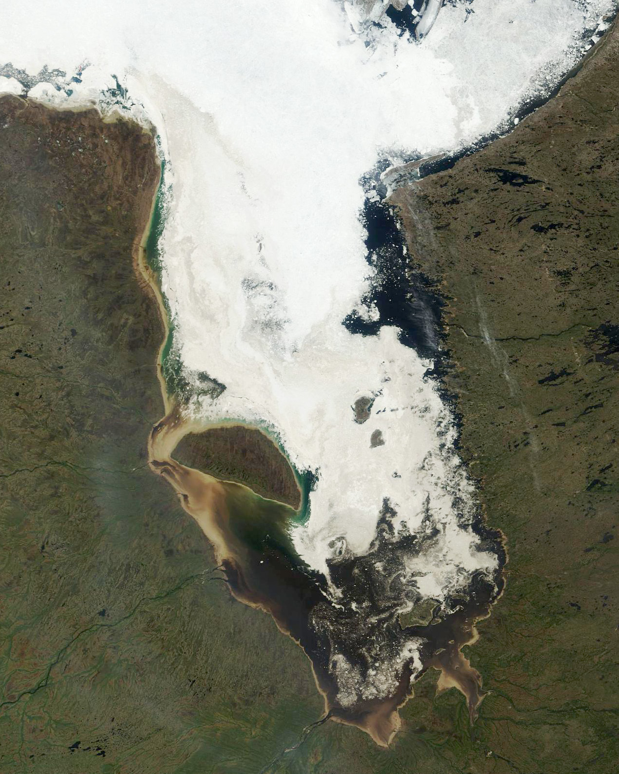
James Bay is a large body of water located on the southern end of Hudson Bay in Canada. Both bodies of water extend from the Arctic Ocean, of which James Bay is the southernmost part. Despite bordering the Canadian provinces of Quebec and Ontario, the bay and the islands within it, the largest of which is Akimiski Island, are politically part of Nunavut. Numerous waterways of the James Bay watershed have been modified with dams or diversion for several major hydroelectric projects. These waterways are also destinations for river-based recreation. Several communities are located near or alongside James Bay, including a number of Aboriginal Canadian communities, such as the Kashechewan First Nation and nine communities affiliated with the Cree of northern Quebec. As with the rest of Hudson Bay, the waters of James Bay routinely freeze over in winter. It is the last part of Hudson Bay to freeze over in winter, and the first to thaw in summer.
The local scenery on the ground is as follows.

Reference: NASA Earth’s Tweet
See earthview photo gallery: LiVEARTH