[:ja]欧州宇宙機関ESAの地球観測衛星Sentinel-1が捉えた、東アフリカのヴィルンガ山地です。ヴィルンガ山地はルワンダ、コンゴ民主共和国、ウガンダ国境地域に位置する火山群で、8つのうち6つが休火山、2つが活火山で、2006年と2010年に噴火しています。
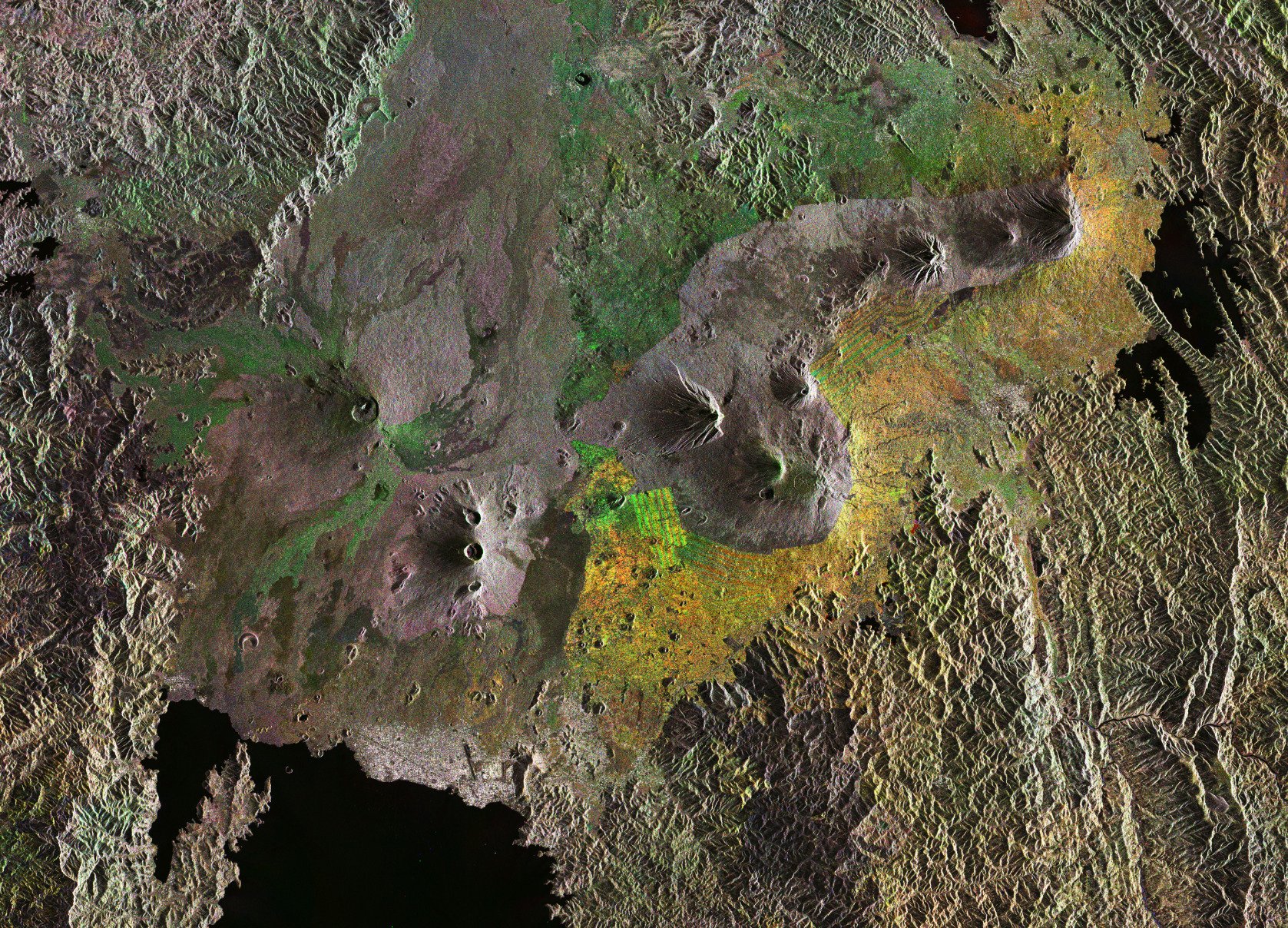
ヴィルンガ山地は、アフリカ大陸からソマリプレートが離れていっている大地溝帯アルバーティーン・リフトの一部です。この地域は生物学的に興味深い一方、人口過密、貧困、紛争などの問題のために、自然保護が難しくなっています。マウンテンゴリラの絶滅危惧地域として、IUCNレッドリストに記載されています。
地上の様子はこちらです。

参考文献: Virunga Mountains
ウェブ地球儀で地球俯瞰画像を見る: LiVEARTH
[Earthview Wonders] No.128: Virunga Mountains
ESA’s Sentinel-1 satellite captured the Virunga Mountains in Eastern Africa.
The Virunga Mountains are a chain of volcanoes in East Africa, along the northern border of Rwanda, the Democratic Republic of the Congo and Uganda. While most are dormant, two of the eight volcanoes are active, with the most recent eruptions in 2006 and 2010.
The mountains are on the Albertine Rift, where the Somali Plate is splitting away from the rest of the African continent. The area is one of Africa’s most biologically diverse regions, but high human population density, poverty and conflict pose a challenge to conservation.
The scenery on the ground is as follows.
Reference: Virunga Mountains
See earthview photo gallery with web-globe: LiVEARTH[:en][Earthview Wonders] No.128: Virunga Mountains
ESA’s Sentinel-1 satellite captured the Virunga Mountains in Eastern Africa.
The Virunga Mountains are a chain of volcanoes in East Africa, along the northern border of Rwanda, the Democratic Republic of the Congo and Uganda. While most are dormant, two of the eight volcanoes are active, with the most recent eruptions in 2006 and 2010.
The mountains are on the Albertine Rift, where the Somali Plate is splitting away from the rest of the African continent. The area is one of Africa’s most biologically diverse regions, but high human population density, poverty and conflict pose a challenge to conservation.
The scenery on the ground is as follows.
Reference: Virunga Mountains
See earthview photo gallery with web-globe: LiVEARTH[:]