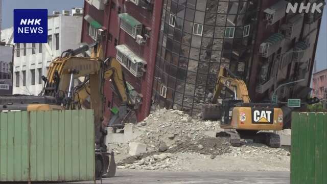
China’s Gaofen-4 satellite captured Taiwan. On Apr. 3, 2024, Taiwan’s biggest earthquake in at least 25 years killed more than 10 people as of Apr. 5, and Hualien County was seriously damaged. Our thoughts and prayers are with those who were affected by the earthquake.
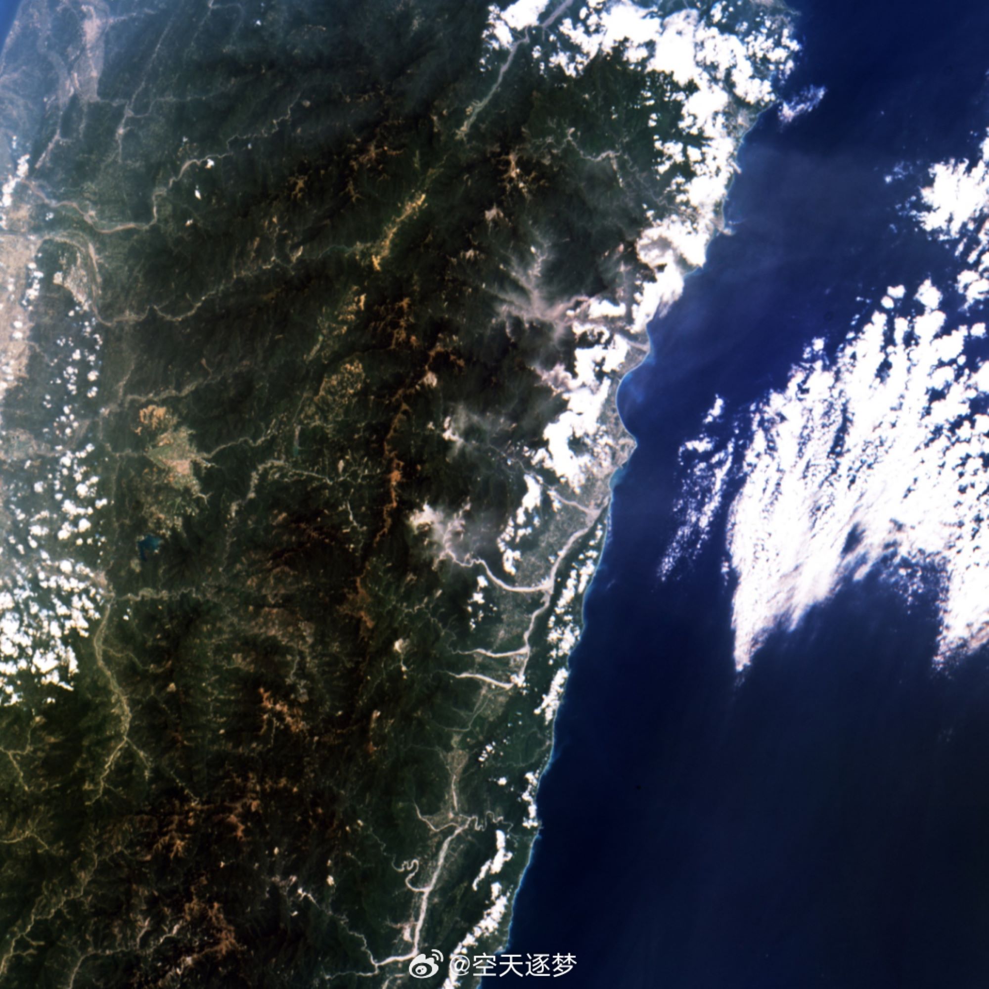
Geologically, the main island of Taiwan, known historically in Portuguese and English as Formosa, comprises a tilted fault block, characterized by the contrast between the eastern two-thirds, consisting mostly of five rugged mountain ranges running parallel to the east coast, and the flat to gently rolling plains of the western third, where the majority of Taiwan’s population resides. Several peaks exceed 3,500 m in height – the highest, Yu Shan at 3,952m, makes Taiwan the world’s 4th-highest island. The tectonic boundary that formed these ranges remains active, and the island experiences many earthquakes, a few of them highly destructive. There are also many[quantify] active submarine volcanoes in the Taiwan Straits. The climate ranges from tropical in the south to subtropical in the north, and is governed by the East Asian Monsoon. Recently, its relationship with China has entered a difficult phase.
The local scenery on the ground is as follows.
Reference: CNSA’s Tweet
See earthview photo gallery: LiVEARTH