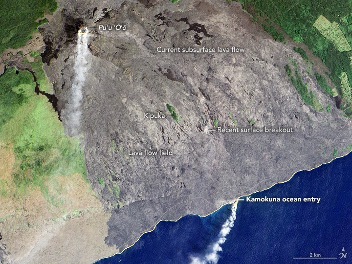
[:ja]NASAの地球観測衛星Earth Observing-1が捉えたハワイ島の活火山、キラウエアの溶岩流です。灰色の部分が溶岩部分で、1983年にキラウエア火山の最初の噴火が確認されて以来、30年以上も活発に活動しています。
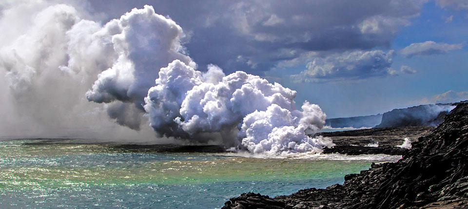
溶岩は陸地拡大にも寄与しています。溶岩が海岸に接触している地上の画像はこちらです。
参考文献: Kilauea’s Lava Pours Into the Pacific
ウェブ地球儀で地球俯瞰画像を見る: LiVEARTH
[Earthview Wonders] No.135: Kilauea’s Lava
NASA’s Earth Observing-1 satellite captured the lava of active Kilauea Volcano, Hawaii, U.S.. The gray area shows the flow filed accumulated since 1983 when Kilauea made first eruption, and it has been active for three decades.
The lava contributes to the expansion of the land as well. The actual scenery of the lava pouring into the sea is this.
Reference: Kilauea’s Lava Pours Into the Pacific
See earthview photo gallery with web-globe: LiVEARTH[:en][Earthview Wonders] No.135: Kilauea’s Lava
NASA’s Earth Observing-1 satellite captured the lava of active Kilauea Volcano, Hawaii, U.S.. The gray area shows the flow filed accumulated since 1983 when Kilauea made first eruption, and it has been active for three decades.
The lava contributes to the expansion of the land as well. The actual scenery of the lava pouring into the sea is this.
Reference: Kilauea’s Lava Pours Into the Pacific
See earthview photo gallery with web-globe: LiVEARTH[:]