NASA’s Landsat 8 satellite captured Rokan River, Indonesia.
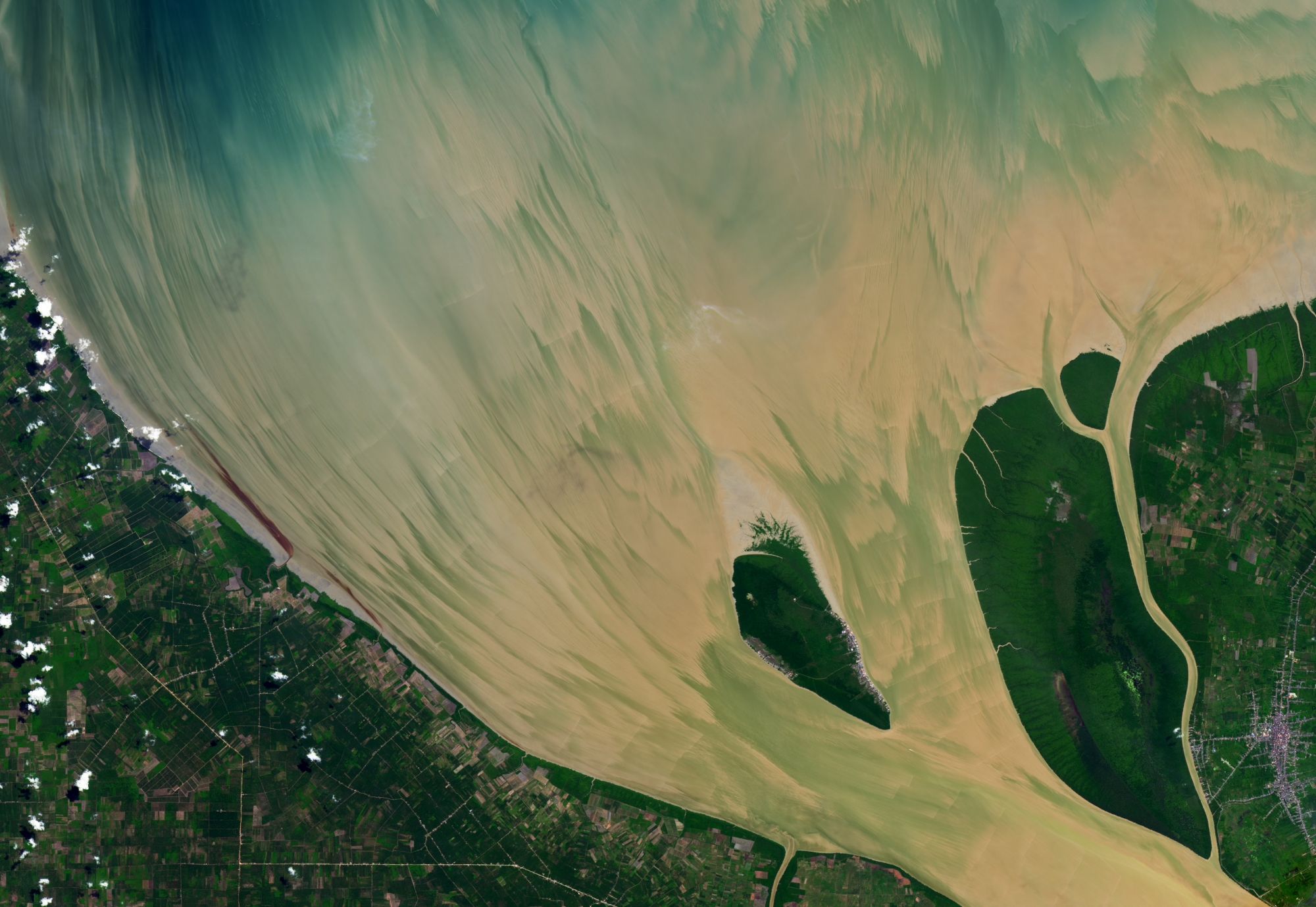
Rokan River is a river in Riau province, central-eastern Sumatra, Indonesia, about 1,100km northwest of the capital Jakarta. The river originates in the Barisan Mountains in the west, and drains northeast-ward with estuarine located near the port town of Bagansiapiapi draining the water to Malacca Strait. The river flows in the central area of Sumatra with predominantly tropical rainforest climate (designated as Af in the Köppen-Geiger climate classification). The annual average temperature in the area is 23 °C, and the average annual rainfall is 3766mm.
The local scenery on the ground is as follows.

Reference: NASA Earth’s Tweet
See earthview photo gallery: LiVEARTH