Astronaut Kimiya Yui captured from ISS Iwo Jima, Japan.
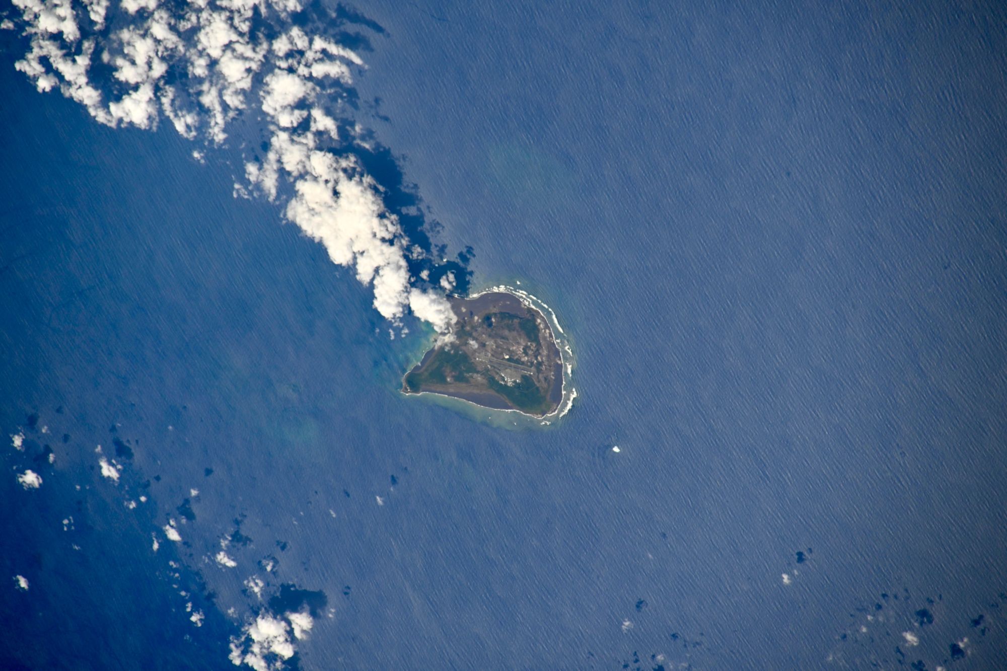
Iwo Jima (‘Sulfur Island’) is one of the Japanese Volcano Islands, which lie south of the Bonin Islands and together with them make up the Ogasawara Archipelago. Although 1,200km south of Tokyo on Honshu, Iwo Jima is administered as part of the Ogasawara Subprefecture of the Tokyo Metropolitan Government. Only 29.86km2 in size, the island is still volcanic and emits sulfurous gases. The highest point of Iwo Jima is Mount Suribachi at 169m high. Although likely passed by Micronesians who made their way to the Bonins to the north, Iwo Jima was largely ignored by the Spanish, Dutch, British, and Japanese until a relatively late date after its 1543 rediscovery. The Japanese eventually colonized the island, administering it as the Ioto or Iojima Village under Tokyo’s jurisdiction until all civilians were forcibly evacuated to Honshu in July 1944 near the end of World War II. The area of Iwo Jima continues to increase due to the uplift of the ground due to active volcanic activity; in 1911 it was 19.3km2 and in 2023, it was 29.86km2.
The local scenery on the ground is as follows.

Reference: Kimiya Yui’s Tweet
See earthview photo gallery: LiVEARTH