[:ja]トーマス・ペスケット宇宙飛行士がISSから撮影したスカンジナビア半島のスウェーデンです。手前にはデンマーク、東側にはバルト海が見えています。
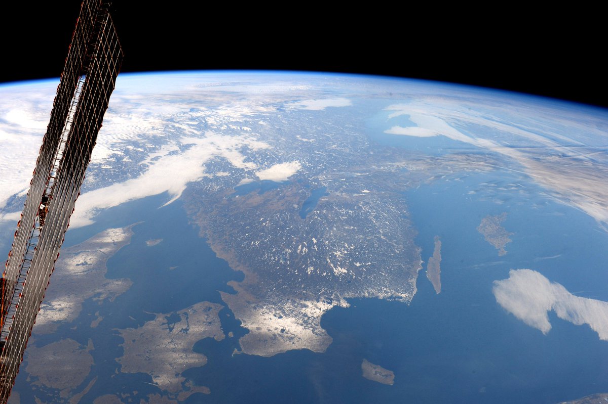
衛星画像からもわかりますが、スウェーデンには湖や河がたくさんあり、国土の1割を占めます。また、国土の6割は森林に覆われています。湖が多い理由は、最後の氷河期で氷河が溶け始め、その後に地形の凹凸によってたくさんの湖が残りました。
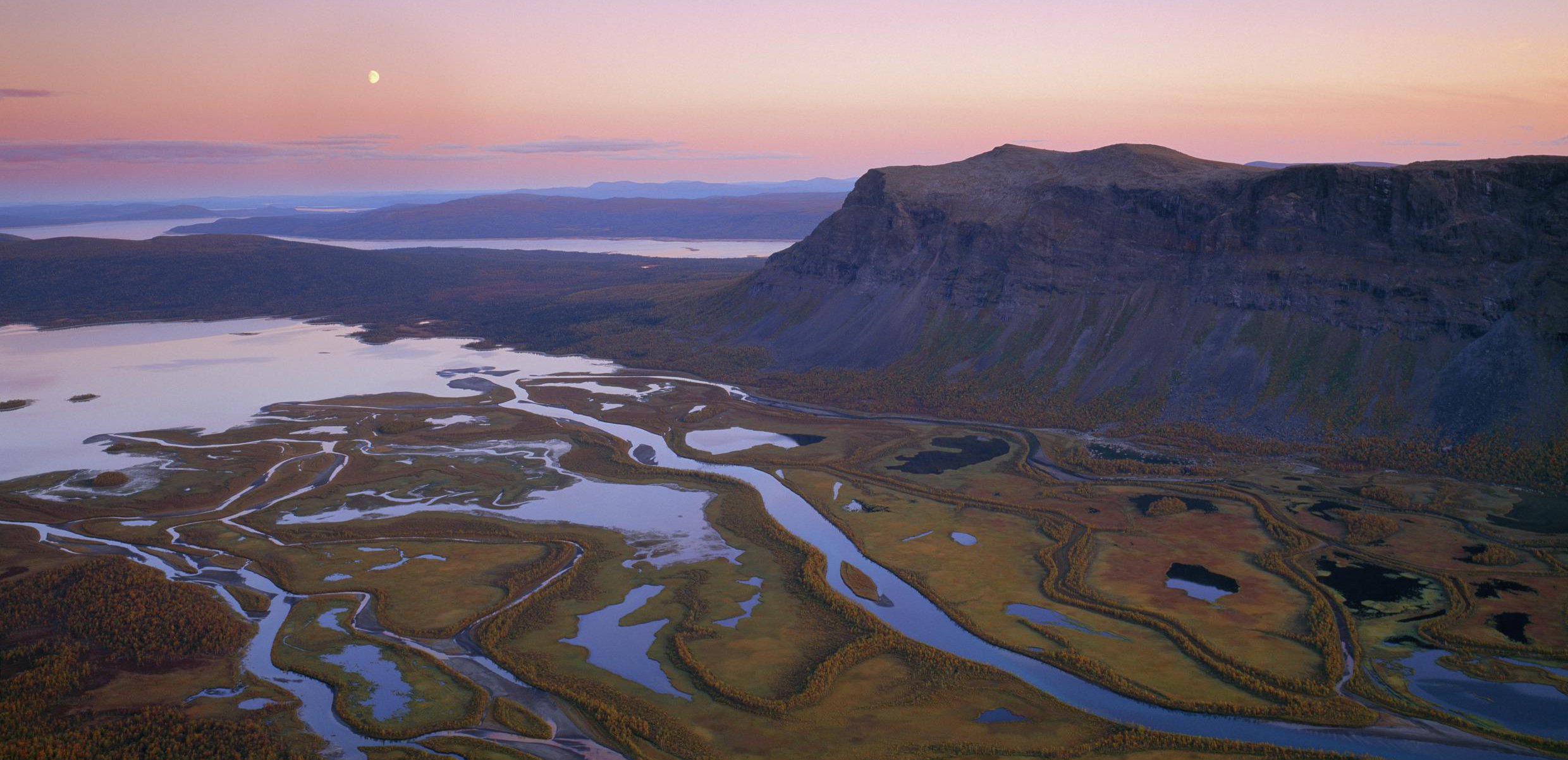
地上の様子はこちらです。
参考文献: Thomas Pesquet’s Tweet
ウェブ地球儀で地球俯瞰画像を見る: LiVEARTH
[Earthview Wonders] No.217: Sweden🇸🇪
Astronaut Thomas Pesquet captured from ISS Sweden. At the near end shows Denmark and the Baltic Sea to the east.
As can be seen from satellite image, Sweden has many lakes and rivers which occupy about 10% of the country while 60% is covered with forests. Various-sized lakes were created by the glaciers. At the end of the last Ice Age, receding glacers scrateched the land and left bumpy landscape which becase lakes.
The local scenery on the ground is like this.
Reference: Thomas Pesquet’s Tweet
See earthview photo gallery with web-globe: LiVEARTH[:en][Earthview Wonders] No.217: Sweden🇸🇪
Astronaut Thomas Pesquet captured from ISS Sweden. At the near end shows Denmark and the Baltic Sea to the east.
As can be seen from satellite image, Sweden has many lakes and rivers which occupy about 10% of the country while 60% is covered with forests. Various-sized lakes were created by the glaciers. At the end of the last Ice Age, receding glacers scrateched the land and left bumpy landscape which becase lakes.
The local scenery on the ground is like this.
Reference: Thomas Pesquet’s Tweet
See earthview photo gallery with web-globe: LiVEARTH[:]