[:ja]マーク・ヴァンデハイ宇宙飛行士がISSから撮影した南極、リビングストン島のバイヤーズ半島です。
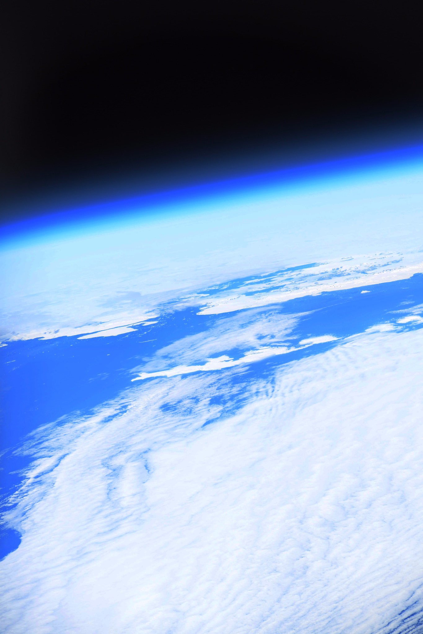
南極半島は、南極大陸西部にある、南極海に向かって南緯75度から南緯63度まで伸びるS字状の細く長大な半島です。この半島は、1820年代に人類が最初に到達した南極大陸の一角で、南極の中では気候が最も温和なので、この半島や周辺の島には多くの観測基地があります。リビングストン島はその1つで、バイヤーズ半島には湖が集中して存在します。南極条約により、島に入るには許可が必要です。
地上の様子はこちらです。

参考文献: Mark Vande Hei’s Tweet
ウェブ地球儀で地球俯瞰画像を見る: LiVEARTH
[Earthview Wonders] No.413: Byers Peninsula🇦🇶
Astronaut Mark Vande Hei captured from ISS the Bayers Peninsula of Livingston Island, Antarctica.
Byers Peninsula is a mainly ice-free peninsula forming the west end of Livingston Island in the South Shetland Islands of Antarctica. It occupies 60km2 and includes the small freshwater Basalt Lake. Byers Peninsula has a regime of special environmental protection under the Antarctic Treaty System and requires a permit to enter.
The local scenery on the ground is as follows.
Reference: Mark Vande Hei’s Tweet
See earthview photo gallery with web-globe: LiVEARTH[:en][Earthview Wonders] No.413: Byers Peninsula🇦🇶
Astronaut Mark Vande Hei captured from ISS the Bayers Peninsula of Livingston Island, Antarctica.
Byers Peninsula is a mainly ice-free peninsula forming the west end of Livingston Island in the South Shetland Islands of Antarctica. It occupies 60km2 and includes the small freshwater Basalt Lake. Byers Peninsula has a regime of special environmental protection under the Antarctic Treaty System and requires a permit to enter.
The local scenery on the ground is as follows.
Reference: Mark Vande Hei’s Tweet
See earthview photo gallery with web-globe: LiVEARTH[:]