[:ja]NASAのLandsat 8が撮影したモロッコ南東のエルグシェビ砂丘です。
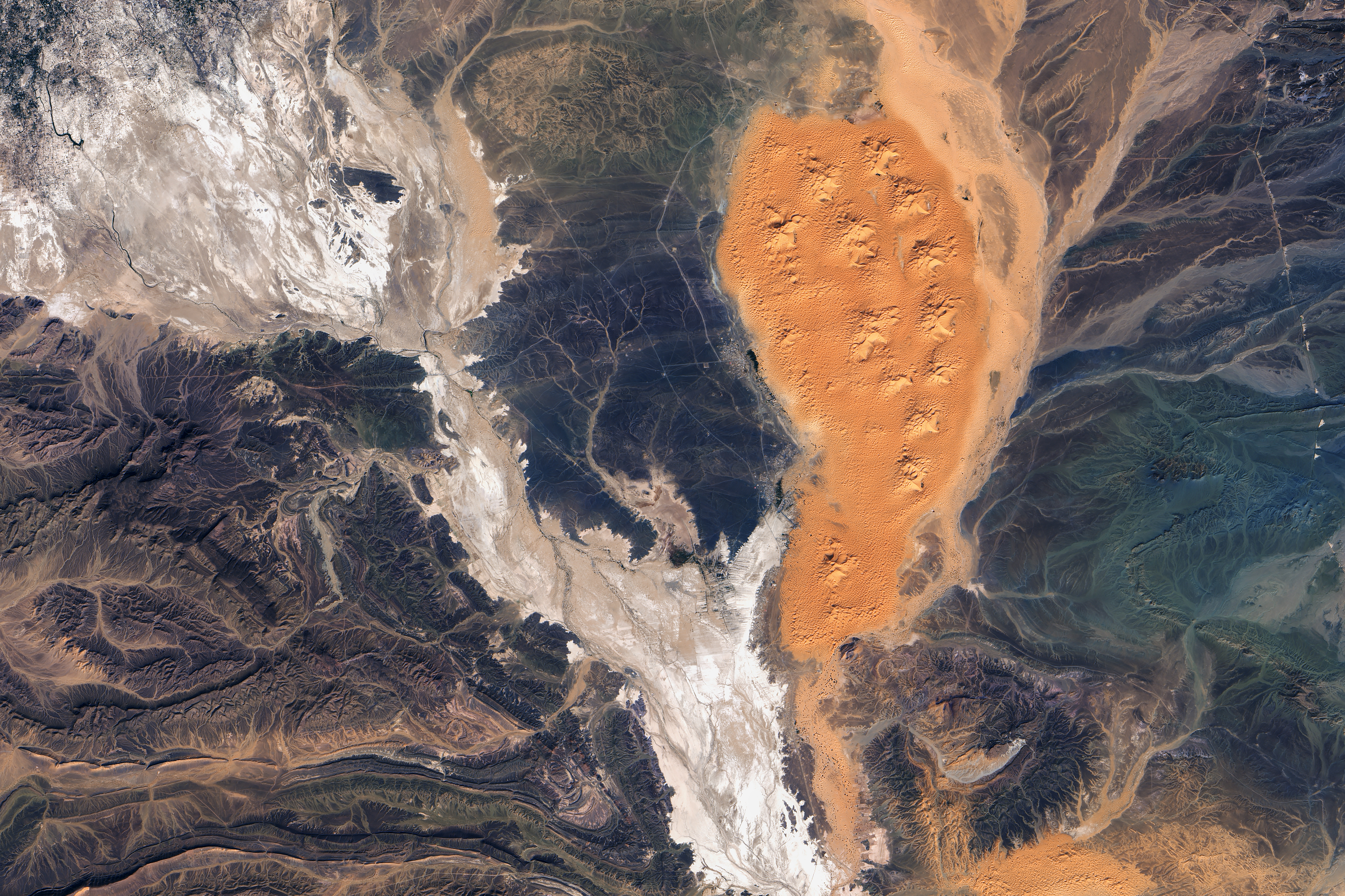
エルグシェビ砂丘はアルジェリアとの国境付近にある南北50km、東西5~10kmの砂丘ですが、150mもの高さがある場所があります。砂丘の下には、硬い片岩(へんがん、schist)の地層が広がっており、画像では黒くなっています。
地上の様子はこちらです。

参考文献: The Shallow Aquifers of Erg Chebbi
ウェブ地球儀で地球俯瞰画像を見る: LiVEARTH
[Earthview Wonders] No.437: Erg Chebbi Dunes, Morocco🇲🇦
NASA’s Landsat 8 captured Erg Chebbi Dunes, Morocco.
Erg Chebbi Dunes, located near Algerian border, are spread 50km north-south, 5-10km east-west, and reach a height of up to 150m in places. A hard, impervious layer of rock—mainly schist—lies directly beneath the dunes and blocks water from seeping deep into the ground.
The local scenery on the ground is as follows.
Reference: The Shallow Aquifers of Erg Chebbi
See earthview photo gallery with web-globe: LiVEARTH[:en][Earthview Wonders] No.437: Erg Chebbi Dunes, Morocco🇲🇦
NASA’s Landsat 8 captured Erg Chebbi Dunes, Morocco.
Erg Chebbi Dunes, located near Algerian border, are spread 50km north-south, 5-10km east-west, and reach a height of up to 150m in places. A hard, impervious layer of rock—mainly schist—lies directly beneath the dunes and blocks water from seeping deep into the ground.
The local scenery on the ground is as follows.
Reference: The Shallow Aquifers of Erg Chebbi
See earthview photo gallery with web-globe: LiVEARTH[:]