[:ja]ランディ・ブレズニク宇宙飛行士がISSから撮影した中央アメリカのホンジュラスのロアタン島です。西側にはベリーズも見えています。
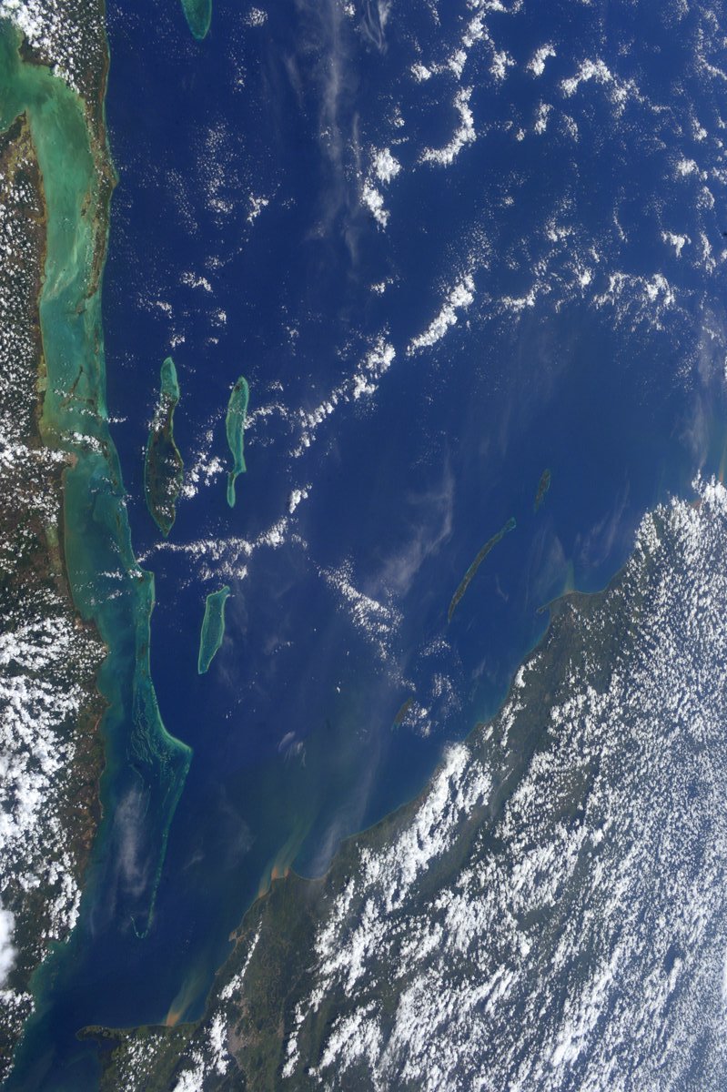
ホンジュラスは国土の約80%を山岳地帯が占め、基本的に熱帯ですが、国土主要部の標高1,000mから1,500mの高原地域では常春に近い気候になります。ロアタン島はカリブ海、ホンジュラスの北海岸から約65km北にあります。島の東西は約77km、南北は約8kmで非常に細長い島です。周囲は、オーストラリアのグレート・バリア・リーフに次ぐ世界2番目に大きいサンゴ礁です。ホンジュラスの西方には、ベリーズが見えています。
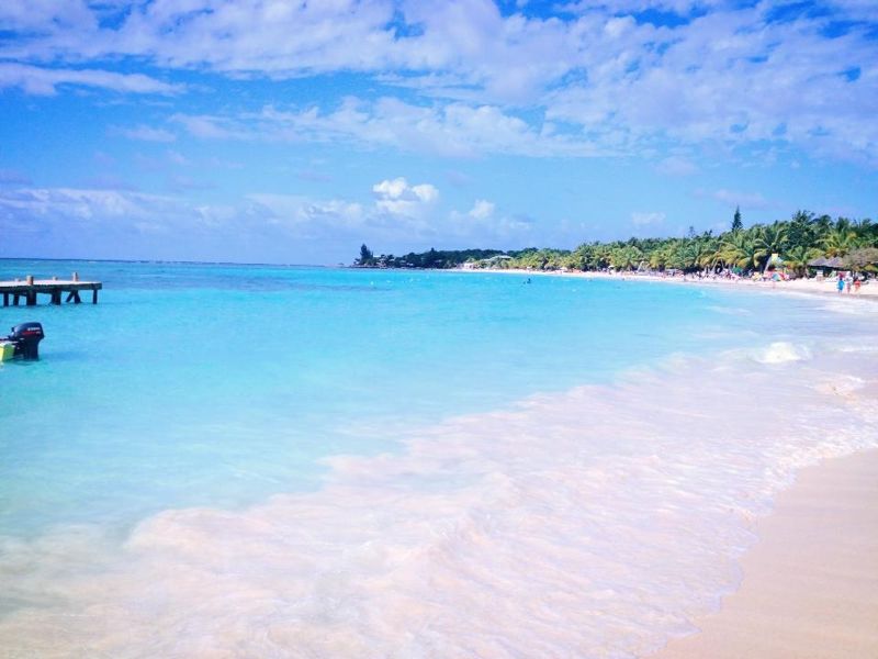
地上の様子はこちらです。
参考文献: Randy Bresnik’s Tweet
ウェブ地球儀で地球俯瞰画像を見る: LiVEARTH
[Earthview Wonders] No.471: Roatan Island, Honduras🇭🇳
Astronaut Randy Bresnik captured from ISS Roatan Island, Honduras.
80% of the country is covered with mountainous areas. Roatán Island is in the Caribbean, about 65km off the northern coast of Honduras. The island is about 77km long and less than 8km across at its widest point. The coral reef around the island is the second largest in the world after the Great Barrier Reef of Australia.
The local scenery on the ground is as follows.
Reference: Randy Bresnik’s Tweet
See earthview photo gallery with web-globe: LiVEARTH[:en][Earthview Wonders] No.471: Roatan Island, Honduras🇭🇳
Astronaut Randy Bresnik captured from ISS Roatan Island, Honduras.
80% of the country is covered with mountainous areas. Roatán Island is in the Caribbean, about 65km off the northern coast of Honduras. The island is about 77km long and less than 8km across at its widest point. The coral reef around the island is the second largest in the world after the Great Barrier Reef of Australia.
The local scenery on the ground is as follows.
Reference: Randy Bresnik’s Tweet
See earthview photo gallery with web-globe: LiVEARTH[:]