[:ja]ランディ・ブレズニク宇宙飛行士がISSから撮影したスイスアルプスとレマン湖、アヌシー湖です。
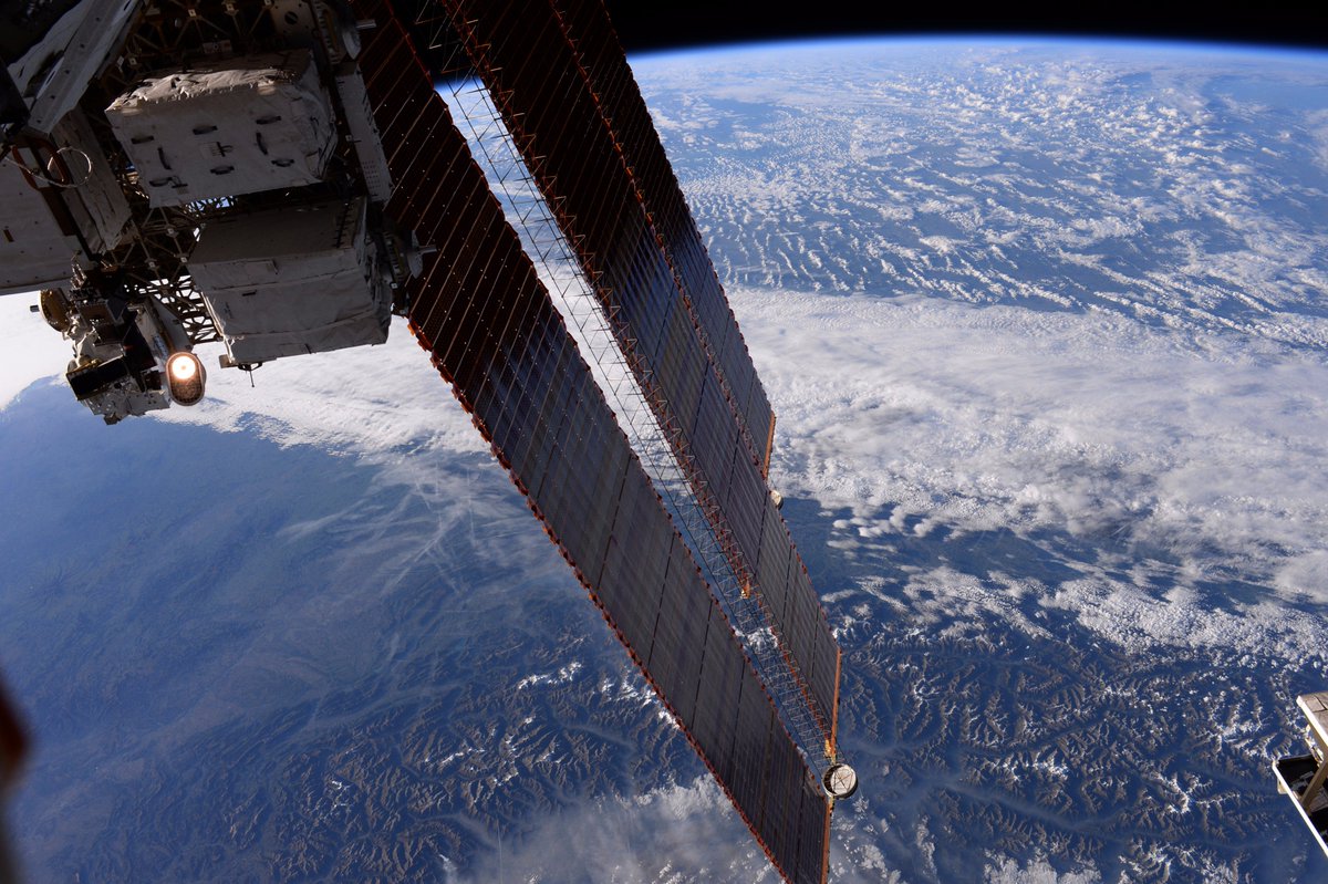
ヨーロッパ最高峰のモンブランは標高4,810mを擁するアルプス山脈は、ヨーロッパ中央部を東西に横切る山脈です。プレートテクトニクスにより、アフリカ大陸がヨーロッパ大陸へ衝突したことで、白亜紀にテーチス海で堆積した地層が圧縮され盛り上がって形成されました。山脈の西端付近のアヌシー湖は約1万8千年前に大アルプス氷河の融解にともなって形成されたとされ、世界屈指の透明度で知られ、様々な水上スポーツのメッカとして高い知名度を誇ります。
アヌシー湖の地上の様子はこちらです。

参考文献: Randy Bresnik’s Tweet
ウェブ地球儀で地球俯瞰画像を見る: LiVEARTH
[Earthview Wonders] No.488: Swiss Alps🇫🇷🇨🇭🇮🇹
Astronaut Randy Bresnik captured from ISS Swiss Alps, Lake Geneva (Lake Leman) and Lake Annecy.
The Alps with the Mont Blanc, the highest peak (4,810m) in Europe, are the most extensive mountain range system, stretching 1,200km across 8 countries. The mountains were formed over tens of millions of years as the African and Eurasian tectonic plates collided. At the western end of the Alps lies Lake Annecy (Lac d’Annecy), known as “Europe’s cleanest lake”. It is a popular tourist destination known for its swimming and water sports.
The local scenery on the ground of Lake Annecy is as follows.
Reference: Randy Bresnik’s Tweet
See earthview photo gallery with web-globe: LiVEARTH[:en][Earthview Wonders] No.488: Swiss Alps🇫🇷🇨🇭🇮🇹
Astronaut Randy Bresnik captured from ISS Swiss Alps, Lake Geneva (Lake Leman) and Lake Annecy.
The Alps with the Mont Blanc, the highest peak (4,810m) in Europe, are the most extensive mountain range system, stretching 1,200km across 8 countries. The mountains were formed over tens of millions of years as the African and Eurasian tectonic plates collided. At the western end of the Alps lies Lake Annecy (Lac d’Annecy), known as “Europe’s cleanest lake”. It is a popular tourist destination known for its swimming and water sports.
The local scenery on the ground of Lake Annecy is as follows.
Reference: Randy Bresnik’s Tweet
See earthview photo gallery with web-globe: LiVEARTH[:]