[:ja]アレックス・ゲルスト宇宙飛行士がISSから撮影したイラン東部デイフーク付近です。
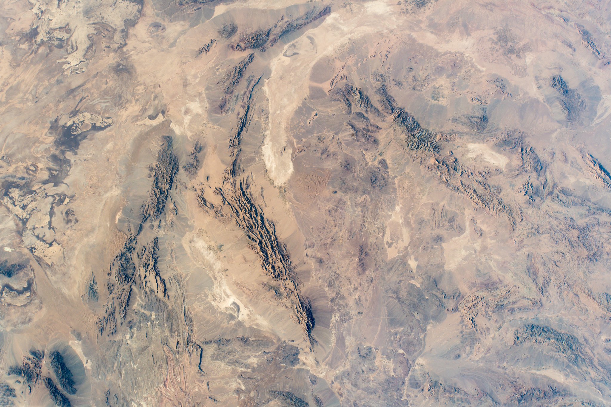
イランの景観では無骨な山々が卓越し、盆地や台地を互いに切り離しています。イランの東半は塩分を含むキャビール砂漠のような無人に近い砂漠地帯が広がり、塩湖が点在します。平野部はごくわずかで、大きなものはカスピ海沿岸平野とアルヴァンド川河口部にあたるペルシア湾北端の平野だけです。国土の大部分が砂漠気候あるいはステップ気候です。
地上の様子はこちらです。

参考文献: Alex Gerst’s Tweet
地球俯瞰画像を見る: LiVEARTH
[Earthview Wonders] No.608: Iran🇮🇷
Astronaut Alex Gerst captured from ISS Deyhuk, Iran.
Iran consists of the Iranian Plateau, with the exception of the coasts of the Caspian Sea and Khuzestan. It is one of the world’s most mountainous countries, its landscape dominated by rugged mountain ranges that separate various basins or plateaux from one another. The eastern part consists mostly of desert basins, such as the Kavir Desert, which is the country’s largest desert, and the Lut Desert, as well as some salt lakes.
The local scenery on the ground is as follows.
Reference: Alex Gerst’s Tweet
See earthview photo gallery: LiVEARTH[:en][Earthview Wonders] No.608: Iran🇮🇷
Astronaut Alex Gerst captured from ISS Deyhuk, Iran.
Iran consists of the Iranian Plateau, with the exception of the coasts of the Caspian Sea and Khuzestan. It is one of the world’s most mountainous countries, its landscape dominated by rugged mountain ranges that separate various basins or plateaux from one another. The eastern part consists mostly of desert basins, such as the Kavir Desert, which is the country’s largest desert, and the Lut Desert, as well as some salt lakes.
The local scenery on the ground is as follows.
Reference: Alex Gerst’s Tweet
See earthview photo gallery: LiVEARTH[:]