[:ja]アレックス・ゲルスト宇宙飛行士がISSから撮影したニュージーランド南島です。
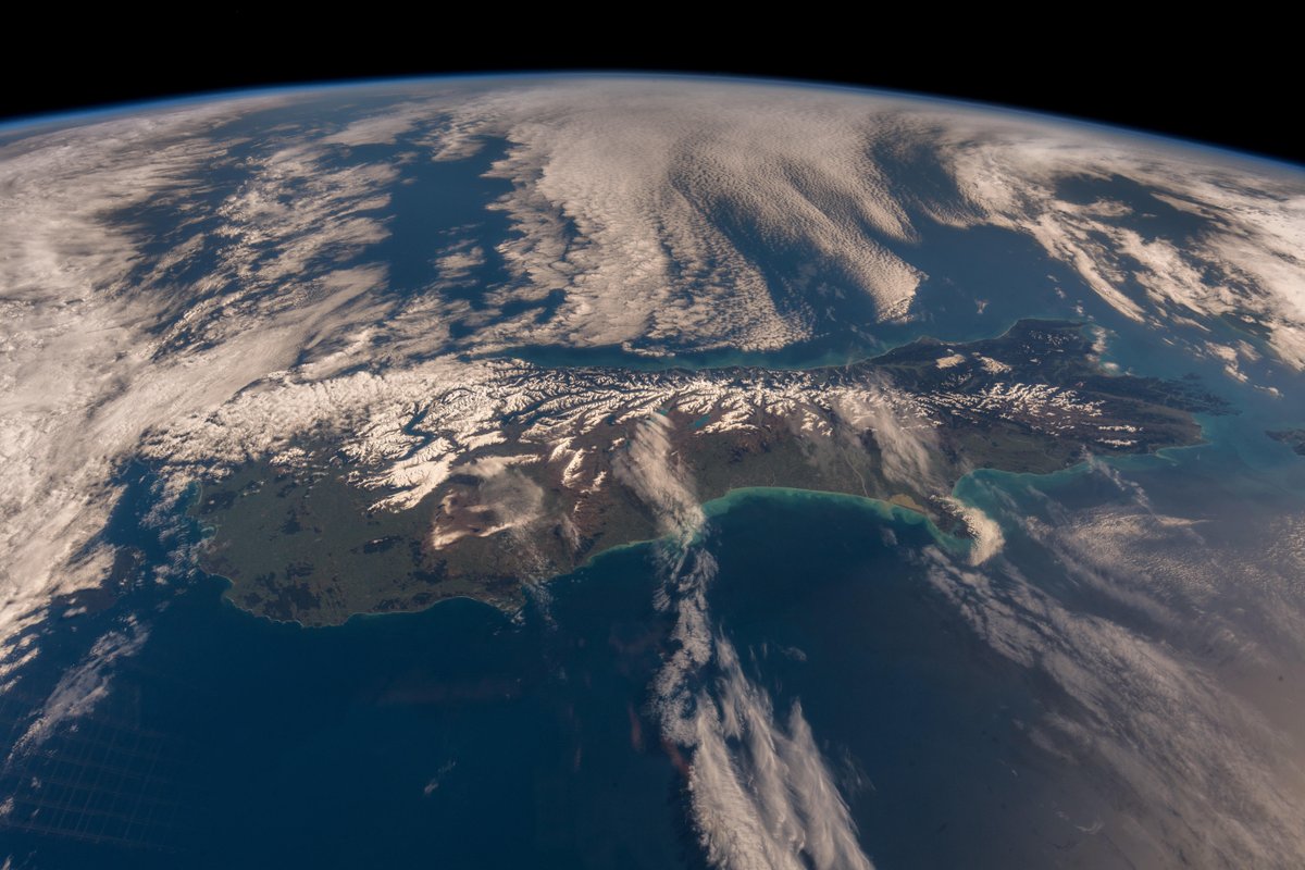
南島は、最も陸地面積の大きな島で、中心都市はクライストチャーチです。島の中央には「南半球のアルプス山脈」と呼ばれる南アルプス山脈がそびえます。最高峰は、3,754m のクック山(マオリ語ではアオラキ、「雲を貫く」という意味)で、その他に3,000m 以上の峰が18あります。
他にもタスマン氷河、ミルフォード・サウンドのような豊かな自然も有名です。クイーンズタウンは世界的に有名な観光・保養地です。温泉地も各地に点在します。
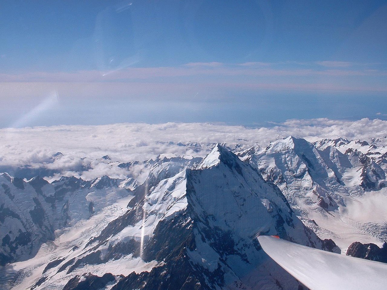
南アルプス山脈のクック山の地上の様子はこちらです。
参考文献: Alex Gerst’s Tweet
地球俯瞰画像を見る: LiVEARTH
[Earthview Wonders] No.654: South Island, New Zealand🇳🇿
Astronaut Alex Gerst captured from ISS the South Island of New Zealand.
The South Island is the largest landmass of New Zealand. The island is divided along its length by the Southern Alps. There are 18 peaks over 3,000m, the highest of which is Aoraki / Mount Cook at 3,754m. Other famous destinations include Tasman Glacier, Milford Sound and more.
The local scenery of the Mt. Cook of the South Alps on the ground is as follows.
Reference: Alex Gerst’s Tweet
See earthview photo gallery: LiVEARTH[:en][Earthview Wonders] No.654: South Island, New Zealand🇳🇿
Astronaut Alex Gerst captured from ISS the South Island of New Zealand.
The South Island is the largest landmass of New Zealand. The island is divided along its length by the Southern Alps. There are 18 peaks over 3,000m, the highest of which is Aoraki / Mount Cook at 3,754m. Other famous destinations include Tasman Glacier, Milford Sound and more.
The local scenery of the Mt. Cook of the South Alps on the ground is as follows.
Reference: Alex Gerst’s Tweet
See earthview photo gallery: LiVEARTH[:]