[:ja]リッキー・アーノルド宇宙飛行士がISSから撮影したベリーズです。画像左上の白く突き出ている半島が、同国最大の都市ベリーズシティです。
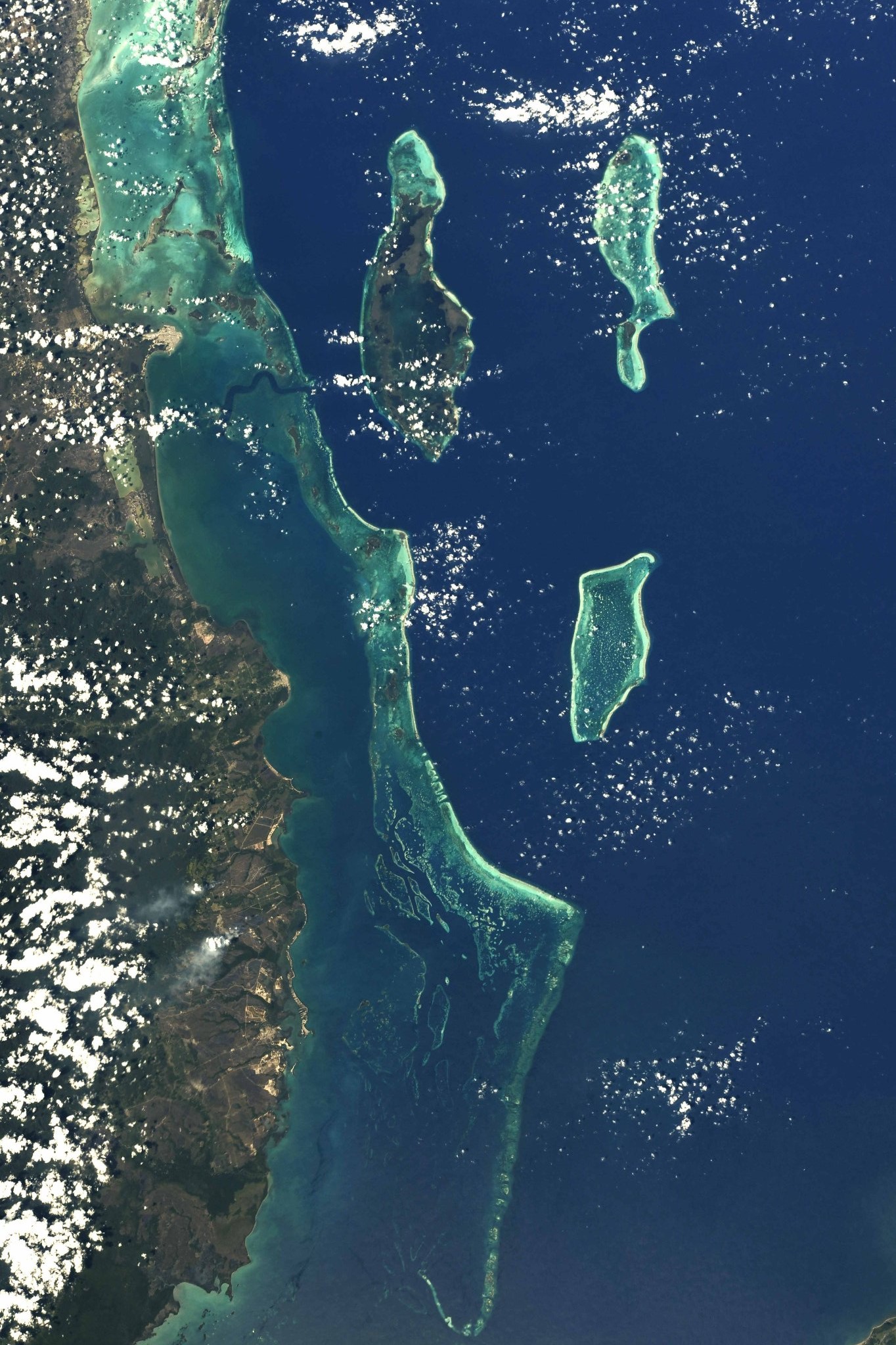
ベリーズは、中央アメリカ北東部、ユカタン半島の付け根の部分に位置し、メキシコ、グアテマラ、カリブ海に面しています。美しい海と珊瑚礁に恵まれ、「カリブ海の宝石」と呼ばれており、海岸線に沿って約450の離島があり、リゾート地として知られます。ヨーロッパ人のアメリカ大陸到達以前、ベリーズを含むユカタン半島一帯はマヤ文明の領域に属していました。スペインによるアメリカ大陸の植民地化により、ベリーズはグアテマラ総督領の一部となりましたが、密林地帯の彼方にあったベリーズ一帯には統治が及ばず、17世紀以降イギリス人の入植地が形成されていきました。このような歴史的背景から、公用語は英語です。一次産品は、砂糖、柑橘類、バナナ、イセエビ、木材資源などです。
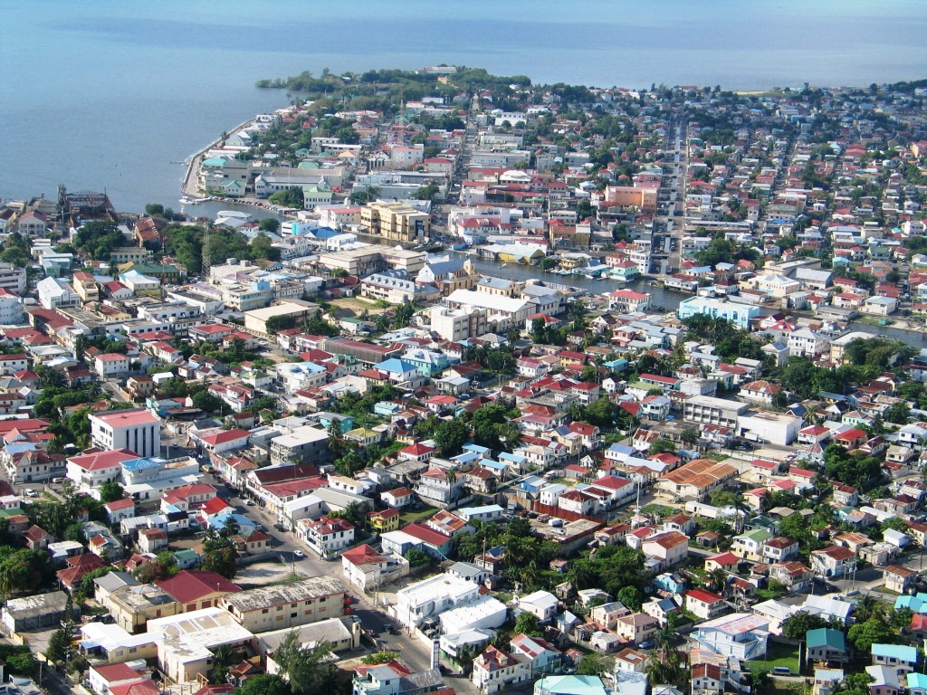
地上の様子はこちらです。
参考文献: Ricky Arnold’s Tweet
地球俯瞰画像を見る: LiVEARTH
[Earthview Wonders] No.666: Belize🇧🇿
Astronaut Ricky Arnold captured from ISS Belize. At the top left white peninsula is Belize City, the largest of the country.
Belize is in the Central America bordered by Mexico, the Caribbean Sea, and Guatemala, with 290km long and 110km wide. The Mayan civilization spread into the area of Belize and flourished until about 1200. It became a British colony in 1840 and independence was achieved from the UK in 1981. English is the official language of Belize, while Belizean Creole is an unofficial native language. Sugar is one of Belize’s top exports.
The local scenery on the ground is as follows.
Reference: Ricky Arnold’s Tweet
See earthview photo gallery: LiVEARTH[:en][Earthview Wonders] No.666: Belize🇧🇿
Astronaut Ricky Arnold captured from ISS Belize. At the top left white peninsula is Belize City, the largest of the country.
Belize is in the Central America bordered by Mexico, the Caribbean Sea, and Guatemala, with 290km long and 110km wide. The Mayan civilization spread into the area of Belize and flourished until about 1200. It became a British colony in 1840 and independence was achieved from the UK in 1981. English is the official language of Belize, while Belizean Creole is an unofficial native language. Sugar is one of Belize’s top exports.
The local scenery on the ground is as follows.
Reference: Ricky Arnold’s Tweet
See earthview photo gallery: LiVEARTH[:]