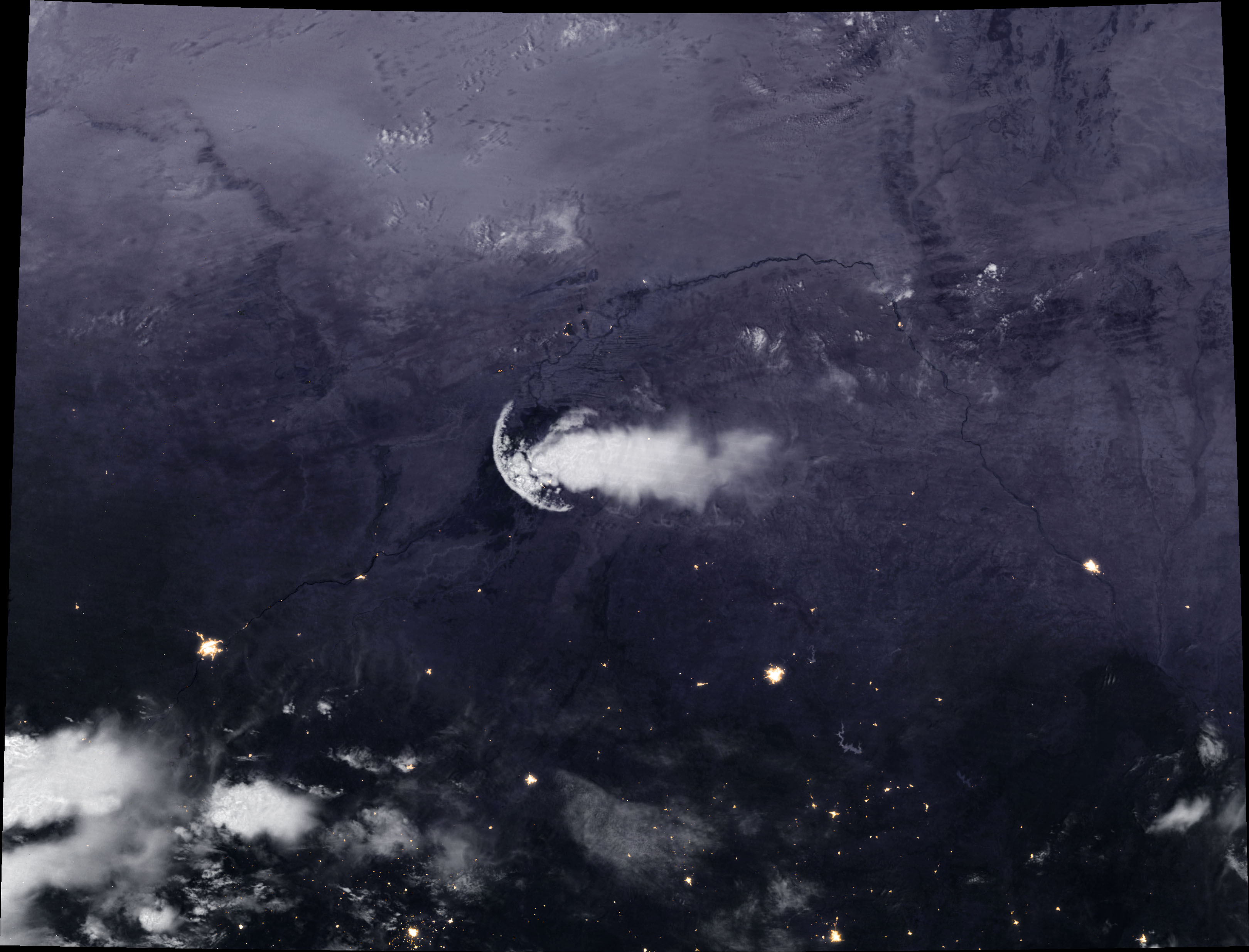
[:ja]NASAの地球観測衛星Suomi NPPが撮影したマリ上空の噴流境界です。半円のようになっている部分がその境界です。
積乱雲から吹き出す冷たい気流(outflow)と周囲の空気の境界をoutflow boundary(噴流境界)の1つです。ガストフロント(gust front)とも呼ばれ、積乱雲からの冷たい下降気流が水平に吹き出し、周囲の暖かい空気と衝突した際にできる、上昇気流を伴った小規模な前線のことです。gustは突風、frontは前線を意味するため、突風前線、陣風前線とも言います。
地上の様子はこちらです。

参考文献: An Outflow Boundary—Not a Jellyfish—Over Africa (NASA Earth Observatory)
地球俯瞰画像を見る: LiVEARTH
[Earthview Wonders] No.685: Outflow Boundary Over Mali
NASA’s Suomi NPP satellite captured semicircular outflow boundary over Mali.
The arc shape cloud hovering Mali is the product of an outflow boundary associated with a decaying thunderstorm. The falling rain from cumulonimbus thunderstorm clouds cools the air and creates a downdraft that spreads outward in a circular fashion once it reaches the ground. The outflow boundary, or a gust front, is the leading edge of a spreading pool of cool air near a thunderstorm, which can persist for many hours.
The local scenery on the ground is as follows.
Reference: An Outflow Boundary—Not a Jellyfish—Over Africa (NASA Earth Observatory)
See earthview photo gallery: LiVEARTH[:en][Earthview Wonders] No.685: Outflow Boundary Over Mali
NASA’s Suomi NPP satellite captured semicircular outflow boundary over Mali.
The arc shape cloud hovering Mali is the product of an outflow boundary associated with a decaying thunderstorm. The falling rain from cumulonimbus thunderstorm clouds cools the air and creates a downdraft that spreads outward in a circular fashion once it reaches the ground. The outflow boundary, or a gust front, is the leading edge of a spreading pool of cool air near a thunderstorm, which can persist for many hours.
The local scenery on the ground is as follows.
Reference: An Outflow Boundary—Not a Jellyfish—Over Africa (NASA Earth Observatory)
See earthview photo gallery: LiVEARTH[:]