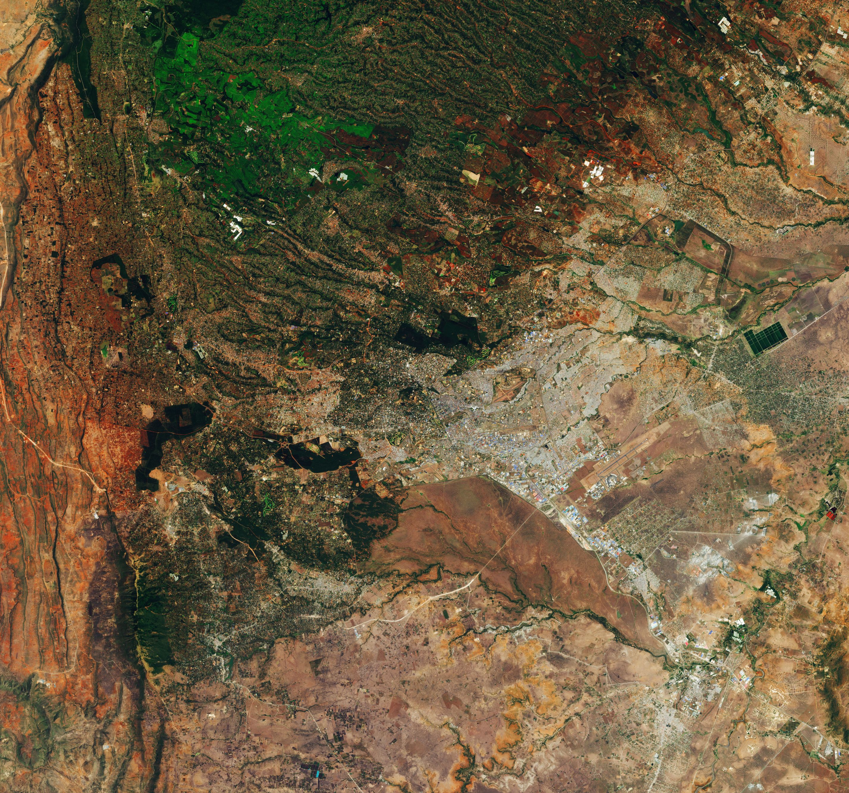
[:ja]ESAの地球観測衛星Sentinel-2が撮影したケニアの首都ナイロビです。

ナイロビは、人口340万人を擁するケニアの首都で最大の都市です。赤道に近いが標高約1600mに位置し気候は比較的冷涼です。東アフリカの中心的都市として、多くの国際機関が本部あるいはアフリカの代表部などを置き、中でも国際連合は、国連環境計画 (UNEP) や国際連合人間居住計画 (UN-HABITAT) の本部をナイロビに置いています。ナイロビはアフリカ大地溝帯の東端に接しているため、小さな地震や火山性の微動がときおり発生しています。町の北にはケニア山、南東にはキリマンジャロ山があり、どちらも晴れてよく澄んだ空の日には市街から眺めることができます。
地上の様子はこちらです。

参考文献: Nairobi, Kenya (ESA)
地球俯瞰画像を見る: LiVEARTH
[Earthview Wonders] No.727: Nairobi, Kenya🇰🇪
ESA’s Sentinel-2 satellite captured Nairobi, the capital of Kenya.

The name Nairobi comes from the Maasai phrase Enkare Nairobi, which translates to “cool water”, a reference to the Nairobi River which flows through the city. The city proper has a population of 3.4 million. Home to thousands of Kenyan businesses and over 100 major international companies and organisations, including the United Nations Environment Programme (UN Environment) and the United Nations Office at Nairobi (UNON), Nairobi is an established hub for business and culture.
The local scenery on the ground is as follows.

Reference: Nairobi, Kenya (ESA)
See earthview photo gallery: LiVEARTH[:en][Earthview Wonders] No.727: Nairobi, Kenya🇰🇪
ESA’s Sentinel-2 satellite captured Nairobi, the capital of Kenya.

The name Nairobi comes from the Maasai phrase Enkare Nairobi, which translates to “cool water”, a reference to the Nairobi River which flows through the city. The city proper has a population of 3.4 million. Home to thousands of Kenyan businesses and over 100 major international companies and organisations, including the United Nations Environment Programme (UN Environment) and the United Nations Office at Nairobi (UNON), Nairobi is an established hub for business and culture.
The local scenery on the ground is as follows.

Reference: Nairobi, Kenya (ESA)
See earthview photo gallery: LiVEARTH[:]